The Coast as Commons: Why Fishers’ Tenure Rights Need Recognition, Not Just Resources

Land governance in Tamil Nadu was the subject of sustained discussion at the ILDC Regional Dialogue on Land, Governance and Coastal Futures, held in Chennai on June 19–20, 2026. The event convened researchers, panchayat representatives, practitioners, and civil society organizations engaged in questions of land, livelihoods, governance, and coastal sustainability. The dialogue’s framing was direct: despite being the first tier of local self-governance, gram sabhas and panchayats are routinely side-lined in decisions over land, associated resources, and access to livelihoods, even as industrial expansion, port development, and infrastructure displace coastal and rural communities. Its second day focused on the role gram sabhas and panchayats can — and currently cannot — play in governing coastal and infrastructure-related land: ports and Special Economic Zones (SEZs), industrial pressure, displacement, and the adequacy of frameworks such as the CRZ notification, the Land Acquisition Act of 2013, and environmental impact assessment processes.

The discussion drew out a distinction that earlier conversations on village and forest commons had already begun to surface: terrestrial and aquatic commons are not the same, and neither are the communities that depend on them. As Sridhar Raghavan, who moderated the discussions on coastal commons, and Saravanan of the Coastal Resource Centre, Chennai, pointed out, the coast is increasingly treated as a frontier (or gold mine) — “vacant,” free resource the state can allocate to private investors in the name of economic development. This framing erases the customary governance through which fishing communities have managed beaches, landing sites, drying yards, and inshore waters for generations.

Unlike agricultural or forest land, coastal commons are fluid, seasonal, and shared across overlapping users—harder to map and therefore more easily treated as vacant or available for state allocation, making them especially vulnerable to enclosure. Coastal communities are also distinct from terrestrial populations: their livelihoods depend on access to interconnected land-, sea-, and shore-based commons, yet governance and tenure systems continue to be designed largely through a terrestrial lens.

The Coastal Regulation Zone (CRZ) framework illustrates this well. While it requires Coastal Zone Management Plans to demarcate fishing villages and commons, recognition in practice has been partial and contested. In Puducherry, fisher panchayats found government draft maps left out large stretches of eco-sensitive areas and seine-fishing grounds their own community surveys had documented — over 1,200 acres missed by official satellite-based mapping. Similar protests over missing villages and commons have surfaced in Tamil Nadu, Goa, and Maharashtra, suggesting a structural gap in how the state sees the coast, not an isolated error. That panchayats, the institutions closest to the commons, remain structurally absent from coastal land-use decisions is itself a tenure security problem, not merely a procedural one — the body best placed to certify customary use has no statutory seat when ports, energy projects, or industrial corridors are approved.

One concrete way to close this gap was set out in a research paper on marine bioregions, which argued for coastal panchayats to be given statutory jurisdiction over the inshore 4 nautical miles of the state’s 12-nautical-mile territorial waters — the zone where small-scale and artisanal fishers actually operate, and which is currently governed, if at all, as an extension of state fisheries departments rather than as a commons under local self-governance. Some semblance of this already exists in Indonesia. In Aceh in Indonesia, the Panglima Laot — a customary institution of “sea commanders” dating to the Sultanate period and now formally recognised under Aceh’s 2008 Qanun on Customary Institutions — has long enforced fishing rules, allocated fishing grounds, and resolved disputes within its own stretch of coastal sea, with the state deferring to that customary authority rather than displacing it. The precedent suggests that statutory recognition of local sea tenure is not just legally feasible but has working models elsewhere in the region; India’s coastal panchayats currently have no equivalent foothold in law.

This gap matters more given the speed at which new claims on coastal space are being made. The Sagar Mala programme, the central government’s port-led development push, is a case in point. In Nagapattinam, plans to expand the port into a greenfield facility and convert it into an economic zone under Sagar Mala have been opposed by the local fishing community, which fears restrictions on access and livelihood. The pattern is not unique to Tamil Nadu — in Karnataka’s Honnavara, ninety acres of commons land were handed to a private port company beside an existing fishing harbour identified as turtle nesting ground, while the overwhelming share of Sagar Mala investment goes toward harbour infrastructure rather than community development.

Energy transition projects add a new layer of pressure on coastal commons. Around Rameswaram in Tamil Nadu, fishers have learned — often informally and late — about proposed offshore wind installations in the Gulf of Mannar, a biosphere reserve some 110,000 fishing families across 268 villages depend on. “We know no details, nobody has discussed it with us… we are seriously concerned and we are against it,” said Jesu Rathinam, a long-time activist based in Nagapattinam. Fishers already work within a narrow strip of sea — about five nautical miles before risking arrest by the Sri Lankan navy — and fear turbines and undersea cables will shrink that space further while disrupting breeding grounds.

Rameswaram’s commons are eroding from the land side too. In Ariyankundu, artisanal fishers allege shrimp farms built without observing the mandatory 200-metre setback from the high tide line have polluted groundwater and encroached on community commons, destroying coral formations that both protect the shore from erosion and serve as fish breeding sites. Locals note the farm owners are outsiders, and the operations create no economic benefit for fishers themselves — a familiar feature of “blue economy” investment that bypasses the people who depend on the resource.

Across Nagapattinam, Rameswaram, and Puducherry, a common thread is the absence of secure, legally recognised tenure over coastal commons. Equally significant is the lack of a local governance institution empowered to assert and defend these rights—a concern that emerged repeatedly during the discussions at the Chennai dialogue. Customary use has not been transformed into a legally enforceable tenure right. As a result, the state is under no obligation to negotiate with customary users, and may instead choose to overlook or selectively accommodate their presence.  Strengthening panchayats’ legal standing over coastal and common land would not by itself resolve these conflicts, but it would at least give communities a recognised seat when decisions are made, rather than leaving them to learn of projects after the fact. Until coastal commons are mapped, governed, and titled with fishers and their local institutions as co-authors rather than affected bystanders, every new port, energy project, or aquaculture lease will keep arriving as a fait accompli rather than a negotiation.

Note:

Dr. John Kurien, a steadfast advocate of community management of coastal commons, has long maintained that aquatic commons differ fundamentally from terrestrial commons—and so do the communities that inhabit and depend on them. The discussions at ILDC’s Chennai Regional Dialogue in June 2026 brought this insight to life, helping me better understand the distinctive character of aquatic commons and their commoners.

From Menstrual Health to Land Rights: Grassroots Advocacy for Women and Girls in Luweero

This interview with Olivia Namukwaya, Programs Coordinator of Girls Outloud Luweero–Uganda is part the Women’s Land Rights Champions series, which profiles people around the world who are working to advance women’s land rights.

Tell us about yourself
Namukwaya Olivia

I am Olivia Namukwaya, Programs Coordinator of Girls Outloud Luweero–Uganda, a community-based organization located in Lumu Zone, Luweero Town Council, Luweero District. Our organization works to empower women, girls, youth, and persons with disabilities through advocacy, health education, skills development, information sharing, and community-based support.

I am a Ugandan community leader from Kasoma Zone, Luweero West Ward. I have more than 15 years of experience as a community volunteer and advocate, supporting youth, women, girls, and persons with disabilities in Luweero District. My work focuses on gender equality, community empowerment, sexual and reproductive health rights, menstrual health, disability inclusion, and protection from violence and discrimination.

I am a strong communicator and committed grassroots organizer. In 2024/2025, I participated as a fellow in the Global Multifaith Fellowship, which strengthened my leadership, advocacy, and interfaith engagement in service of vulnerable communities.

Could you briefly introduce Girls Outloud Luweero – Uganda? What inspired the creation of the organization?

Girls Outloud Luweero–Uganda is a community-based organization located in the Lumu area of Luweero District. We envision an empowered community where girls, women, youth, and persons with disabilities live in dignity, harmony, and safety.

Our mission is to build the capacity of girls, women, and persons with disabilities so they can improve their standards of living and participate fully in community development. We do this through skills building, health education, information sharing, advocacy, and support for income-generating activities.

The organization was created in response to the everyday challenges faced by vulnerable groups in our communities, especially girls and women who lack access to information, services, protection, and economic opportunities. We saw that many people were being left behind, not because they lacked potential, but because they lacked support, confidence, resources, and platforms where their voices could be heard.

What are the main challenges facing girls, women, youth, and people with disabilities in Luweero District today?

The challenges facing girls, women, youth, and persons with disabilities in Luweero District are deeply connected. Poverty, unequal access to land and education, gender-based violence, limited health information, and exclusion from decision-making all reinforce one another.

For girls, some of the most urgent challenges are child abuse, neglect, early marriage, teenage pregnancy, and school dropout. Many girls leave school because their families cannot afford scholastic materials, because they lack menstrual hygiene products, or because pregnancy and early marriage interrupt their education. In some households, poverty, alcoholism, and family breakdown also increase the risk of neglect, child labor, and exploitation. These problems are not only individual hardships. They affect girls’ long-term confidence, health, education, and ability to participate in community life.

Women face many of the same pressures, but land rights and economic dependence are especially serious. In Luweero, many women contribute greatly to agricultural production, yet they often do not own or control the land they cultivate. Widows and divorced women may be pushed off family land, and customary inheritance practices often favor men. Many women also have limited knowledge of land laws, land registration processes, and available dispute-resolution mechanisms. When women lack secure rights to land and property, they become more vulnerable to poverty, domestic violence, family conflict, and economic insecurity.

Youth are also facing high levels of unemployment and underemployment. Many young people lack vocational skills, startup capital, and access to productive land or decent work. Rural youth often have few opportunities outside subsistence agriculture or informal low-paying work. This creates frustration and can contribute to migration, school dropout, substance abuse, crime, and other risky survival strategies. Young people also remain underrepresented in local governance and development planning, even though decisions being made today will shape their future.

Persons with disabilities face exclusion across nearly every area of life. Negative attitudes and stigma still prevent many people with disabilities from participating fully in community activities, leadership, education, employment, and family decision-making. Schools often lack disability-friendly facilities, learning materials, and trained teachers. Health services are not always physically accessible or responsive to their needs, including sexual and reproductive health needs. Women and girls with disabilities face multiple forms of discrimination because of gender, poverty, and disability. They may also be excluded from inheritance, land ownership, and decisions about family property.

Your mission focuses on building capacity through skills, education, health information, advocacy, and income-generating activities. What does this look like in practice?

In practice, our work starts with meeting people where they are. We are currently implementing a project focused on sexual and reproductive health and rights, menstrual health management, hygiene, and disease prevention in rural primary schools in Luweero District.

Through this project, we provide accurate information about menstruation, hygiene, puberty, and body changes. We work with girls, teachers, parents, and school communities so that menstrual health is no longer treated as shameful or hidden. We also distribute reusable sanitary pads and educational brochures so that girls have both practical support and reliable information.

Our advocacy work happens alongside this community education. Whenever we meet girls, parents, teachers, local leaders, and community members, we raise awareness about rights and protection issues, including child abuse, gender-based violence, early marriage, discrimination, unequal access to education and health care, and land rights. We also encourage people to seek services, report abuse, and understand that girls, women, youth, and persons with disabilities have rights that must be respected.

Can you share one example of how your work has changed the life of a girl, woman, young person, or person with a disability?

One important example is our menstrual hygiene management project, which we have been implementing since February 2025. Through this project, we have reached more than 1,500 girls and women in 11 schools.

Before receiving support, many girls were missing school during their menstrual periods because they did not have sanitary pads or accurate information about menstruation. Some stayed home until their cycle ended and then returned to school after missing lessons. This affected their confidence, attendance, and academic performance.

By providing reusable sanitary pads and clear information on menstruation and body changes, we have helped girls stay in school during their periods. The project has reduced absenteeism linked to menstruation and helped girls feel more confident, prepared, and supported.

Economic empowerment is one of your key areas of focus. What kinds of livelihood skills or income-generating activities do you support, and why are they important?

Economic empowerment is very important to us because many girls and women remain trapped in harmful situations when they do not have their own source of income. Economic dependence can make it difficult for women to leave abusive relationships, support their children, continue education, or claim their rights.

At the moment, we are not implementing a full skills-building program because of limited funding. However, we have plans to support out-of-school adolescent girls and women, including survivors of gender-based violence, with practical livelihood skills such as knitting and making craft bags for sale. These activities can help women and girls earn income, build confidence, and create safer pathways toward independence.

You also work on Sexual and Reproductive Health Rights and HIV/AIDS awareness. What are the biggest information gaps or barriers young people face in accessing these services?

In Luweero District, especially in rural communities, many young people still lack accurate information about puberty, menstruation, contraception, consent, healthy relationships, sexually transmitted infections, and HIV prevention. Some young people rely on rumors, peers, or incomplete information, which can expose them to health risks.

Stigma is also a major barrier. Many adolescents fear being judged if they ask questions about sexual and reproductive health. Girls may be blamed or shamed, while boys may avoid seeking services because of embarrassment. Young people with disabilities face even greater barriers because their sexual and reproductive health needs are often ignored.

Through our menstrual health project, we share health education wherever we go. For HIV/AIDS services, we provide referrals to Luweero Hospital, where young people can receive testing, checkups, counseling, and medical prescriptions from qualified health workers.

Climate change is one of your thematic areas. How is climate change affecting girls, women, youth, and people with disabilities in your community?

Climate change is already affecting families in Luweero District, especially those who depend on agriculture. Prolonged droughts, erratic rainfall, crop failure, and food insecurity are increasing pressure on households that are already struggling. These impacts are environmental, but they are also social and economic.

Women and girls are especially affected because they often carry responsibility for food, water, firewood, and care work. During dry seasons, they may walk longer distances to collect water and firewood, which increases exhaustion, school absenteeism, and exposure to violence. When harvests fail and household income declines, girls may be at greater risk of school dropout, early marriage, and teenage pregnancy.

Young people are also affected because agriculture is central to livelihoods in Luweero. When farming becomes less reliable, youth have fewer opportunities to earn income or build a future in their communities. Some migrate in search of work, while others may turn to risky livelihood activities. Young women and girls face additional barriers because gender discrimination can limit their access to land for farming, even when land is the main productive resource.

Persons with disabilities are often among the most affected during climate-related crises. Droughts, floods, disease outbreaks, and food shortages can be harder for them to manage because of limited access to information, transportation, health facilities, water sources, and relief services. Many climate adaptation and disaster preparedness programs still do not adequately include persons with disabilities, which leaves them more exposed to harm.

How do you help young people and women become stronger advocates, leaders, and peacebuilders in their communities?

We help young people and women build confidence, understand their rights, and speak about the issues affecting them. We support them to engage with local leaders, schools, cultural institutions, and government structures through community dialogues, campaigns, school activities, and advocacy forums.

These spaces allow women and youth to raise concerns about violence, education, health, land rights, disability inclusion, and community development. They also learn that leadership is not only about holding a formal position. It is also about speaking up, supporting others, resolving conflicts peacefully, and helping communities find solutions together.

Your organization emphasizes teamwork, accountability, love and care, transparency, and servanthood. How do these values guide your work?

Our values guide how we serve the community and how we relate to one another. Teamwork helps us collaborate with community members, schools, health facilities, local leaders, government agencies, and partner organizations. We know that lasting change cannot be achieved by one organization alone.

Accountability and transparency help us build trust. We are committed to using resources responsibly, communicating honestly, and remaining answerable to our beneficiaries, donors, partners, and the communities we serve.

Servanthood reminds us that leadership is service. We listen to community needs, place beneficiaries at the center of our work, and support people to find sustainable solutions rather than imposing answers on them.

Love and care shape the spirit of our work. We approach every person with compassion, respect, and empathy. This helps us create safe spaces where girls, women, youth, and persons with disabilities can access information, services, and opportunities without discrimination.

What are the biggest challenges Girls Outloud Luweero currently faces as a community-based organization?

Our biggest challenge is limited and unpredictable funding. As a grassroots organization, we often find that funding opportunities favor larger NGOs with long institutional histories and stronger administrative systems. This makes it difficult for community-based organizations like ours to secure flexible support for staffing, transport, monitoring, outreach, and day-to-day operations.

The level of need in the community is also much greater than our current resources. Families need support with girls’ education, menstrual health, sexual and reproductive health information, child protection, gender-based violence prevention, disability inclusion, economic empowerment, climate resilience, and land rights awareness. Because our resources are limited, we sometimes have to make difficult decisions about which schools, villages, or groups we can reach.

Another challenge is that harmful social and cultural norms require long-term engagement. Issues such as child marriage, teenage pregnancy, gender-based violence, discrimination against persons with disabilities, and unequal land rights cannot be solved through one activity. They require continuous dialogue with families, local leaders, schools, cultural institutions, and duty bearers.

We also face practical challenges in reaching rural communities. Transport costs are high, roads can be difficult, and some schools and villages are far from our office. We also need a larger office space where staff and volunteers can plan, prepare materials, and sometimes stay overnight before field activities. Being closer to the field helps us arrive at schools on time and implement activities more effectively.

Looking ahead, we are working to strengthen our organizational sustainability. We want to improve our systems, diversify funding, build partnerships, and develop income-generating initiatives that can support long-term community impact.

What kinds of partnerships or support would help you expand your impact?

We would benefit from partnerships that help us expand both our programs and our organizational capacity. Financial support and flexible funding would allow us to reach more schools and communities with programs on education, sexual and reproductive health, menstrual health, child protection, climate action, peacebuilding, land rights, and economic empowerment.

We also need technical and capacity-building partnerships. Training in project management, fundraising, advocacy, safeguarding, digital skills, monitoring and evaluation, and proposal writing would strengthen our ability to serve the community and manage programs effectively. Mentorship opportunities for staff, volunteers, and youth leaders would also be very valuable.

Health partnerships would help us improve access to accurate SRHR information, HIV prevention services, menstrual health support, and youth-friendly care. Education partnerships could support learning materials, reusable pads, school outreach, and assistive devices for learners with disabilities.

We are also interested in climate and environmental partnerships, including support for tree planting, climate-smart agriculture, disaster preparedness, renewable energy, and environmental education. Research and advocacy partnerships would help us document community experiences, generate evidence, influence policy, and amplify the voices of girls, women, youth, and persons with disabilities.

Finally, we value peer-to-peer learning. We would like to connect with other organizations through in-person workshops, exchange visits, and open learning spaces where grassroots groups can share experiences and practical solutions.

Looking ahead, what is your vision for the future of Girls Outloud Luweero and the communities you serve?

Over the next several years, our vision is to expand our reach across Luweero District and beyond. We want to strengthen our programs in education, health, sexual and reproductive health rights, climate action, land rights, economic empowerment, leadership development, peace and security, and child protection.

We hope to see communities where girls stay in school, women can claim their rights and earn income, youth have meaningful opportunities, and persons with disabilities are fully included. We want Girls Outloud Luweero–Uganda to grow into a strong, trusted, and sustainable community organization that continues to serve vulnerable groups with compassion, accountability, and lasting impact.


This interview is published as a contribution to the Stand for Her Land Campaign, a global initiative working to advance secure and equitable land, housing, and property rights for women. The campaign focuses on closing the gap between legal protections for women’s land rights and the realities women face in practice, including discriminatory social norms, limited access to information and services, weak enforcement, and exclusion from decision-making.


The role of local governments in protecting commons and resource rights

What would it mean in practice for local governments and communities to have a meaningful say in decisions about the land and natural resources on which their livelihoods depend?

Shivakumar Srinivas

Nandakumar Siva

Fr. John Kumar S.J.

Across Tamil Nadu, many communities depend on village commons, water bodies, forests, agricultural lands, and coastal resources for their daily lives and livelihoods. These shared resources are coming under increasing pressure from urbanisation, infrastructure projects, industrial activity, and competing land uses. The effects are often felt most directly by those with the fewest resources or the least voice in decision-making.

Decline of Water Bodies in Tamil Nadu
Tamil Nadu has lost around 1,000 water bodies over the past five decades due to encroachment, rapid urbanization, and inadequate maintenance. While the decline has occurred over a long period, the rate of loss has accelerated significantly since 2000.

The impact has been particularly severe in and around Chennai. The districts of Chennai, Kancheepuram, and Tiruvallur—historically known as the ‘Yeri districts’—once contained more than 6,000 lakes and reservoirs. Today, only about 3,896 remain. Chennai city alone has lost nearly 150 water bodies, while approximately 2,400 acres of water bodies have disappeared as a result of urban expansion.

Since 2000, uncontrolled urban sprawl and encroachment have transformed the region’s hydrological landscape. Buildings have expanded progressively from the coast towards inland areas, reducing, fragmenting, and degrading many lakes, tanks, wetlands, and other traditional water bodies.

Key Message: The rapid disappearance of water bodies in and around Chennai highlights the urgent need to protect urban commons, strengthen land-use planning, and restore traditional water systems to enhance water security and climate resilience.

The Big Picture: Gross Cropped Area
Tamil Nadu’s gross cropped area fell from approximately 62 lakh hectares in 1970 to 45 lakh hectares in 2019 — a loss of 17 lakh hectares (~1.7 million ha) over five decades. Agriculture’s share of the state’s GDP collapsed from 17% in 2000 to just 13% in 2020.


In many parts of Tamil Nadu, village commons and poramboke lands face encroachment and conversion. Water bodies and tank systems are under pressure. Forest-dependent communities continue to face difficulties in securing their rights. Agricultural land is being diverted to non-agricultural uses. Coastal communities are navigating growing pressures from development projects (e.g., tidal wave energy projects) and changing coastlines. These are not new challenges, but they are becoming more acute.

The constitutional framework gives panchayats and municipalities an important role in local governance, including responsibilities related to land, natural resources, and community welfare. In practice, however, critical decisions are often taken at higher levels of government, with limited involvement of local bodies or the communities most affected. Strengthening local participation in these decisions — not as a solution in itself, but as a step towards more accountable governance — is what this workshop is about.


About the Workshop

The India Land and Development Conference (ILDC), along with its partner groups, is bringing together around 100 participants in Chennai on 19–20 June 2026 for a two-day regional workshop on land governance and the role of local governments alongside a discussion on village and coastal commons. The group includes panchayat leaders, municipal representatives, grassroots organisations, researchers, and civil society practitioners from across Tamil Nadu.

Conversations will be organised around six themes: village commons and poramboke lands; water bodies and tank governance; forest rights and tribal communities; ecology, biodiversity, and agricultural land use; urban land and displacement; and coastal tenure and fisher rights. The format includes panel discussions, small group sessions, and open plenaries, with space for participants to share their own experiences and perspectives.


From Dialogue to Action

The workshop will produce a summary of key findings and recommendations across the thematic areas, along with a charter of shared priorities to strengthen the role of local governments in land and natural resource governance. It will also identify key themes for future dialogue on commons governance. Participants will explore the formation of an ongoing peer-learning network to continue these discussions.

The Chennai workshop is a modest step towards thinking through, together, how local governments and communities can play a more meaningful role in land governance.

Note: As the workshop unfolds and in the weeks thereafter, Tenure Security will provide a platform for participants to share their reflections, insights, and learning from the dialogue.

What the Land Record Doesn’t Tell?

There is a quiet assumption embedded in almost every climate intervention that touches farmland. It runs through NbS project designs, food systems traceability platforms, RE siting frameworks, and carbon market methodology documents alike. The assumption is this: that the person named in land document, mostly referred as land record, is the person whose decision or behaviour determines what happens on that land.

This assumption is almost always wrong. And the consequences of that wrongness — for climate outcomes, for community equity, and for the long-term integrity of the interventions themselves — are more serious than most practitioners have reckoned with.

Land Is Not What the Title Says It Is

“Land is not simply a resource or a commodity. It is a social, legal, ecological, cultural, and political question.”

This is not philosophical throat-clearing. It is the most practical thing a climate practitioner must hear. Every intervention that treats land as a commodity, a carbon sink, a supply chain input, or a renewable energy site is making a category error from the outset if it ignores the social, legal, ecological, and political web of relations that actually governs what that land does, and who it does it for.

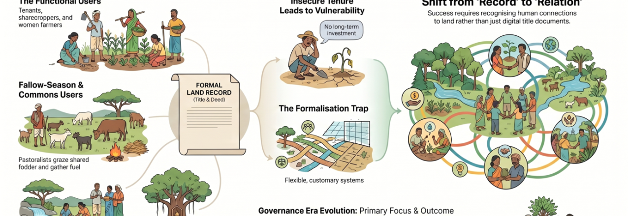
The formal land record, the Record of Rights, the cadastral map, the land parcel boundary in a GIS system — captures some details about a named individual, parcel and the state, more  with a transactional objective. It tells, who can sell the land, mortgage it, and receive compensation if it is acquired. What it does not tell, and what it was never designed to tell you, is who actually farms it, who grazes it between crops, who depends on it for their livelihoods or culture, who protects the watershed or forest that feeds it water, nutrition and pollination, and who will bear the consequences when a climate shock, a carbon project, or a solar farm arrives.

The Five Invisible Stakeholders on Every Farm

In any piece of agricultural land in South Asia — a rainfed plot in the Gangetic plain, a terraced field in the hills of Nepal, a smallholder farm on the edge of a forest in Bangladesh. The land record or document may show a single owner. The reality on the ground is almost always a layered, overlapping web of at least five distinct groups of people with real, substantive relationships to that land — none of whom may appear in the record.

  1. The tenant, the sharecropper, the woman farmer, the agricultural labourer: These are people who till the soil, contribute to decisions about what to plant, manage soil health, and extract the harvest. They exercise genuine, functional tenure – access, use, manage and extract  the land. Their care, persistence, adaptability and what we might recognise as local ecological knowledge, are precisely the kind of engagements, that climate resilience depends on. Yet they are invisible in the public farm service program who transfers subsid/grant to bank account of recorded land owner, to the carbon project developer who consults the land record, invisible to the food company conducting supplier due diligence, and invisible to the RE developer seeking consent from the “landowner.”
  2. The fallow-season users : When the crop is harvested and the land lies fallow, it does not stand empty. Landless and herders bring their animals to graze. Village youth use it as a playground. Families gather fodder and fuel. Women collect seasonal produce. The land is, in this period, a commons — accessed, managed, and depended upon by people whose names never appear in any title document, but whose livelihoods are directly at stake when a solar park fence goes up or a carbon project recommends change in land use.
  3. The upstream contributors : Perhaps the most conceptually challenging group: people who do not use or access or directly derive any benefit the agricultural land at all, but whose actions on other land directly conditions on it, making it usable as a farm land. The community that protects the commons- the wetlands, pasture land in the village landscape mosaic or care the forests on the ridge above, supports the moisture regime, the pollination, the nutrient flow, and the microclimate of the farmland below. They are, in the most meaningful ecological sense, the ignored tenure holders of that farmland’s productivity — but neither tenure law nor project design has any category for them. NbS interventions that reward the forest community and the farmer separately, without recognising this connection and relationship, risk breaking the very ecological chain they are supposed to protect.
  4. The power-holders: On many landscapes, the person who actually determines what happens on the land is neither the titled owner nor any of the productive users above. It is a local power-broker: a village leader, a trader, a money-lender, a political figure who controls access, dictates terms, often decide the crop choice and takes a share of the surplus. Any traceability system, carbon registry, or value chain initiative that conducts due diligence with the formal landowner while ignoring these power relations is conducting due diligence on a fiction.
  5. The emotionally and ecologically connected:  The final category is the most easily dismissed and perhaps the most consequential for the long term: communities whose connection to a piece of land is mediated not through use or ownership but through a sacred tree, a migratory species, a water source, an ancestral memory. These communities may have no legal claim and no day-to-day management role, yet their connection is threatened,  when the tree is felled for a solar project, when the grassland that supports their sacred species is converted to a carbon plantation. Then they become active and powerful actors in shaping what that land does and does not permit. Ignoring them in project design does not make them disappear; it makes them opponents.

Is Formalisation a Trap for NbS and Carbon Markets?

Here is where the argument becomes most urgent for practitioners in NbS, carbon markets, and RE transitions specifically.

The default response to tenure complexity in climate project design is formalisation: map the land, title the owner, document the rights, create the contract. This feels like due diligence. It feels like inclusion. It is frequently neither. Rather on ground, it would lead to exclusion, injustice; often triggering conflict and adding risk to very resilience and permanence that such climate investments look at.

What this Means for Climate and Food Intervention?

For practitioners across the four domains, here are what the implications look like.

For NbS designers and implementers: Your theory of change almost certainly passes through tenure. If your intervention involves changing land use — planting trees, restoring grasslands, creating buffer zones, shifting from annual crops to perennials — you are changing the tenure, the land-people relations, for every one of the five invisible stakeholder groups described above, whether you intend to or not. Tenant or women farmers will lose access to land they depend on or will be required to put more labour, without any matching benefits. Fallow-season users run the risk of being excluded from areas the project now controls. Upstream communities will find their traditional forest management reclassified as a carbon asset belonging to someone else. Designing for tenure complexity is not a safeguard add-on to an NbS project. It is the intervention that any NbS investment must not ignore, if they aim intended result.

For traceability practitioners: Your supplier due diligence and traceability systems are reading land records and mistaking them for ground truth. The smallholder farmer who appears in your system as the “landowner” may be farming on land they share with a tenant, borrowing land from a relative, or managing a plot whose actual productive decisions are controlled by a trader-creditor. Deforestation-free commitments, living income benchmarks, and regenerative agriculture certification all require understanding not just who owns the land on paper, but who works it, who depends on it, and who has the power to change what happens on it. Traceability without tenure intelligence is traceability without integrity, and may not serve the purpose otherwise.

For renewable energy developers and siting teams: The social licence problem that has slowed RE deployment across South Asia is substantially a tenure problem. Projects that consult the titled landowner and bypass the tenant, the fallow-season user, and the power-holder do not have community consent — they have a signed document. The difference becomes apparent when construction begins. More fundamentally, RE siting that converts productive agricultural or agroforestry land — particularly land with high tenure complexity and multiple invisible users — creates climate injustice even as it delivers climate mitigation. The question is not just whether the land is “available.” It is whether the transition is tenure-just?

For carbon market developers and climate finance practitioners: This may be the most urgent message of all. Carbon and climate finance that treats tenure as a compliance checkbox — something to tick before the real work of carbon accounting begins — will fail ecologically and socially. Projects that skip genuine tenure due diligence do not just risk community resistance. They risk undermining the very ecological conditions their carbon claims depend on. A community whose customary tenure arrangements have been disrupted by a REDD+ or NbS project does not continue to manage the forest the way they did before. The carbon is not permanent. It never was, because the governance was never secure. Tenure due diligence is not a legal formality. It is the ecological foundation of carbon integrity.

The Framework That Is Imperative

This 360 degree framing  brings a spectrum that is worth taking seriously as a practical planning tool. At one end: relational land systems, where land is identity, stewardship, and collective accountability. At the other: transactional land systems, where land is a commodity, a carbon asset, a market instrument. Most landscapes in South Asia occupy a hybrid, contested middle ground — and the most important insight is that both relational and transactional approaches can reproduce inequality if poorly designed.

The question for practitioners is not which end of the spectrum to push toward, but how to design interventions that genuinely strengthen the relational systems that underpin social justice and ecological resilience while providing the security and recognition that transactional engagement requires.

This is not a both-and compromise. It is a fundamentally different design logic — one that starts by asking, before any project document is written: who actually governs this land, under what conditions and terms, and with what consequences for climate resilience if we intervene?

The evolution of land governance thinking in most countries, can be mapped in four words: from Revenue (colonial-era extraction) to Reform (rights-based redistribution) to Record (digitisation and formalisation) to Relation (the recognition that governance is ultimately about people and their connections to land, not about documents).

Most climate projects are operating at the Record stage and calling it progress. The work ahead is to move to Relation — and to do so with the urgency that the climate timeline demands.

A Closing Provocation

Aldo Leopold wrote that conservation is harmony between people and land. The word he used was (wo)men, a deliberate correction that places the gendered dimensions of land access at the centre of the conservation project.

Harmony, in the context of climate action on farmland, means recognising that the land being intervened on is already full — full of relationships, dependencies, histories, and ecological knowledge that your project design did not create and cannot replace. The question is whether such external intervention will work with those relationships or against them.

Every climate project that lands on farmland without understanding the tenure relations governing it is not just missing an opportunity. It is, in the most specific and measurable sense, a climate risk.

The land record is not lying out of malice. It was never designed to tell what you need to know in the climate contexts. The work of climate-responsive land governance is to build the tools, the protocols, and the institutional will to see what the present record cannot show — and to govern accordingly.

This blog draws on Pranab Ranjan Choudhury’s session on Land Tenure, Land Use and Climate: A Nexus Perspective, delivered at the Summer School on Climate Responsive Land Governance, Dhulikhel, Nepal, April 2026, and on the multi-tenure framework he has been arguing for as a way forward for climate actions.

Women’s Land Rights Champion: Patricia Malasha

This interview with Patricia Malasha, USAID/REFS, is part the Women’s Land Rights Champions series, which profiles people around the world who are working to advance women’s land rights.

Tell us about yourself

Patricia Malasha, USAID/REFSMy name is Patricia Malasha, and I am a Gender Specialist whose focus for the past 30 years has been on working with women and men to advance gender equality and ensure women have access to land rights and land ownership. I am currently the Country Coordinator for the USAID-funded Integrated Land and Resource Governance Program II (ILRG II) in Zambia, which supports inclusive natural resources management and women’s access to and control of land. I also served as a gender specialist on USAID’s ILRG activity from 2018-2023. My project supports land documentation in customary areas that host 90 percent of land in Zambia, and engages with stakeholders to support inclusive land tenure and resource governance systems.

Why are women’s land rights and resource governance important to your work? And to other USAID development work?

A majority of Zambian women depend on agriculture for their livelihood, and yet less than 22 percent of them own land and property in their country. Despite women having the legal right to own land, systemic challenges and cultural biases deny them the opportunity to enjoy the social and economic benefits associated with land ownership. Through ILRG, USAID has advanced gender equality in Zambia, breaking through structural and cultural barriers so that women gain the power to own land and make decisions about the use of their land. Through our programming, we speak to women and men, hear their views, and leverage their perspectives to design the right interventions for promoting women’s land rights. As a result, 50 percent of women that we work with have their names included on a land certificate. Through this work, we are changing the perceptions and realities for women, making them owners or co-owners of the land rather than just workers on it. This positively changes their social and economic status and gives them the confidence to reshape their role in their familial and community development.

What are some of the biggest challenges in helping women secure land rights and what are some things being done to overcome them?

In Zambia, cultural rules dictate that land belongs to men. These norms and rules are hard to shift away from, and challenging these norms often leads to social rejection or gender-based violence for women. Helping women to understand the importance of being included on land certificates and convincing men to accept women as landholders takes a lot of time and resources. Under ILRG I and now ILRG II, we ride on the local context, using positive influence to achieve success. A traditional saying we often use: “umucele ukufina baumfwa kubausendapo,” means that “the weight of salt is known only to those who have carried it.” We apply this to our work by talking to men and women to help them understand harmful norms, their meaning, as well as what we can change and the impact our interventions can have on individual lives. As a first step, we hold dialogues with traditional leaders (as influencers) and families to increase the acceptability of women as land holders. We then identify and work with women and men within the communities to become role models to champion the benefits of women’s land ownership. Eventually, communities realize these benefits, and more people join in the efforts to include women on the land ownership certificates.

What are some of USAID’s successes in the area of women’s land rights?

Using a holistic and transformative approach to promote women’s land rights ensures that USAID’s approaches are informed by a complete analysis of the barriers, norms, and the power dynamics in land documentation. ILRG II’s approach also helps to build an understanding of the risks and devise mitigation measures. As a result, USAID succeeded in documenting 40,000 parcels in nine customary areas for 170,000 people, 41 percent of which included women as newly registered landholders. In addition, 50 percent contained names of women on the land certificate as joint landholders.

Is there anything else you’d like to share?

ILRG II has developed tools and documents on the work to support women’s land rights. We share our stories to motivate others to learn and build on these efforts.

Our resources are available at: https://tenuresecurity.org/project/integrated-land-and-resource-governance-ilrg-ii/


Standing at the Entrance to Chiribiquete

An indigenous community in the Amazon learns basic land surveying to fix the errors of the past.

One glance at the shape of Itilla reveals that the person who determined the community’s oblong borders, was unaware of the realities of forest-dwelling communities in the Amazon. The Itilla reservation is an unusual 45 kilometers long and two kilometers wide. The territory looks more like a city block than the collective territory of a community in the Amazon.

Itilla, home to over 250 people, is located in Colombia on the northwestern edge of the vast Amazon rainforest. The community is accessed from San José de Guaviare, over 100 kilometers of dirt road followed by a boat ride down the Itilla river. Over 20 years ago, Amancio Yukuna, the community’s school teacher, was there when a public servant came to measure the Itilla reservation.

“The agent got out of the boat and walked a couple of kilometers. He took some photos and then turned around and got back in the boat and left,” Yukuna remembers.

Although the creation of the reservation was seen as an achievement, this territory of straight lines left out the most important aspects of their lives: the forest and everything within.

“Little by little we realized that we weren’t happy with the borders of our collective land,” explains Yakuna. “We are missing all the places we need to survive, where we hunt and fish and our sacred sites. There are no rivers or lagoons or any water, it’s all outside of our territory.”

A Forested Country

John Jairo García painting his faceThe majority of Colombia’s forests are concentrated in the Amazon and considered one of its most valuable resources. Today, these forests are threatened more than ever by the expansion of cattle ranching, illicit crop plantations, and illegal mining. All of these activities drive deforestation and put indigenous communities in a vulnerable position.

To push back against deforestation, in 2018, the Colombian government almost doubled the nearby Chiribiquete National Park, bringing its total area to 4.3 million hectares, making it the world’s largest protected area of tropical rainforest. With the expansion of Chiribiquete, the 8,000-hectare Itilla reservation was swallowed.

“In the past, it was all spoken. We simply told the government: ‘this is our territory’. But today, there is technology, and the information is organized and systematized. It’s more important than ever that the government recognize the entirety of our territory,” explains John Jairo García, Itilla’s current Captain, or political leader.

two dimensional map with drawings of wildlifeWith support from USAID and Colombia’s mapping authority IGAC, the families of Itilla have embarked on a new way to interact with their territory: using GPS and viewing the map on a tablet.

The Intercultural Geography School is the first of its kind and a groundbreaking opportunity to involve indigenous communities in the mapping of their territories while transforming the way they view the forest around them. The school, which included cartography professionals from IGAC, equipped 40 members of the Itilla community with the knowledge and skills to collect land use information, to document their territory, and create a map that can be used to update the boundaries of their land.

a man sat writing in a journalFollowing a multi-day training on land surveying concepts and how to use GPS tablets, the novice land surveyors first documented the forty something homes and buildings in their community, including the maloca where the community gathers for traditional ceremonies. After that, in small teams, they ventured into the forest surrounding their community to document the natural and cultural resources that are vital for their survival and growth.
This is the first time that an indigenous community has carried out government-sanctioned land surveying and reflects a significant step towards more inclusive and participatory rural land administration. The activity is part of USAID’s commitment to the Colombian government to survey and update the boundaries of the expanded Chiribiquete National Park.

Eleonora Garcia and Hermes Londoño visit a nearby lagoon where the community often fishes.

“If rural communities learn mapping exercises in an effective way, they can understand why it is useful and how the community fits into their territory. Through mapping, communities can get to know their surroundings better and strengthen their spatial relationships.

A Map of Instruments

Itilla’s community does not view the surrounding rivers and forests as natural resources. They prefer the word instruments. Under their vision of the natural world, the plants and animals of the forest and rivers have been offered to them as mere instruments that humans can use to connect with the spiritual universe of the Amazon.

Medicinal plants, forest food products, fish, and wild animals are all examples of these instruments. The bamboo-like plant caño de carrizo is used by the community to make the pan flute, which is used in traditional ceremonies and dances to communicate with ancestral spirits. Knowing where these plants grow and the animals inhabit is paramount to cultural preservation.

“Out there in the forest is where we find our sacred sites. Our elders have shown us where to go to find these sites and how to use the instruments they offer. We know the trails that the jaguars use, we know what fish are living in the lagoons and rivers,” explains Hermes Londoño, one of the community members who learned to map Itilla territory with a tablet and GPS.

Since launching the mapping initiative, Hermes and his neighbors have carried out expeditions, some during multiple days, to reach the farthest sites in the community’s territory.

In August 2024, the community finished the mapping exercise, logging hundreds of GPS coordinates, complete with descriptions and land use types. The completed map was printed and hung in the maloca for the community to view. For the majority of the community, it was the first time they had viewed their territory on a two-dimensional map that overlays sacred sites and land usage over the 2002 borders of the collective land rectangle.

“With this exercise, we are telling the government that we have formed our territory with our own team and we want to use these resources. Everybody is looking at this zone wanting to exploit the original forests, but these forests support our lives and are the basis of our cultural values. And now, we have documented it.” says Captain Garcia.

Under Captain Garcia’s leadership, they unanimously agreed to send this information to the IGAC and eventually to Colombia’s National Land Agency to expand the boundaries of their territory from the current 8,000 hectares to more than 102,000 hectares.

If they are successful, proper land use management and administration in protected areas like national parks could also consolidate indigenous land rights to disincentivize further deforestation. USAID bases its strategy on the logic that addressing land tenure issues and developing modern concepts of land administration with indigenous communities will lead to improved biodiversity conservation and open the doors to climate change mitigation.

Cross-posted from USAID Exposure

Licit Alternatives in Catatumbo

USAID is promoting value chains that will help producers embrace licit economies.

a birds eye view of CatatumboSince 2000, Catatumbo has been synonymous with the presence of illicit crops and a drug trafficking corridor. In this region, which borders Venezuela and includes 10 municipalities from Norte de Santander, there are an estimated 30,000 hectares of coca.
While the area is disputed by various armed groups, thousands of farming families see few possibilities to enter into a licit agribusiness that allows them to leave illicit cops behind. Informal land tenure aggravates the situation, tertiary roads are in poor condition, and the government is still largely absent. Approximately 70% of the land is not formally owned, and this lack of secure land tenure is an obstacle to access bank loans and government subsidies.

However, Catatumbo has suitable weather and fertile soils for diverse agricultural products. The most common and profitable crops are coffee and cocoa, which provide income for more than 8,000 families.

To take advantage of these conditions, USAID through the Land for Prosperity Activity, promoted two Public Private Partnerships (PPPs) in the coffee and cocoa value chains, reaching more than 2,500 producers and resulting in more than $650 billion pesos in sales for cocoa growers.

To diversify agribusiness and boost additional licit economic opportunities in the region, USAID supported the creation of two more partnerships in the avocado and honey value chains.

The Avocado Bonanza

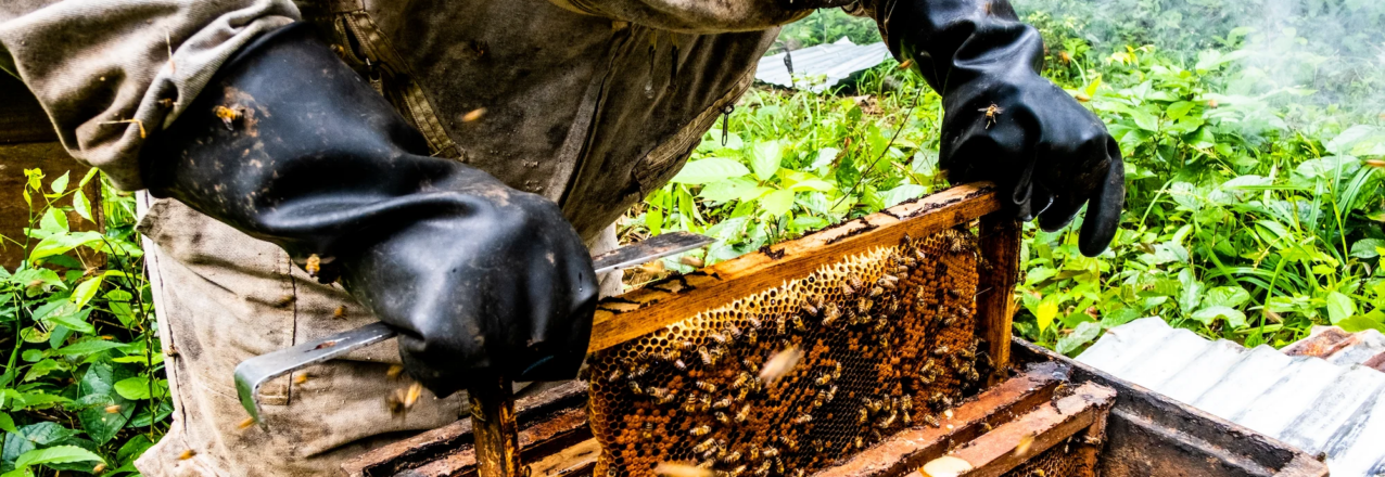
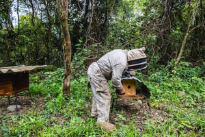
a suited beekeeper inspecting a hiveRecent studies show that Colombians are eating more and more avocados. Over the last five years, consumption has risen from 6 to 10 kg per person, per year. The trend bodes well for regions like Catatumbo, where conditions are apt.
To strengthen the value chain, meet the demand for avocados in Colombia, and explore export opportunities, USAID promoted the country’s first avocado PPP. The partnership has linked 17 associations that bring together more than 1,000 producers from 12 municipalities in Catatumbo. The partnership has already mobilized more than COP $1,900 million (USD $680,000) in funding and investment.

The partnership is important to identify needs and challenges in the value chain and foster collaboration among public entities to offer technical assistance on planting, grafting, and pest control to farmers.

Diomar Contreras, avocado producer from the Afrucar association in El Carmen, Norte de Santander.“The avocado is a highly profitable crop and brings income to families. We have been replacing illicit crops with avocado,” says Diomar Contreras, avocado producer from the Afrucar association in El Carmen, Norte de Santander.
Avocado farmers face challenges with consistency and supply commitments. For commercial partners and avocado buyers linked to this PPP, such as the large supermarket chains in the departmental capital, Cúcuta, it is important to be able to rely on avocado delivery times and established quantities to guarantee producers the purchase of their product.

“For buyers, the issue of trust is important. The relationship between supplier and buyer is like a dating relationship, where we don’t always agree, but by talking and being there, we can achieve and strengthen our commercial partnership,” says Angie Garzón, fruit and vegetable purchasing manager at Los Montes supermarket in Cúcuta.

A Sweet Future

The honey produced in Catatumbo is known for its unique flavor profiles. However, most beekeepers lack the knowledge and tools to comply with the quality standards. This, added to the lack of appropriate infrastructure such as roads, has limited the options to sell outside of the region.

USAID facilitated a partnership in the honey value chain to create opportunities and build the capacity of beekeepers The PPP organized leadership schools for community leaders. USAID is currently working with the Norte de Santander Secretary of Agriculture to create departmental honey and avocado committees which will maintain the collaboration between the PPP participants and ensure the long-term sustainability of the partnerships.

Carlos Ascaño, technical leader, Coosocata Cooperative, Catatumbo.“We need knowledge, we need training, and these partnerships allow us to know what the producers need to be able to sell to larger markets. That is why we need to come together, so that smallholder farmers can reach big clients and offer that added value that formal markets require.”

– Carlos Ascaño, technical leader, Coosocata Cooperative, Catatumbo.

Cross-posted from USAID Exposure

It’s About More Than a Land Title

USAID is helping rural communities to obtain property titles and leverage investments in agricultural value chains.

two farmers working in a fieldFor decades, rural communities in Colombia have faced challenges related to not owning the land they live on. The lack of secure tenure has consequences and keeps thousands of families from accessing government programs and subsidies that could improve their opportunities for success.

Without a registered property title, rural families can continue to cultivate their land and invest in their homes, but in the face of potential displacement due to a resurgence in violence, they lack the legal protection and risk losing their entire livelihood.

Carlos Romero is a farmer in the Montes de María region, whose land has never been formalized. A notarized receipt of payment is all he has to show that he is the land’s rightful owner. His whole life, Romero has grown ñame, a starchy yam-like tuber, as his main income and the means to raise his family. In fact, Romero credits ñame for the fact that three of his four children have finished school, and his son is currently at university. Despite the challenges, Romero has given them a promising future.

Land Ownership

a man and child posing with a donkeyIn 2024, Carlos received the registered land title to his farm in San Jacinto, Bolívar, thanks to USAID’s support to increase land formality in rural areas affected by the conflict. In San Jacinto, experts surveyed 3,700 parcels and delivered some 1,100 cases to Colombia’s National Land Agency for titling. So far, the government has issued over 600 land titles to farmers like Romero.

“Now that we have our property title, we can cultivate with confidence. If you don’t have a land title, even the person who sold you the land can come and claim it as their own. But with a title you are safe from those problems,” says Romero.

USAID is using its expertise in land tenure programming and rural development to carry out 11 large-scale land formalization activities across the country, many of which have taken place in some of Colombia’s most complicated municipalities.

Small Business Owner

a farmer walking down a row of cropsSecure land tenure is still just part of the larger picture to improve rural development. For Carlos, a property title means being able to peacefully cultivate yams, but it does not immediately make him a more successful farmer.

He is also part of a Public-Private Partnership (PPP) that USAID helped to establish in the Montes de María region. The PPP, which is building on over seven years of strengthening the value chain, has allowed him to produce innovative products like Ñami Chips, which are thin, fried slices of ñame that are sold in the Caribbean region.

Romero has also learned and improved his production and processing techniques, met commercial partners, and received technical assistance directly at his farm.

Romero is no longer a subsistence farmer, he runs his own agribusiness. Now that he has a land title, Carlos is connected to the formal land market and can more easily access government subsidies like agriculture training and technical assistance from public entities and private partners.

Explaining Land Rights

brown bags full of Chips de NameCarlos Romero’s wife, Luz Dary, also benefits from the strategy, first by being included as landowner on the land title, but also thanks to the accompanying social outreach strategy to improve the understanding of women’s rights. The role of women as caregivers is just as important as the role of the men who work the land. In rural areas, women are almost exclusively responsible for caring for children, senior citizens, and people with disabilities; as well as for guaranteeing the food security of their families.
“My wife does not go to the field to work, but she supports me from our home. I am very happy that her name also appears on the land title. She is my partner and the mother of our children,” says Carlos.

USAID designed the Land for Prosperity Activity to improve land administration in rural areas of Colombia to create the foundation for a formal land market, and at the same time, strengthen key agriculture value chains to help those communities support their families and improve their quality of life. To capitalize on the entry of thousands of families into the formal land market, it is essential for public and private actors, including donors, to enhance agriculture skills, introduce new technologies, and make market linkages with the private sector.

a graphic displaying LFP's Integrated Results

Cross-posted from USAID Exposure

Women’s Land Rights Champion: Aslihan Kes

This interview with Aslihan Kes, USAID/REFS, is part of USAID’s Land and Resource Governance Division’s Women’s Land Rights Champions series, which profiles staff across USAID Missions and operating units who are working to advance women’s land rights.

Tell us about yourself

Aslihan Kes' headshot photoI am a Senior Gender Advisor with the USAID Bureau for Resilience, Environment and Food Security (REFS). I have been with USAID for about 6 years. Before joining the Agency, for over a decade, I worked at the International Center for Research on Women, last as a Senior Economist.  That is where I first started working on women’s land and property rights as a key priority not only for increasing women’s economic security and wellbeing, but also for increasing their empowerment across many spheres of their lives. One of the first research projects I worked on explored the linkages between women’s land tenure security, access to housing, and human health and well-being in South Africa and Uganda. In this work, we explored the impact of secure land and property on women’s ability to protect themselves from HIV and reduce gender-based violence (GBV). Together with colleagues, I also developed one of the early survey instruments to better understand and measure women’s rights to land and assets. The tool helped analyze relationships between different types of land ownership and women’s perceptions of longer-term security of their land and assets and ability to make decisions over their land and assets. Finally, I had the privilege to work with grassroots organizations across East Africa and support the development of paralegal programs that raised awareness about women’s land rights, supported community-level conflict resolution, and enhanced women’s access to justice.

Why are women’s land rights and resource governance important to your work? And to other USAID development work?

At USAID, REFS coordinates the Agency’s efforts to promote food security and improved nutrition, access to safe water, a healthy environment, and improved livelihoods for all. We can achieve these goals only with women at the center of our efforts; when women have the tools to succeed and when they are empowered to chart a course for themselves and their families. And women’s land rights and resource governance are fundamental for driving equity and empowering women.

The latest (2023) FAO report on the Status of Women in Agrifood Systems synthesizes the most recent gender data and evidence from the agricultural sector and reinforces a key message that there are significant economic and social costs to persistent gender inequities in agrifood systems—a sector in which women contribute significant labor and rely more heavily on for their livelihoods.

One of the key inequities the report underscores is land ownership. Despite progress in some areas, women’s tenure security over agricultural land continues to lag behind that of men. All the while we have an ever-growing evidence base that clearly lays out the case for secure rights over land because they incentivize women—and men—to invest in their land to make it more productive and to be more resilient. Land as collateral remains the more common way for women and men to access financing for their investments both on and off the farm. In fact, the ImpAct Review that was done by the USAID Office of Chief Economist last year lists formalizing women’s land rights and expanding co-titling as meaningful interventions for increasing women’s agricultural income. And finally, as summarized in the same FAO report, there is a large body of evidence that highlights the positive linkages between women’s land rights and improved bargaining power, human capital investment and intergenerational transfers, just to name a few. In other words, the ripple effects of securing women’s land rights can set a foundation for generating positive outcomes from much of the work that we do at USAID.  

At this point, the question is not “why” it is important to ensure that women have tenure security over land and a voice in their natural resource governance, but “how” to advance these through programs and policies.

What are some of the biggest challenges in helping women secure land rights and what are some things being done to overcome them?

While it is encouraging to see that more countries have undertaken legal and policy reforms that promote and protect women’s equal rights to land, there continue to be significant implementation and enforcement challenges. This has to do with the limited capacity and resources of institutions to effectively implement policies but also with the tension that often exists between the laws on the one hand and social norms governing land ownership on the other.

I think the way we can tackle this complex challenge is through programs that pursue multi-pronged approaches that address both demand and supply. For example, it is important to build the capacity of institutions to design and implement gender responsive land policies, raise awareness about women’s legal land rights, and engage with men and community leaders in meaningful dialogue to tackle long standing norms that might prevent equitable and inclusive land ownership.

For the last couple of years, through the U.S. Government’s Gender Equity and Equality Action (GEEA) Fund, managed by USAID’s Gender Equality and Women’s Empowerment Hub (GenDev) and implemented by USAID and the Department of State, USAID has been supporting African Women in Agricultural Research and Development (AWARD) to implement the Gender Responsive Agriculture Systems Policy (GRASP) fellowship program. GRASP invests in building the leadership of women in food systems policy in Africa and is currently working with about 100 women fellows from 12 countries across the African continent. These fellows and the mentors and mentees they work with—300 changemakers in total—are working to ensure agricultural policies and their implementation, including around land and natural resource management, are more gender responsive. I think this is a great example of how we can make inroads to transforming agrifood systems with women as leaders driving the change.

As a donor, it is also important that we set clear targets and direct resources toward programs that will help us achieve those targets. Last year, USAID announced Generating Resilience and Opportunities for Women (GROW), which is a commitment to more than double USAID’s investments in Fiscal Year 2023 funds to advance gender priorities in agrifood, water, and climate adaptation programming to reach $335 million. Today, some 17 months later, USAID has actually exceeded the GROW commitment by $114 million to reach a total of $449 million in investment.  

GROW is enabling USAID to deepen and scale the impact of our programs that support women on and off their farms. One of the targets that USAID has set under GROW is that 150,000 women will be provided with legally recognized and documented tenure rights to land or marine areas by FY 2025.  

This target will help us stay the course and stay accountable to this important priority.

What are some of USAID’s successes in the area of women’s land rights?

There are some successes in this space achieved through awareness raising and capacity building as well as innovative models such as the Mapping Approaches for Securing Tenure (MAST), which USAID and partners use to support local communities to document, manage and secure their land and resource rights.

There are also some promising results that came out of intentionally embedding women’s access to land and tenure security as a priority within USAID’s agricultural value chain activities. For example, the Advance II activity in Northern Ghana tapped into the existing outgrower business networks to promote women farmers’ access to land. With support from the Activity, the outgrower business owners, who saw a strong business case for working with women farmers, organized community sensitization meetings with male landlords, chiefs, husbands and women leaders in the community and advocated for land access for women farmers. At the same time, the Activity supported locally led research that helped them more effectively advocate on this critical issue. The research revealed the significant productivity losses that are caused by women farmers’ lack of easy access to land, and helped secure commitments from traditional leaders and landowners to extend land tenure rights to women; rights that were documented through a Memorandum of Understanding (MOU).

Building Resilience to a Changing Climate under Insecure Tenure

By Julius Bright Ross and Amanda Clark

In a sunny field in El Salvador’s Usulután Department this August, approximately twenty members of a Farmer Field School gathered around a plot containing six different varieties of maize. As they discussed the comparative advantages of the varieties, they keenly appraised their likelihood of withstanding both dry spells and heavy precipitation events. Heavy precipitation, in particular, was top-of-mind after intense storms fell on much of El Salvador this June, flattening young crops and stripping fields of topsoil and organic matter. Another tool for improving resilience wound its way through the maize plants: jack bean (Canavalia ensiformis), planted alongside maize as beans have been for millennia to enrich the soil and provide ground cover. Using funding from the United States Agency for International Development’s (USAID) Bureau for Humanitarian Assistance (BHA), Catholic Relief Services (CRS) is promoting Canavalia ground cover as part of a suite of climate-smart agriculture (CSA) practices, which aim to sustainably increase agricultural productivity and incomes, adapt and build resilience to climate change, and (where possible), reduce or remove greenhouse gas emissions. CRS’ suite of CSA approaches in El Salvador, which they term “water-smart agriculture”, focuses primarily on increasing and stabilizing yields sustainably to improve food security during intermittent droughts. One farmer, Adonis, has enthusiastically adopted Canavalia and other CSA techniques, emphasizing to the BHA team that the ground cover keeps his soil moist during brief dry spells.

Nevertheless, greater adoption of Canavalia and, in particular, more laborious soil and water conservation measures such as in-field infiltration trenches by Salvadoran farmers is heavily curtailed by the trade-off between near-term results and how long a farmer can count on farming the same plot of land — that is, how secure their land tenure is. In El Salvador, a high percentage of farmers do not own their land, often paying a landowner for the usage rights in-kind through crop residues to feed cattle with during the dry season. When unofficially surveyed, only about half of the CRS farmer field school members reported owning the land they farmed, and only half of those that rented (including Adonis) were confident they would be able to farm the same land the next year.

Land tenure refers to the relationship individuals and groups have with land and its resources, including trees, minerals, pastures, and water. These relationships are defined by land tenure systems – the rules, customs, and laws that define how property rights to land are allocated, transferred, used, or managed. More broadly, the field of land and resource governance (LRG) describes the complex relationships between land and societal elements such as culture, politics, economics, and history. The unique LRG context that describes a community’s land tenure varies both geographically and over time, but is of crucial importance to understanding challenges to economic development.

Insecure land tenure is linked in complex ways to food insecurity. The possession of secure tenure over land can itself be a marker of wealth and permanency, which can affect food security in myriad ways including the ability to invest in inputs, the time to acquire knowledge of the land’s idiosyncrasies for growing crops, and social capital with long-term neighbors that might provide coping mechanisms during shortages. In some cases, land tenure security may provide greater access to credit, directly driving the agricultural investments (including both assets and financial mechanisms such as insurance) that cushion the effects of climatological drivers of crop failure such as drought. These factors encourage smallholders with secure land rights to make longer-term decisions for themselves, their families, and their lands.

USAID is a leader in developing evidence at the juncture of land tenure security and CSA adoption. A follow-on impact evaluation of the USAID-funded Tenure and Global Climate Change Project in Zambia found strong links between land tenure security and increased uptake of Climate-smart Agriculture practices, although it is worth noting that the strength of these links varies geographically. Many CSA practices have long-term payouts that require significant upfront investments. For farmers with insecure access to land, these costs can be a significant barrier to adopting such practices. Farmers will likely avoid the high investment incurred by practices that improve long-term sustainability if they cannot count on benefitting from them in the short-term. Conversely, LRG improvements such as strengthening land tenure and investing in governance of communal resources can provide the scaffolding farmers need to embrace CSA approaches, which, despite their initial costs, can improve soil health, increase biodiversity, and build resilience against climate change, thereby increasing the stability of productivity over time.

USAID works to improve land and resource governance and strengthen property rights in 23 countries globally. In each of these countries, the agency ensures that programming is context-specific and responds directly to the needs of those most vulnerable to land exploitation. In Ethiopia, issues such as farmer-herder conflict and unequal land access for women and youth hinder equitable adaptation to climate challenges. The Ethiopia Land Governance Activity aims to address these issues by strengthening land governance systems, expanding communal land tenure security in pastoral areas by facilitating policy reforms, and creating opportunities for more women to serve in land administration entities. In Colombia, unclear land tenure and property rights obstruct economic growth, generate violence and social tension, and fuel illicit activities that lead to increased deforestation and land-based carbon emissions. By providing access to land titles, supporting land restitution, strengthening local government capacity for land administration, and integrating citizens into licit socioeconomic opportunities, the Land for Prosperity Activity aims to protect members of rural communities from climate and socioeconomic risks.

In El Salvador, Canavalia ground cover is a tenure-conscious component of CRS’ Climate-smart Agriculture: short-term enough to produce results within a growing season, but with long-term value for those with surer land tenure. Nevertheless, Canavalia works best in concert with other CSA practices, including mulching crop residues that often go towards paying rent and establishing trenches or live barriers to reduce loss of soil and organic matter on steep farmed slopes. CRS is exploring alternative arrangements to make these investments possible for tenant farmers, such as through promoting herbaceous live barriers paired with silage training to provide an alternative value proposition for landowners.

Whether through increasing land tenure security or finding creative solutions to increase the feasibility of soil and water conservation on rented land, long-term stewardship can make a substantial difference. The BHA team visited Santos Franco Reyes’ farm in the department of Morazán, which he has owned for twenty years and which he has steadily improved over that time. Despite a 12 to 13 percent slope, the field’s maize plants were growing strong in clearly healthy soil, with ample mulch from the well-pruned trees growing throughout the field and worm-castings every few inches. Santos proudly showed off the infiltration trenches that he had dug to capture heavy rainfall and infiltrate it into downslope maize over subsequent days, telling us he has been digging these for half a decade already. Santos has farmed this slope since his daughter Sulma, standing out with us, was a young girl. As Santos put it, “I do everything I can to make sure this farm is here for her when I move on.”

Cross posted from Agrilinks