
Tools and Resources

Photo Credit: Gary Hunter and Anna Soave / Tetra Tech

Use these land rights tools to connect practical methods with country-specific evidence and program experience.

Land and resource tenure issues cut across climate resilience, food security, conflict, conservation, investment, urban development and livelihoods. This collection brings together practical tools, approaches, technical resources, and program materials that can help practitioners, researchers, policymakers, community organizations and others understand and address these issues.

Many of the resources were developed through USAID-supported programs and initiatives. They remain useful beyond their original context, offering approaches, lessons and evidence that can inform work on land and resource rights in different settings.

Choosing land rights tools for your work

Start with the question you need to answer: documenting rights, reviewing policy, assessing land use, or designing an intervention. Check each resource’s publication date, geography, intended users, and implementation assumptions before applying it in a different setting.

Mapping Approaches for Securing Tenure (MAST) Learning Platform

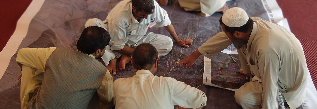
MAST blends participatory mapping approaches with flexible technology tools to help local communities who lack access to government services to document, manage and secure their land and resource rights, improving long-term governance of community land and resources. Learn more »

Funding/Contract Mechanisms

The Strengthening Tenure and Resource Rights (STARR) IDIQ was a USAID mechanism for providing technical assistance on land and resource tenure. This resource provides an overview of STARR, STARR II, and other USAID funding and contract mechanisms relevant to land and resource governance. It is intended as a practical reference for land practitioners seeking to understand how such mechanisms are structured. Learn more »

Integrated Land and Resource Governance

The Integrated Land and Resource Governance (ILRG) project explored practical approaches to strengthening land and resource governance, with work spanning land rights, tenure security, natural resource management, gender and responsible investment. The project generated tools, evidence and lessons from implementation that can inform current thinking and practice on land and resource governance. Learn more»

Geospatial Analytics

Geospatial analytics can turn land and resource data into information that helps land practitioners make better-informed decisions. This resource introduces applications ranging from satellite image analysis and land-use change modeling for risk analysis, thematic mapping and interactive online mapping. Learn how»

Land Advisors Program

The USAID Land Advisors Program expanded USAID’s cadre of land and resource governance ambassadors from Missions and across sectors by building the capacity of selected USAID staff in land and resource governance (LRG) programming. Learn more »

Tools and Guides

A suite of tools and guides provides background, guidance, and constraints to consider on a variety of land tenure and property rights related issues. Learn more »

Water and Conflict: A Toolkit for Programming

USAID has released its revised Water and Conflict Toolkit, first published in 2014. As of 2015, 177 million people lacked basic drinking water and 284 million people did not use basic sanitation in conflict-affected settings. In the face of increasing and protracted conflict and crises around the world, USAID strives to lead and influence development…Read More

Mapping Approaches for Securing Tenure (MAST) Learning Platform

Mapping Approaches for Securing Tenure (MAST) is a collection of participatory mapping approaches to help communities manage, document, and secure their land and resource rights. Using the MAST learning platform The MAST learning platform brings together introductory guidance, country applications, and a resource library. Start with Learn About MAST to explore what the approach is...Read More

I want to use MAST! How do I get started?

Getting started with MAST involves adapting a participatory mapping approach to local land information needs and institutions. This guide brings together case studies, implementation steps, and technology resources for planning that work. MAST is a flexible participatory mapping approach that can be adapted to the local context. MAST can fill different land-related needs depending on…Read More

Where has MAST been used, and for what?

MAST country applications in this archive cover Tanzania, Burkina Faso, Zambia, Liberia, and Mozambique. The examples below describe how participatory mapping was adapted to different land and resource governance objectives. USAID and its partners have used MAST across multiple countries to improve land and resource governance and to achieve multiple objectives ranging from women’s empowerment…Read More

Learn About MAST

Learn about MAST through this archived overview of participatory mapping, community involvement, and land documentation. Mapping Approaches for Securing Tenure combines a locally adapted process with flexible technology tools; the sections below explain its purposes and supporting evidence. MAST blends participatory mapping approaches with flexible technology tools to help local communities who lack access to…Read More

Advancing Capacity for the Environment (ACE) Fact Sheet

The ACE environment fact sheet describes Advancing Capacity for the Environment, an archived USAID program linking technical capacity with environmental and land governance priorities. The original summary is retained below. ACE is a global USAID program that facilitates the Agency’s ambitious work to fight climate change, conserve biodiversity and manage natural resources, improve land governance,…Read More

Land Tenure and Resource Governance Capacity Assessment Framework

The United States Agency for International Development’s (USAID) Integrated Land and Resource Governance (ILRG) program has developed a capacity assessment framework (CAF) focused on land tenure and resource governance. It is comprised of this document (the framework) and the accompanying application tool (the tool). There is also an accompanying video tutorial. The CAF documents and measures the progress…Read More

Land And Conflict: A Toolkit for Intervention 2.0

The purpose of this toolkit is to introduce readers to the complex relationship between land and violent conflict and to provide guidance on recommended approaches and actions to address some of the root causes of conflict. This understanding can help staff diagnose a problem, support strategic planning, and develop projects and activities that build on…Read More

Incorporating Land and Resource Governance in Other Development Sectors

Integrating land and resource governance across development sectors is the focus of these archived reference sheets. The series connects tenure and resource governance with biodiversity, climate, democracy, and gender equality programming. Land and natural resources are discrete, finite, and fundamentally important assets. In developing countries, they constitute a substantial part of personal and national wealth….Read More

USAID Climate Strategy 2022 – 2030 Resource Page

Climate change is a global crisis. As temperatures and sea levels rise, people around the world are increasingly seeing heat waves, droughts, floods, cyclones, and wildfires upend their lives. The effects of climate change are not equal – they disproportionately impact the poorest and most marginalized communities USAID works to support every day. Climate change…Read More