
Ask the Expert: An Interview with Yaw Adarkwah Antwi, Tenure and Global Climate Change – Ghana

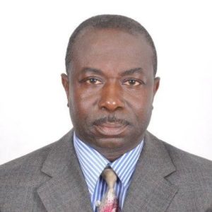
Yaw Adarkwah Antwi has more than 20 years of experience in land tenure and administration policies and holds a Ph.D. in Sub-Saharan Africa Urban Land Markets and an M.A. in Property Valuation and Law. Antwi has helped to develop land policies, particularly on the topics of land tenure, land management and agricultural development, in Liberia, Ghana, Nigeria, Sierra Leone and, within the COMESA region, Kenya and Sudan. Antwi is currently the country lead and senior land tenure expert on the Improving Tenure Security to Support Sustainable Cocoa project funded jointly by USAID and Hershey’s.

Tell us about the Tenure and Global Climate Change Project in Ghana.

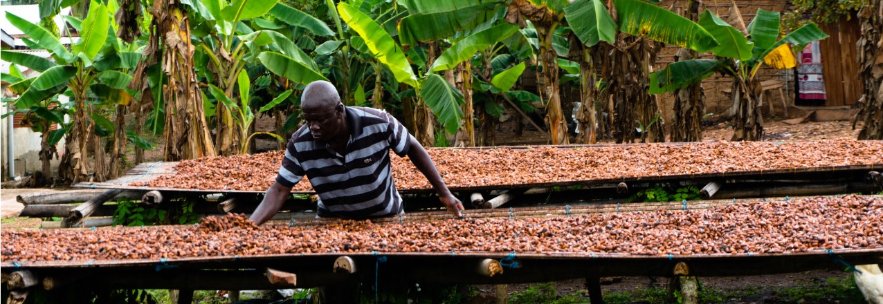
Starting in 2016, Hershey’s and AgroEcom Ghana Ltd (ECOM), a supplier of cocoa to Hershey’s, began collaborating with USAID’s Tenure and Global Climate Change (TGCC) Program to gain a better understanding of how to address the complex challenge of deforestation around smallholder cocoa farming in Ghana. This initial work resulted in an assessment and recommendations for a future pilot, captured in the report Land and Natural Resource Governance and Tenure for Enabling Sustainable Cocoa Cultivation in Ghana. Over the period from February to December 2017, a pilot in Nyame Nnae, a cocoa farming community in the Asankrangwa district of Ghana, was initiated to clarify and document rights to land and trees, and to develop a financial model for cocoa rehabilitation. Through this pilot, we sought to encourage tree planting on existing cocoa farms to reduce pressure on the forest fringe.

Why is this work important?

Worldwide, forests are being lost at an alarming rate driven by the expansion of internationally traded commodities. In response, companies have begun to remove deforestation from their supply chains, catalyzing the creation of the Tropical Forest Alliance 2020—a global public-private partnership aimed at reducing commodity induced deforestation. In Ghana, cocoa produced by smallholders has been the leading agricultural product driving deforestation for many years. Cocoa is a critically important commodity because it provides significant economic benefits that include jobs, improved livelihoods and social welfare, expanded tax base, higher family and corporate income and foreign exchange earnings growth. Cocoa production has been on the decline due to land and tree tenure insecurity, an elderly cocoa farming population, over-aged cocoa trees, high costs of cocoa tree removal, high incidence of pest and diseases and poor farm management practices.

In 2016, Ghana’s Cocoa Board announced plans to more than double cocoa output to 1.6 million tons by 2026. Ghana’s Intended Nationally Determined Contribution to the Paris Agreement on Climate Change specifically includes a 45 percent reduction of greenhouse gas emissions from the cocoa landscape. These two objectives require a new approach to sustainable cocoa production that controls forest cutting, builds back secondary growth forests on fallow cocoa lands, and increases cocoa productivity. Expansion of shaded cocoa systems would help Ghana achieve its greenhouse emission and cocoa production targets, improve the livelihood and resiliency of Ghana’s cocoa farmers and increase the sustainability of the global cocoa value chain, thereby benefiting global producers and consumers.

What are key achievements/successes from TGCC’s Ghana work?

We began field implementation of the pilot in April 2017 and concluded in December 2017 and achieved the following outcomes:

  • Mapped the boundaries of the community and individual cocoa farms, and clarified and documented rights between 190 landholders and farmers in Nyame Nnae community including 120 (63 percent) males and 70 (37 percent) females.
  • Working with migrant and indigenous farmers, documented three types of customary land tenure arrangements and negotiated agreements that reinforce the rights of farmers in seeking landowners’ consent to replant cocoa trees.
  • Successfully tested alternative dispute resolution systems of Asankrangwa Stool to reduce conflict and strengthen application of local systems for future documentation efforts.
  • Working with ECOM staff, developed a financial model for cocoa rehabilitation that shows it is possible to pay-back rehabilitation costs in three years while boosting farmer income and food security.
  • Developed and successfully piloted a model of public-private partnership between USAID, Hershey’s, and ECOM that leveraged 1:1 private sector investment with field implementation costs along with other support that included office space, vehicles, planning assistance and provision of extension personnel.
  • Provided training to community, traditional authorities and ECOM extension staff that proved effective and are transferable to future cocoa rehabilitation efforts.
  • Developed and piloted a comprehensive model of land rights documentation, alternative dispute resolution, finance, community and traditional authority engagement and cocoa rehabilitation for purposes of further refinement, replication and scaling up.
  • Assisted ECOM to successfully include tenure as a variable in their supply management and monitoring system.

What were the key lessons learned by TGCC, particularly those that can be applied to other activities?

  • The project successfully demonstrated that a public-private partnership linking tenure documentation, alternative dispute resolution, community engagement and financial modelling with cocoa rehabilitation was feasible. Upon completion, farmers were happy that the process protected rights of both indigenous landholders and migrant farmers including men, women, and youth. Traditional authorities from Asankrangwa district appealed for expanded participation of farmers to create peace in the community and for partners to replicate and scale up cocoa rehabilitation efforts. They further offered their leadership to advocate and support future projects with traditional authorities in other areas.
  • The process of building tree tenure security, which takes into account deforestation, cocoa productivity, environmental quality and farmer livelihoods, can take many years. Trees and cocoa systems need maturation before many of the pilot outcomes can be realized. An evolving policy and high costs of tree tenure documentation were seen as unsustainable, requiring more strategies to lower costs and address perverse incentives that lead to loss of tree cover.
  • The project studied how public goods and services (seedling supply, extension services, land administration and dispute resolution) can be covered given cocoa value chain constraints and tight government budgets, particularly as these costs are beyond private sector expertise and support. The project noted the necessity for dialogue and cooperation between the private and public sectors to develop strategies for lowering costs and designing innovations that promote sustainable cocoa cultivation. This cooperation can help improve the livelihoods of Ghana’s cocoa farmers, improve the profitability of the chocolate industry, provide consumers worldwide with high quality chocolate sourced from Ghana and use forest resources sustainably.

Where can I find more information on the project?

More information can be found on this TGCC project in Ghana here:

Ask the Expert: An Interview with Ryan Sarsfield, Global Forest Watch

Ryan Sarsfield is the Latin America commodities manager with World Resources Institute’s Global Forest Watch (GFW) team. He works to reduce the environmental impact of key commodities in Latin America through collaboration with corporate and NGO partners and the development of tools to reduce deforestation and supply chain risk.
Tell us about the development of the “Tierras Indígenas” indigenous lands platform in Paraguay under the Tenure and Global Climate Change program:

This activity under USAID’s Tenure and Global Climate Change (TGCC) program developed an interactive platform that provides maps and critical information about lands and territories of indigenous peoples and communities in Paraguay. The activity focused on the intersection of land tenure, deforestation and the private sector, which is a tricky place to work given the complexity of these issues and how they interact. In Paraguay (like so many places in the world), commercial agriculture is expanding into previously intact ecosystems – Paraguay’s Chaco forest, in this case – and this expansion is both an economic boon to some, and a cause of environmental degradation and land dispossession to others. In particular, the expansion has created land conflicts with the indigenous people of the Chaco, who have seen much of the region’s forest turned to cattle ranches over the last 15 years. As the country’s agricultural exports grow, so will the demand for agricultural production that is socially just and environmentally sustainable. This poses an interesting question: How would a well-meaning company in the beef sector go about reducing their exposure to these risks, and indeed reduce negative impacts of their investment on the ground?

Through our work, it became clear that one of the essential “raw materials” for responsible investment was data, specifically map data about indigenous lands in Paraguay, along with the varied levels of legal status or recognition that these lands exhibit. My day-to-day engagement with companies usually focuses on forest and deforestation data, which comes from satellites and is delivered via World Resources Institute’s Global Forest Watch platform. But it was clear that a locally managed platform would be best suited fill the gap on indigenous data. Under the Tenure and Global Climate Change program, we forged an excellent partnership with the Federation for the Self-Determination of Indigenous Peoples (FAPI) in Paraguay, and they led the development process of a mapping platform built on Global Forest Watch’s technology called Map Builder, which they continue to manage now that the project has wrapped up.

Why is this work important?

FAPI and its members already had a great deal of digital map data, and in fact, so did the government, but these data simply weren’t freely available. The general trend towards precise digital land mapping has been a great advance, but the creation of the maps is only one part of the process. How can data be distributed publicly and transparently, and how can potential users access the data, analyze it and best use it to positively influence the conditions on the ground?

As FAPI developed the project with its members and other partners, including 12 indigenous groups, it became clear that they saw the project as a medium to express their perspective on their own lands, and a means to reach audiences in Paraguay and abroad. At the same time, companies and financiers connected to the beef industry expressed their interest in having better indigenous data to work with as they carried out due diligence on their investments. Large-scale commercial agriculture and indigenous peoples are hardly allies in Paraguay, but in this case, the shared goal of obtaining better data was a helpful alignment.

What are key achievements/successes from this Tenure and Global Climate Change activity?

  • The Tenure and Global Climate Change team’s local partners launched the platform in late November 2017, called Tierras Indígenas Paraguay, which is now live online. More than 120 people attended the launch of what is the first publicly accessible online map of Paraguay’s indigenous lands, and the data was also featured on the global indigenous and traditional lands platform LandMark, filling a gap in Paraguay’s data.
  • Behind the platform itself, though, is the collaborative effort and data management that made it possible. FAPI and its collaborators have already taken steps to continue the development process, and this ongoing management is what will make Tierras Indígenas Paraguay an enduring asset and useful tool. As more data is collected, the status of individual lands change, and the pressures on their communities evolve, the platform has the potential to maintain and even increase its usefulness.

What were the key lessons from this TGCC activity? 

  • As the project sought to apply geographic and information systems (GIS) and technical assets (Global Forest Watch’s Map Builder) to a politically sensitive and enduring challenge at the local scale (the lack of publicly available indigenous data), working with the right local partner was far and away the key to bridging this gap and successfully carrying out the project goals. FAPI was ideal in serving as a trusted convener for their indigenous member organizations (magnifying the reach of the project). They were savvy and connected regarding national politics around indigenous land issues and skilled in managing partner meetings and media outreach.
  • Projects that increase data transparency and availability may be successful on their own terms, but will only be effective means to an end if users are aware of the data, accept the value of the work and make use of it. Outreach across many avenues was, and continues to be, critical to a successful and ongoing use of the platform. The platform was launched in a well-attended event that included indigenous groups, the private sector (meatpacking companies, banks, etc.), Paraguayan ministries and a range of domestic and international civil society organizations and received extensive press coverage in Paraguay and abroad.

Where can I find more information on the project?

More information on USAID’s TGCC activity in Paraguay can be found on Land-Links.org here

Ask the Expert: An Interview with Emiko Guthe, Tenure and Global Climate Change – Burma

As Burma Country Coordinator, Emiko Guthe managed Tenure and Global Climate Change (TGCC) project Burma pilot activities by helping to coordinate participatory mapping efforts, which documented community land resources in eight locations. A GIS specialist by training, Guthe brought her experience supporting mapping efforts to many international development projects in Burma.
Tell us about a little about Burma and USAID’s land tenure work there.

Burma is currently experiencing very rapid economic transformation, which poses both risks for the environment, as well as economic opportunities for the country’s diverse population. Land and natural resources are at the center of change, but the legal framework that governs land administration in Burma is complex, confusing and politically sensitive. Unclear laws and policies translate on the ground to a lack of clarity in roles and responsibility for land governance. Land administration is non-transparent and has not historically incorporated the perspectives of local communities.

USAID’s Tenure and Global Climate Change project in Burma, called the Land Tenure Project (LTP), began in 2014 to initiate steps toward a more sustainable land management system in support of equitable economic development. Underpinning all activities are principles of inclusive, public participation to encourage transparent and evidence-based dialogue amongst government, rural communities and civil society. Working on legal change as well as with rural communities, USAID tested and modeled participatory processes with many stakeholders in country.

Why is this work important?

In a nascent democracy, USAID demonstrated the value of including diverse perspectives for policy development and land related decision making processes. By encouraging dialogue amongst interested parties, stakeholders gain the skills and experience to develop sound laws and policies, negotiate conflicts around land and understand their rights. By training local organizations to address land-related challenges, they gain key capabilities to help communities on a path toward economic prosperity.

What are key achievements/successes?

USAID’s TGCC Burma program supported development of Burma’s new National Land Use Policy, which utilized an unprecedented process of public consultation to adopt international good practices. Endorsed by the government in 2016, the policy lays the groundwork for more sustainable land management and promotes people centered development around participatory decision making.

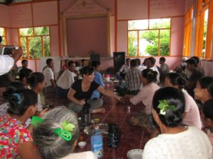
The project also tested the National Land Use Policy in practice at eight pilot sites in four states and regions of Burma. These pilots tested participatory mapping approaches that document community land resources. Local partner teams produced village resource boundary and land use maps for 59 villages and established 52 community representative committees.

To ensure that the new and current legislation was known both to government and constituents, we held legal awareness training seminars at different sites. Overall, we met with over 600 local government authorities in 15 village tracts and helped to improve their understanding of roles and responsibilities under the current legal framework for land.

What were the key learnings?

  • Complex and confusing laws and policies govern land in Burma and this translates to government roles and responsibilities that are not clear for communities. There is a strong need to harmonize and streamline the land legal framework.
  • Communities, especially rural villages, lack access to accurate, up-to-date information about their land rights. Traditionally, communities have had very little interaction with local authorities and do not look to government as service providers. Civil society groups often fill this void, but non-transparent land administration systems make access to information and data difficult. Communities need awareness raising and guidance on how to navigate a complicated land governance system.
  • Mapping initiatives in Burma are historically opaque, mandated from top levels of government, and rarely, if ever, take into account community knowledge or perspectives. The government needs support to integrate participatory approaches into mapping and resource documentation initiatives.

Where can I find more information?

To learn more about TGCC work in Burma click on the resources:

What else should people know about this work?

Burma is at a very early stage in developing sustainable land management systems and there is huge demand for this work!

Cassava and the Next Generation

A partnership in cassava attempts to strengthen production and address the generational labor gap.

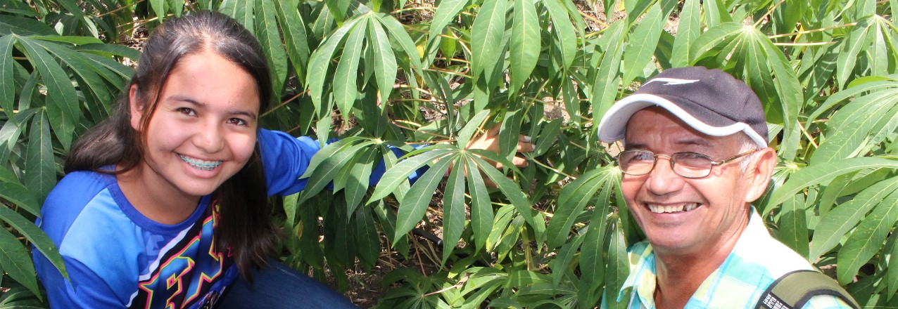
Mario Enamorado noticed a positive change in the appearance of the cassava from his last harvest. The change, he surmised, came after participating in a Farmer Field School, where he learned methods of organic preparations and green fertilizers and pesticides. He admits it has not been easy to make changes. He is 68 years old, and for the past 50 years, he has been using agrochemicals to combat pests, because that is what his father did.

These farmer field schools represent one of the strategies of a Public-Private Partnership in the cassava value chain—signed in March 2017—with the support of USAID to increase opportunities for some 140 farmers in Montes de María. The partnership targets cassava for industrial use, and is developing rural capacities in production and processing, in coordination with private sector allies, Almidones de Sucre and the cassava growers’ federation, Colfeyuca. In addition, the partnership has a wide range of support from the public sector, including Sucre departmental government, Sincelejo Chamber of Commerce, and national training organizations like SENA and Corporica (the National Institute for Agricultural Research).


LandCover: A Mobile Tool for Vegetation Monitoring

The Land Potential-Knowledge System (LandPKS; landpotential.org), a joint USAID-USDA program, is creating mobile applications that help land managers collect, store, and analyze data in order to inform decision making, agricultural production, and vegetation monitoring and restoration. It does this through the use of the LandPKS Mobile app, which is free to download and use for both Android and iPhone. The LandPKS app currently has two modules: LandInfo and LandCover.

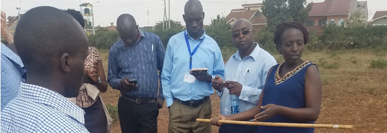
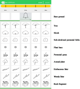
The major goal of the LandCover module is to assist users with collecting vegetation cover data using a point-intercept method. LandCover is designed to be a simple, user-friendly substitute for traditional paper monitoring sheets for vegetation cover. The only equipment needed is a meter/yard stick and the LandPKS app installed on a smartphone. First, the user designates a center point of the plot. Next, the user walks 5 meters/yards in one direction from the center, drops the stick, and enters which vegetation types directly touch the stick at 5 points along the stick, measures plant height, and establishes if there are canopy or basal gaps. This is then repeated at 10, 15, 20, and 25 meters/yards along that given transect. Lastly, this process is repeated in the 3 remaining transect. Overall, this method yields 100 points of vegetation cover data per plot in about 20 minutes.

Screenshot of the LandCover data entry screen and the different types of cover that are collecting with the LandCover module.

Importantly, results are calculated immediately on the phone about cover type, plant cover, canopy height, and gaps. In addition to receiving results on the phone, users can also access their data on our open-source data portal at portal.landpotential.org. Further, a user can enter vegetation cover data for the same plot at various intervals and immediately get results about trends in vegetation cover. LandCover can be used globally, and the module is currently being used extensively in the rangelands of Namibia and Kenya.

There are several important advantages of using the LandCover module for measuring vegetation cover. First, it gets rid of paper forms that can be lost or damaged. Second, results are delivered immediately to a user without the need for extensive data analysis. This benefit was mentioned by rangeland managers in Samburu County, Kenya, who told the LandPKS team that now they can see results directly on the phone themselves, instead of waiting months to maybe get results back from their headquarter offices. This makes it easier and more efficient for real-time vegetation monitoring and decision making. Third, the LandCover module makes vegetation restoration efforts easy to monitor. This has important implications for both maintaining wildlife habitat and encouraging the growth of fodder species for livestock. Lastly, the LandCover results help natural resource managers make more sustainable decisions about their land, which can lead to greater productivity and less environmental degradation. Download the LandPKS app to try out the LandCover module today! For more information about LandPKS please visit our website at landpotential.org or e-mail us at contact@landpotential.org.

Historical Land Decree for Women

Colombian municipality becomes the first to guarantee land ownership rights of women by decree.

THE STRUGGLE 

For more than 200 years, women around the world have been fighting for their rights. In Colombia, women gained citizenship only in 1954, and three years later, a woman voted in an election for the first time. Ever since, Colombian society is sharpening its awareness that women have economic, social, and cultural rights, as well as men.

Today, the struggle for equality continues. Women are victims of discrimination and face barriers in accessing their rights—among them, the formalization and titling of their properties.

In December 2017, the municipality Santander de Quilichao—located in Cauca Department in southcentral Colombia—and its mayor, Hernando Mendoza Bermúdez, made a historic step in land rights and women by singing into decree that “measures are taken in regard to land-related rights for women.”


USAID Land Champion: Zemen Haddis, PhD

Tell us about yourself.

As a Senior Agricultural Policy Advisor in the USAID Ethiopia Mission, I am responsible for providing advice on land and agricultural policies to the Mission, and I design and manage land administration and development projects. I currently manage the Land Administration to Nurture Development (LAND) project that aims to improve the tenure security of rural people in Ethiopia by strengthening land legal frameworks, improving the capacity of land administration institutions, certifying community land rights, and promoting research and learning. I serve as a co-chair of the national land administration and use task team and participate in other land platforms working to improve the tenure security of landholders. I wrote a number of papers and presented some of them at World Bank conferences. I have also published a doctoral dissertation entitled “Implications of Land Policy for Rural-Urban Migration”.

Why is land tenure/property rights important to your work at USAID?

USAID allocates about 800 million dollars annually to support economic growth, agriculture, food security, health, and education in Ethiopia. To achieve assistance objectives and sustain development gains, it is paramount to secure land tenure security and property rights. The issue of tenure security and property rights has attracted the attention of leadership at both USAID and the Government of Ethiopia (GOE). If tenure security and property rights of citizens are protected, this would help attract more foreign direct investment, encourage farmers to invest in their land, reduce conflict, and improve land governance.

What are some of the biggest challenges you see in addressing land tenure/property rights issues in Ethiopia? And how are we tackling these challenges?

Ethiopia is governed under an ethnic-based federal system. Regional states are constitutionally mandated to administer land, while the federal government provides the broader legal framework. Regions enact their respective land laws based on the federal legal framework, but the regions determine the detailed land administration provisions such as the length of land rental periods according to regional contexts and political interests. Although such a decentralized land administration system is helpful when working with each region separately on ways to improve tenure security by relaxing restrictions, for example, it also leads to heterogeneous land administration systems and inconsistent land laws throughout the country. In addition, the Federal Government takes a very long time to amend land laws because it is very difficult to achieve consensus from the regional states.

USAID has introduced an evidence-based, land policy development approach by involving local universities in assessments of land laws and related research. Local universities have played an important role in identifying issues and suggesting solutions to regional governments. The evidence-based approach has been effective at encouraging the federal and regional governments to revise existing land laws and to amend restrictive articles.

What are some successes USAID has achieved in the land sector?

The issue of land tenure security has remained a politically sensitive issue in Ethiopia since land became a state property in 1975. The GOE leadership once mentioned that land policy will be changed on the burial ground of the ruling party. However, despite this firm stance of the ruling party and government on land, USAID has worked tirelessly to convince the Government of Ethiopia to work on amending its land policy. After a USAID and GOE joint assessment of the status of land administration in 2004, GOE become open to working on land administration and policy issues.

In 2005, USAID launched the first ever land administration project that helped to review Ethiopia’s legal frameworks on land, pilot certification of landholdings, raise public awareness of land policies, and improve the capacity of land institutions. Since then, USAID has been at the forefront of the land sector by supporting the enactment and implementation of land laws, introducing GIS-referenced landholding certificates, building capacity of land institutions, encouraging research and learning on effective land administration, and expanding land certification to pastoral areas. USAID’s support and achievements have attracted other donors such as the UK’s Department for International Development to invest more than $100 million to expand land mapping and registration activities to millions of small-scale farmers. Recently, USAID has assisted with the surveying and registration of communal holdings in pastoral areas. If GOE issues communal land certification as planned, it will be the first time that pastoral communities’ land rights have been formally recognized in the long history of the country.

Final thoughts?

The experience in Ethiopia with regards to influencing land policy taught us the need to be patient to achieve results. Although the initial attitude of government officials towards addressing tenure security issues was discouraging, our sustained long-term effort helped them understand the importance of land sector reform. There are still many issues requiring the attention of decision makers to improve tenure security and property rights, but we remain optimistic that government officials are open to continued dialogue and action. In fact, the successful introduction of land use planning into GOE policy is encouraging and is paving the way to work further on securing smallholder land use rights and avoiding land allocation for investments without adequate studies and consultation of communities.

Gaining Ground in 2017

Advances in Land Conflict Prevention, Capacity Building Tools, and Responsible Land-Based Investment

USAID’s programming in the land sector in 2017 showcased many of the ways that the Agency is strengthening communities and better preparing them for the day when they will no longer need development assistance. USAID worked with communities to address land conflict, build in-country land delimitation and administration capacity, and partnered with the private sector to make land-based investments less risky and more sustainable. Understanding the challenges and successes from this past year will help us build self-reliant communities who can use the valuable asset of land as the foundation for inclusive economic growth, to help create the conditions for peace and security, and to transform lives, communities, and countries.

Preventing Land Conflict

USAID is collaborating with governments at all levels to advance democracy and governance, and address conflict and support global stability. To share this important issue with the LandLinks community, USAID hosted a webinar discussing the important cross-sector impacts of land and conflict, specifically looking at land-related conflicts in Colombia and Ethiopia. Following the signing of the Colombia peace accord that officially put an end to 52 years of civil war, the story Getting Answers gave a personal account of how the USAID Land and Rural Development Program’s activities in Northern Cauca, Colombia is bringing 1,300 displaced residents home. We also looked at how USAID, through the Property Rights and Artisanal Diamond Development (PRADD) II project in the Central African Republic, is working with local leaders to reduce the flow of conflict diamonds.

The Right Tools and Knowledge to Build Local Capacity and Prosperity

Technology paired with tools and in-country capacity building are reinventing how USAID implements land programming and helps prepare people, communities, and partners to become more self-sufficient. In Zambia, villagers are using a USAID-developed mobile application to map and document land rights in remote areas—leading to more than 6,000 people and families having their land rights certified. In addition, LandLinks launched a learning platform for Mobile Applications to Secure Tenure (MAST), which shares the suite of land-focused applications developed under different USAID activities.

But apps and technology aren’t the only answer: making land management an inclusive process is a key technique for economic growth. In Cote d’Ivoire, the PRADD II project uses maps to demonstrate land use as well as opportunities for activities such as mining, fish farming, poultry raising, and cultivating cashew orchards. The USAID process brings together the entire community of stakeholders, including women, pastoralists, and youth, who have historically been left out of this process, to view the maps and discuss land management. Thanks to the inclusion of these groups, youth are contributing new ideas and techniques to modernize Cote d’Ivoire’s agricultural practices and reinvigorate its economy. And women are forming cooperatives that are transforming inactive diamond mining sites into vegetable farms, an important source of household income and food security.

One of the most practical and effective tools in our development toolbox to enable communities to grow small businesses and become more prosperous continues to be crop selection itself. Many of USAID’s projects focus on building communities’ knowledge on how to use their land for a stable and profitable supply of cash crops such as cacao in Colombia, cashews and honey in Cote d’Ivoire, and apricots in Tajikistan.

Forging Private Sector Partnerships

The private sector can play an important role in strengthening legitimate land tenure rights of vulnerable communities by directly supporting land tenure projects and by ensuring their investments do not infringe on such legitimate rights. This creates important win-win benefits for communities as well as for businesses, whose reputational, operational, and financial risks decrease when legitimate rights are respected.

Collaborative engagement with private sector partners that offered solutions to land-based investment challenges was a priority for USAID’s land programming in 2017. Through projects in Ghana, Kenya, and Mozambique, USAID worked with the private sector to raise awareness of the financial, operational, and reputational risks that insecure land rights pose for business investments and to incentivize responsible investments.

In Ghana, USAID launched a partnership with Hershey’s and its local cocoa supplier, ECOM Trading, to strengthen the land rights of cocoa farmers and improve cocoa yields. This partnership has already mapped 200 cocoa plots and clarified leases between farmers and customary landowners, and it has rehabilitated another 71 farms, improving productivity and reducing supply risks for farmers, ECOM, and Hershey’s. This also supports Hershey’s in meeting social and environmental goals under Tropical Forest Alliance 2020 commitments.

In Kenya, USAID and impact investor Moringa Partnership conducted an enhanced due diligence process related to land tenure and environmental risks for an investment in Kwale County. This work will help Moringa’s local investee identify and execute a business development strategy that respects the land tenure rights of legitimate landholders, reduces the company’s risks, and increases the sustainability of their business.

In Mozambique, USAID and Illovo Sugar, Ltd., Coca-Cola’s largest sugarcane supplier in sub-Saharan Africa, are helping farmers to document their legitimate land rights. This year, the project mapped and created documentation for the customary certification of land rights for 1,400 plots of sugarcane and other crops. The project is also developing a grievance mechanism that will provide a clear, transparent redress process for landowners and will reduce financial and operational risks for Illovo.

USAID’s Sarah Lowery looked at why the private sector is important to USAID’s land programming and, in a webinar that had a record-breaking 440 registered participants, interviewed private sector partners from the Ghana land cocoa program to understand the investor’s perspective on the importance of land rights.

Through this important programming, USAID’s work in land, addressing conflict, introducing the right knowledge and tools, and engaging with the private sector helps communities strengthen their land and resource rights, which are critical to meet food security and other strategic international development objectives. USAID is committed to taking these lessons learned into 2018 alongside our in-country partners—women, men, communities, the private sector, and governments—to promote inclusive economic growth, strengthen in-country capacity, and support their journey to self-reliance.

USAID Mobile Applications: Helping Smallholder Farmers Document Their Land Rights

Originally appeared on Agrilinks.

In rural places like Iringa District, Tanzania; Chipata, Zambia; or Boudry, Burkina Faso, USAID’s Mobile Applications to Secure Tenure – referred to as MAST – are helping smallholder farmers achieve greater security over their land. In Zambia, for example, USAID has been working with a local civil society organization, the Chipata District Land Alliance, to help chiefs and hundreds of villagers document and certify their land. This has translated into improved perceptions of tenure security – particularly for female-headed and poor households, as indicated through a randomized control trial impact evaluation.

Now, USAID’s Land Technology Solutions Project (LTS) is providing a suite of integrated support services to USAID Missions to promote and scale the use of MAST worldwide. LTS services focus on meeting the needs and interests of USAID Missions and their implementing partners to achieve host country strategic development objectives, including those outlined in the Global Food Security Strategy, the USAID Gender Equality and Women’s Empowerment Policy, and the USAID Biodiversity Policy.

What are USAID’s Mobile Applications to Secure Tenure (MAST)?

MAST is a suite of innovative mobile technology tools and methods that help communities efficiently, transparently, and affordably map and document their land and resource rights. MAST works through easy-to-use mobile phone applications that empower people to document their own land and resources and to understand their rights. It combines these applications with a robust data management platform to capture and manage land information. This can include names and photos of the people using and occupying land, details about what the land is used for, and information regarding an occupant’s claim to the land. LTS can provide on-the-ground training on MAST to build capacity of communities to document and manage information about their land and resource rights. Training focuses on participatory approaches that ensure communities understand those rights.

How MAST Improves Tenure, Agriculture, and Food Security

MAST’s easy-to-use mobile phone applications and participatory approaches empower local communities, especially vulnerable populations, to clarify their land and resource rights. Doing so, in turn, directly supports key USAID strategic priorities on economic growth, conflict prevention, and food security. Secure land tenure and property rights create incentives that increase long-term investments and boost food security, agricultural productivity and natural resource management. In rural Benin, for example, households that participated in a process to map their land rights had improved tenure security and shifted their focus from subsistence crops to long-term and perennial cash crops. In Ethiopia, the participatory documentation of land rights was found to increase investment in soil and water conservation, which could contribute to improved agricultural productivity and reduced environmental degradation. MAST is a proven, effective tool to strengthen land rights and generate these benefits.

Zambia

In Zambia, USAID’s Tenure and Global Climate Change Program is linking MAST with traditional community engagement practices. These include participatory mapping and support to village governance structures, and improved land-use planning by marrying community information with government records through multi-stakeholder dialogue.

Initial impact evaluation findings from USAID’s randomized control trial in Zambia indicate that the MAST intervention has had a significant and strong effect on perceived tenure security, particularly for female-headed and poor households. These households reported to feel more confident that they could leave their fields fallow longer without threat of encroachment or reallocation.

Tanzania

The USAID Feed the Future Tanzania Land Tenure Assistance Activity is expanding tenure security with MAST technology. Their approach builds off a successful pilot project, which tested an approach for the mapping of land parcels for rural adjudication, which culminated with the delivery of Certificates of Customary Right of Occupancy (CCROs).

To date, over 11,500 parcels have been mapped, and approximately 250 CCROs are being registered per day, with about 4,000 CCROs fully processed. MAST pilot participants in Tanzania, especially women, expressed that they had knowledge of key legal processes as a result of MAST intervention and that they felt that they were less likely to wrongfully lose their land. Other participants noted that they were planning to invest in cash crops.

The MAST Learning Platform

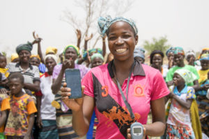
A young woman in Burkina Faso demonstrates how to use MAST on her mobile phone. By: Jeremy Green, USAID Communications and Learning Manager

As part of the LTS Project, the MAST Learning Platform, was launched on the LandLinks website. The MAST Learning Platform is an interactive knowledge management portal that brings together tools, technical documentation, software code, demos, and lessons learned from the implementation of MAST worldwide. Through the MAST Learning Platform, users can access details and lessons learned from current or past MAST projects in Tanzania, Burkina Faso, and Zambia. They can also access guides on how to use the MAST technology and invoke participatory approaches in project design and implementation. The MAST platform features an interactive demonstration of the MAST application used in Tanzania so users can explore how the mobile application functions to inventory and document land information. Users can also find data, access the MAST software code, or even contribute to the MAST software development on Github. The MAST Learning Platform is anticipated to become a living resource and will feature regular updates and contributions from MAST users and projects.

USAID Land Technology Solutions (LTS) Project: Services for USAID Missions and Partners

Using MAST to map and document land in Burkina Faso. By: Jeremy Green, USAID Communications and Learning Manager

The three-year LTS project was specifically designed to support the expansion of MAST into new countries. The LTS project offers a variety of services to USAID Missions and their partners. These include assessments to support the rapid deployment of MAST, design of pilot projects, and training to build capacity at the local, regional and national level in the use of MAST or related land technology solutions.

Examples of Services Offered by the LTS Project

  • Workshops for USAID, host-country government, or NGO actors on how to use land and resource mapping tools to achieve development outcomes
  • Demonstrations, capacity building and training in use of MAST
  • Landscape and feasibility analysis to identify opportunities for use of MAST
  • Land policy, legal and regulatory review
  • Stakeholder engagement and public awareness
  • Development of communications and outreach products
  • Program design, implementation planning and support
  • Development of specifications for country specific land technology solutions, and
  • Design, installation and deployment of customized MAST technology

To learn more, see the LTS Fact Sheet or visit the MAST Learning Platform.

To access LTS services, please contact Ioana Bouvier, USAID E3 Senior Geospatial Analyst and LTS Contracting Officer’s Representative (COR) at ibouvier@usaid.gov or Stephen Brooks, Alternative COR, at sbrooks@usaid.gov.

Bolívar is the Pioneer of Secondary Occupants

Q&A with Ella Cecilia del Castillo, Regional Director of the Land Restitution Unit, Bolívar, Colombia

A LAND RESTITUTION POST-SENTENCING TECHNICAL ROUNDTABLE IN MONTES DE MARÍA IS A SPACE THAT ENABLES THE INSTITUTIONAL COORDINATION NEEDED TO TO COMPLY WITH ORDERS ISSUED BY LAND JUDGES IN FAVOR OF LAND CLAIMANTS THAT WERE DISPLACED DURING THE ARMED CONFLICT. IN THIS INTERVIEW, ELLA CECILIA DEL CASTILLO, REGIONAL DIRECTOR OF THE LAND RESTITUTION UNIT IN BOLÍVAR, DESCRIBES HOW THE GOVERNMENT IS IMPROVING DELIVERY OF SERVICES ION THE POST-RULING PHASE OF LAND RESTITUTION.

Q: How is land restitution process going in Bolívar thus far?

A: In Bolívar, the government has received 5,972 land restitution requests, and 93% of those have are in process or have been answered. In this moment, there are 1,104 demands—corresponding to approximately 16,000 hectares—in the hands of land restitution judges and magistrates. In Bolívar, nearly 5,400 hectares have been restituted. This corresponds to 205 individual and collective rulings, representing approximately 380 families. Some 60% of the rulings are in the course of implementation, and 40% of the cases are pending material delivery.

Q: One of the pitfalls in the implementation of restitution orders has to do with secondary occupants and the ability to vacate the land inhabited by a secondary occupant in order to deliver the land to the claimant. How have you solved this?

A: In the department of Bolívar, we have been pioneers in this issue of secondary occupants and in practice we have created new paths. Along with Sucre, we are the two regions with the most cases of secondary occupants. We have sought solutions together with the other institutions involved, including the restitution judges. We have managed to avoid forced eviction, rather for judges to convene preparatory hearings where all the entities are present, and we generate short-term commitments that will help the secondary occupant. This must happen before there is any recognition of ownership of a property where we know that there is a secondary occupant. If we don’t do this, a very complex situation is likely to unfold. We are trying to adopt practices that mitigate the amount of collateral damage and avoid that the secondary occupants are re-victimized. We also count on the support of regional authorities that assume many of the tasks necessary for the accommodation and transfer of the people, but the ultimate goal of this exercise is that there are no forced evictions and that our restitution work does not causes further damage or negative impacts upon our communities.

Q: Do joint spaces such as the post-sentencing technical roundtable enable the LRU and government partners to address issues such as secondary occupants and order compliance?

A: Yes, these spaces have been fundamental in terms of coordination between the institutions that are involved in land restitution, because together we can better identify bottlenecks and problematic situations preventing compliance and delivery. In these spaces, we have achieved significant coordination with the judges on the issue of secondary occupants and the compliance of delivering the property in question to the original owner. In addition, the LRU has been developing a methodology involving a series of visits along with the judges so that the relevant entities can comply with the ruling’s orders that favor the secondary occupant, who will be leaving the land. This methodology has provided excellent results, and there are recent cases in which we have seen valuable experiences of reconciliation between the second occupant and the claimant.