


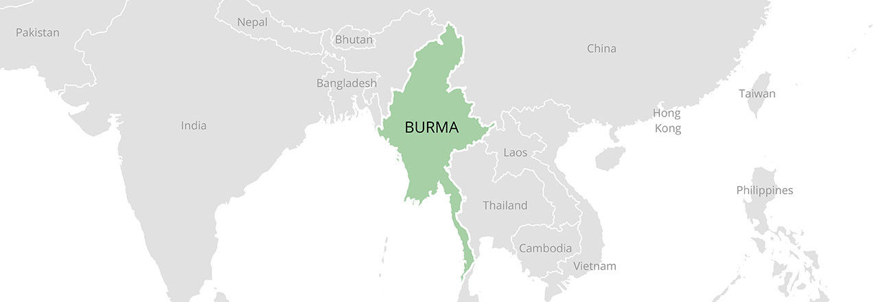
Overview
Burma, also known as Myanmar, has a complex land system shaped by state control, customary tenure, land classification and decades of armed conflict. Farmers, fishers, forest users and pastoral households depend on overlapping rights that are not always reflected in official records. The February 2021 military takeover and subsequent fighting have made secure access, administration and remedies more difficult, with authority varying across the country.
The legal framework and the rules applied in practice are not the same thing. A farmland certificate, customary community recognition and a concession each describe different interests. Conflict, displacement, citizenship restrictions and power imbalances can prevent people from exercising rights even when documents exist.
History and Political Economy
Colonial administration, post-independence nationalization, military rule and armed conflict changed how land was classified and allocated. State-led development and military, agricultural and infrastructure projects generated longstanding claims of confiscation and inadequate compensation. Ethnic communities have also maintained locally specific systems of customary governance, sometimes alongside the administration of ethnic organizations.
Reforms after 2011 opened markets and encouraged new land laws and investment, while disputes over concessions, landlessness and recognition of customary tenure remained. Since the 2021 takeover, territorial control has changed repeatedly. Administrative records and formal procedures do not necessarily describe who controls access on the ground. The World Bank describes the combined effects of conflict, economic disruption and natural disasters.
Legal Framework
The 2008 Constitution asserts state ultimate ownership of land and natural resources. Individuals and organizations can hold different use rights under applicable law. The Farmland Law of 2012, amended in 2020, provides for certified farmland use rights and permits certain transfers subject to conditions. A certificate commonly called Form 7 is evidence of a farmland use right; it is not unrestricted private ownership of all land and resources.
The 2012 Vacant, Fallow and Virgin Lands Management Law, amended in 2018, addresses another category of land. The 2016 National Land Use Policy recognized customary tenure and proposed more inclusive governance, but a policy is not itself a comprehensive enacted land law. The 2019 Land Acquisition, Resettlement and Rehabilitation Law is part of the formal framework; implementation and access to remedies depend on circumstances.
Customary and Community Tenure
Customary systems differ among ethnic nationalities and local communities. They may combine family fields with shared forests, grazing, water, burial places and rotational cultivation. A fallow plot can be part of an active farming cycle. Community authorities and collective decisions can provide social recognition even when the state cadastre does not record the right.
The 2018 amendment includes an exception for land used under customary tenure, but recognition and identification in practice remain contested. UN human rights experts warned that broad classifications, permit requirements and an inability to apply while displaced could expose users to loss of land or penalties. The original six-month application deadline fell in 2019. Read the experts’ communication.
Land Administration and Data
Land administration has historically involved farmland management bodies, agricultural land records, forest authorities and other agencies. Registration depends on classification: a farmland certificate, forest permission and grant of use over land classified as vacant are governed by different procedures. An official map that shows no registered holding may still omit customary use or displaced people’s claims.
In conflict-affected areas, records may be inaccessible, destroyed or controlled by different authorities. Community maps, tax receipts, oral testimony and family records can help preserve evidence, but information about boundaries or claimants can be sensitive. Safe, voluntary documentation and protection against disclosure are especially important where people face displacement or retaliation.
Women’s Land Rights
Women cultivate, inherit, manage household enterprises and use forests and water, but their ability to control land differs by community, household and legal status. A certificate issued only in one family member’s name may fail to record a spouse’s interest. Customary rules are diverse and can protect some women while placing others at a disadvantage in inheritance or decision-making.
Displacement can separate women from documents, relatives and institutions, while movement restrictions and insecurity make claims harder to pursue. The UNHCR 2025 results report describes protection risks, including loss of documentation and gender-based violence. Land processes should recognize women’s claims directly and provide safe, accessible participation and remedies.
Agriculture and Food Security
Rice is central in the delta and lowlands; pulses, maize, oilseeds and other crops support diverse farming systems. Upland communities may use rotational cultivation, agroforestry and common resources. Landless households also depend on agricultural wages, tenancy and access to fisheries and forests. Restrictions on land use, insecure tenancy and costly inputs affect their livelihoods.
Conflict, blocked roads and high transport costs complicate production and marketing. The UN Office on Drugs and Crime estimated 53,100 hectares of opium poppy cultivation in 2025, with a stated uncertainty range; it linked changes to several factors including conflict and displacement. The estimate is not a census of all farms or an explanation of every household’s choices.
Grazing, Fisheries and Mobility
Livestock, inland fisheries and coastal livelihoods complement crop production. Households may depend on seasonal grazing, riverbanks, wetlands, paths and fishing grounds that are shared or used at different times of year. A concession or development that blocks access to a water point can affect users whose homes or fields lie outside its boundary.
Land and resource mapping should include mobile and landless users as well as registered cultivators. This is particularly important where conflict or disasters have disrupted traditional routes and communities cannot return safely to their usual areas.
Conflict, Displacement and Restitution
Armed conflict has destroyed homes and restricted access to land across many regions. UNHCR’s situation portal reported approximately 4.06 million internally displaced people as of October 19, 2026. This is an estimate for a specific date and can change as conditions and reporting change. Mines, unexploded ordnance, insecurity and destroyed documents can prevent safe return.
Rohingya communities have faced severe citizenship and movement restrictions as well as displacement. The Independent Investigative Mechanism for Myanmar documented destruction and seizure of Rohingya property during the 2017 operations. Durable solutions require voluntary, safe and dignified choices, recognition of housing, land and property claims, and effective restitution or other remedies; physical return alone does not settle a claim.
Urban Land and Housing
Yangon, Mandalay and other urban areas contain a mixture of formal grants, rental housing and informal settlements. Residents without secure documents may be vulnerable to eviction or excluded from services even when they have lived in a neighborhood for years. Tenants, informal workers and people displaced to cities have distinct interests that a landowner-only process can overlook.
The March 2025 earthquake damaged housing, infrastructure and livelihoods. The World Bank’s assessment describes widespread losses. Reconstruction needs accessible evidence of occupancy and rights, safe building and fair procedures for renters and owners, rather than assuming every household can produce an intact title.
Water and Watersheds
The Ayeyarwady, Sittaung, Thanlwin and other river systems support irrigation, fisheries, transport and domestic use. River deltas, wetlands and upland watersheds connect upstream land uses to downstream livelihoods. Hydropower, mining, irrigation and urban development can change flows, access and water quality.
Water governance requires attention to seasonal use, local institutions and people who live downstream or rely on fisheries. Conflict and damaged infrastructure can interrupt maintenance and access. Consultation and environmental assessment should cover cumulative impacts as well as the footprint of an individual project.
Forests and Biodiversity
Forests provide food, fuel, timber, medicine and cultural resources as well as biodiversity and watershed protection. Deforestation, logging, mining, plantation development and conflict can undermine these benefits. Community forest user groups and customary institutions can manage resources, but statutory permissions and local systems do not always coincide.
Conservation policies need to distinguish commercial extraction from local subsistence and rotational uses. Mapping community forests, recognizing access, and providing equitable participation in decisions can support both livelihoods and conservation, provided communities can use those processes safely.
Climate and Carbon
Cyclones, flooding, drought and coastal erosion compound insecurity. Cyclone Mocha in 2023 and flooding associated with Typhoon Yagi in 2024 affected communities already facing conflict and displacement. Secure access to land, forests and water influences how households prepare, move and rebuild.
Forest and carbon projects should clarify rights, participation, benefits, monitoring and remedies over their full duration. Where communities are displaced or control is contested, an agreement with an authority or intermediary should not be assumed to represent all customary users. Climate goals and project plans are not evidence that promised emissions reductions or community benefits have occurred.
Mining and Extractive Resources
Jade, gems, gold, tin, rare earths, oil and gas have long been significant to the economy and to armed and political interests. Mining can affect land and water far beyond an extraction site through tailings, chemicals, roads and sediment. Surface use rights do not automatically give the holder rights to minerals.
The UN human rights office’s 2026 report examines violence and illicit economies, including rare earths. Responsible assessment requires transparent ownership and concession information, independent environmental monitoring, meaningful participation and remedies. These safeguards are difficult to implement where conflict restricts access and civic space.
Investment and Land Acquisition
Agricultural concessions, plantations, infrastructure and extractive projects can overlap farms, customary territories, wetlands and land from which people have fled. Classifying land as unused does not establish that no one holds a right to it. A fair assessment needs to identify seasonal users, women, tenants, forest users and absent displaced claimants as well as recorded holders.
Investors and public authorities should disclose boundaries and impacts, respect applicable rights and provide accessible avenues for objection and remedy. The security context can prevent meaningful participation or make disclosure dangerous. A permit or project announcement alone is not evidence of community agreement or a resolved land claim.
Sources
Law and policy: Farmland Law, 2012; 2018 amendment to the Vacant, Fallow and Virgin Lands Management Law; FAOLEX, Myanmar legislation and policy; UN experts’ communication on the 2018 amendment.
Displacement and livelihoods: UNHCR, Myanmar situation; UNHCR annual results report, 2025; Independent Investigative Mechanism, Rohingya land and property; UNODC, Myanmar Opium Survey 2025.
Economy, disasters and resources: World Bank country overview; World Bank earthquake assessment; UN human rights office, 2026 report.
Update Log
October 2026: Updated the land-law framework and its practical limitations, customary and women’s rights, displacement and restitution, urban and rural livelihoods, resources, climate and investment. Added recent UN evidence on displacement, property loss and conflict.
Confidence Assessment
Confidence is high in the cited published legislation and the dates of the cited UN reports. Confidence is more limited for local enforcement, territorial control and the status of individual claims: conflict and restricted access make conditions change quickly and prevent comprehensive reporting. Displacement figures are estimates for the dates specified.