Each month, we will feature profiles of Land Champions within USAID to learn about their work on land tenure, property rights, and resource governance. This month’s Land Champion is Kim Kim Yee, who is the Land Team Leader for USAID’s E3/Land and Urban Office. She also manages the Property Rights and Artisanal Diamond Development project.
Tell us about yourself.
I am currently the Land Team Leader in the Land and Urban Office within USAID’s Bureau for Economic Growth, Education, and Environment (E3). I manage an incredibly talented group of land tenure and property rights experts. I also manage the Property Rights and Artisanal Diamond Development (PRADD) project, which focuses on conflict diamonds in Cote d’Ivoire and the Central African Republic. I spend a lot of time working with my land and urban colleagues thinking about how best to integrate land tenure and property rights into USAID activities, as well as coordinating with and learning from other experts in the field.
Why is land important to USAID?
In the US, we take for granted that when you buy or rent a home, your property rights are very clear – the parameters of the contract you enter are well defined and enforceable. With these clear and secure rights, you are more likely to make long-term investments in your property (remodeling, landscaping, etc). In many countries where USAID works, most people’s rights to the land where they live or farm is undocumented and often insecure. This fundamentally impacts their investment choices; evidence shows that when farmers feel secure in their rights to their land, they tend to make choices that are more sustainable, like letting their land lie fallow or choosing less resource intensive but slower growing crops for example. Strengthening women’s property rights also has direct impact on their economic opportunities. For example, women with stronger land rights are more likely to work off-farm and earn higher incomes. Stronger property rights, coupled with well functioning institutions to protect these rights, also increases sustainability of USAID investments by minimizing risks caused by contestation over land use and access rights, securing transactions, ensuring infrastructure developments, and other types of investments are inclusive and avoid harm.
Many people think of land rights primarily in connection to agriculture and rural development. What is the connection between land tenure and property rights and other development issues, like conflict minerals?
A lot of our work at USAID is focused on agriculture, food security, and rural development, which does evoke land rights. But land rights are truly cross-cutting, including for the importance of clarifying rights to resources – like diamonds, gold, and other minerals – to prevent conflict and criminal exploitation. In the Property Rights and Artisanal Diamond Development (PRADD) project, our strategy is that clarifying and strengthening property rights to land with high-value natural resources will reduce conflict over the control and benefits of these resources. In Cote d’Ivoire, where diamonds once funded violent and deadly conflict, we are working with diamond mining communities to ensure rights to these resources are clarified and understood, as well as strengthening the communities’ abilities to collect taxes used for community development projects. We are also helping these communities develop land use plans to help people transition away from depleting diamond stocks and we are identifying ways to rehabilitate mined out areas. Clarifying property and resource rights is critical for preventing conflict and can increase revenues to local communities.
What is the role of USAID’s E3/Land and Urban Office?
Our primary role is to provide quality technical expertise to USAID missions to increase sustainability of their investments. We can help design stand-alone land activities or integrate land tenure and property rights into other activities. We also engage with other land experts through various platforms, including the Global Donor Working Group on Land and the Committee on World Food Security, to ensure USAID is contributing to and employing global best practices. We are also very focused on building and disseminating evidence on land and resource governance, including through the seven rigorous impact evaluations that our office has commissioned.
What are some of your biggest accomplishments in the land sector?
USAID has been working in the land tenure sector for many years. Collectively, we have helped strengthen the land rights of 182 million people since 2013 through new laws and policies; supported the U.S. business community by developing and testing practical guidance on best practices for making land-based investments less risky and more sustainable; created tools and guidance to mitigate root causes and triggers of conflict over land, such as compulsory displacement and resettlement; and partnered to develop low-cost, easy-to-use mobile technology tools that allow local governments to more easily map, document, and manage land rights and administration.
Final thoughts?
There is a slight misperception that land tenure activities are insurmountable and have to include country-wide formal land titling efforts using expensive technologies. The Land Team has evidence and approaches that clearly counter this argument. We have a wide range of rapid, cost-effective, and locally sustainable interventions, each with proven results. For example, simply ensuring two lines (one for the husband and another for the wife) are included on land documents can help women retain land rights if she becomes widowed. We ascribe to the “secure enough” tenet, believing that customary and formal tenure systems can co-exist and generate positive compounding effects as long as people believe their rights are not arbitrarily contested and have incentives to invest and benefit from their investments.
Q&A with the Restitution Coordinator at the Superintendence of Notary and Registry — SNR
Originally appeared on Exposure.
NEW ELECTRONIC INFORMATION SYSTEMS AT COLOMBIA’S SUPERINTENDENCE OF NOTARY AND REGISTRY (SNR) ALLOW THE AGENCY TO MEET DEADLINES SOONER FOR THE LAND RESTITUTION PROCESS WHILE CREATING BETTER PROTECTION FOR ITS INFORMATION. IN THIS INTERVIEW, PATRICIA GARCÍA, RESTITUTION COORDINATOR AT THE SNR, EXPLORES THE ENTITY’S COLLABORATION WITH USAID.
Q: Why the focus on information systems to support land restitution in Colombia?
A: In general, the SNR has needed to modernize and become stronger in order to carry out its functions under the Victims Law. These information systems increase the security and safety of information that was previously stored only on paper. And they help deliver this information more quickly to entities working on land restitution. Stronger, faster systems also benefit the work of other entities, such as the Land Restitution Unit and the Victims Unit.
Q: How was the first system—the Landowner Search System–developed with USAID’s support?
A: As part of evidentiary material needed for restitution, the Land Restitution Unit often asks us to look up what properties a person has within Colombia’s national territory. Normally, they ask this when the person does not have the property registration number or when the judge needs information related to land formalization. USAID helped us develop an electronic system that allows us to perform this search automatically throughout our 195 local registry offices.
Q: What about the Exemptions System? What does that information system do?
A: When an entity working on restitution or formalization needs to certify that a property is unencumbered, they’re not supposed to pay for this certificate. But you need to have very precise controls in place to be able to issue the certificates for free. Normally this is done via the local public registry offices because they link the fee waiver to their daily cash flows and need to annex a justification for why the requesting entity wasn’t charged. The Exemptions System was very difficult to develop, and USAID helped us figure it out. Now this system delivers these certificates electronically and free of charge to the entities that need them.
An innovative program for rural women affected by the armed conflict strengthens their land rights and empowers them as leaders and decision makers
A WOMEN-FOCUSED GOVERNMENT
The lives of campesino women from Northern Cauca have not been easy. The armed conflict has fiercely infiltrated their homes, leaving an aftermath they cannot erase. They have had to fight to find a way to survive together with their children, some who still have their husbands, and some who are now widows.This situation led, in 2013, to women from the department of Cauca uniting and successfully pressuring the departmental government to create a special agency for women. These joint efforts led to the creation of the Secretariat for Women in Cauca.
In 2015, with the support of USAID and the Secretariat for Women, the Itinerant School for Rural Women was created. Its objective is to develop community participation and awareness about gender-based approaches to land and property rights, the economy, and production initiatives.
In one year, 480 women from 15 municipalities participated in this school, whose goal is to gradually serve the 42 municipalities of Cauca and spread its message to more than 3,000 women.
In the municipality of Suárez, and over a period of three months, 30 women completed the school’s four different modules. Among these women were cacao and aloe growers who have taken advantage of these tools to protect their land and move their business plans forward.
“It has been very helpful to learn how to value myself as a person and to value my skills. Working the land is not just for men, and I have been able to grow my crops successfully together with my children. We learned when our rights are being violated. I am contributing to my society through my work, and what I have done is very valuable,” asserts María Ascensión Choco, an aloe grower from Suárez.
The Cloudburst Group has released the Request for Proposal (RFP) No. 2017-ERC-002, “Investor Report on Land Risks and Mitigation Strategies.” The deadline for questions and inquiries is June 26, 2017, while the overall deadline for proposals is July 14, 2017.
The proposal requested is to subcontract with a firm to undertake a quantitative analysis of land tenure risks and associated costs of investing in developing countries. This subcontract will cover the design and implementation of research, which will include a quantitative survey of investorsworking in developing countries (U.S., multi-national, or local investors), report on findings, and report launch event.
A conflict-affected community of 1,300 residents in Northern Cauca is improving its well-being through a restitution ruling and support from the municipal government.
IN A PARAMILITARY JAIL
In the village of Lomitas, a rural area of the municipality of Santander de Quilichao, paramilitary groups were especially ruthless with residents. Most of the village’s 1,300 inhabitants were Afro-descendants making a living by growing fruits and vegetables on farms. It was a peaceful and self-sufficient community.
In 2000, the paramilitary group United Self-Defenders of Colombia began using the village as a base, displacing many people from their lands and setting up training camps in their place. The paramilitary group used Lomitas’s community center as an interrogation and torture room for people accused of being guerrilla infiltrators. For years, the village was the site of barbarous acts.
“Our town was used as a jail. Here, they tortured people from other municipalities until they would confess. Then, they would kill them and throw them in the Cauca river. You could hear the screams of people crying for help. Every day, you could find dead bodies along the river’s edge,” explains Lorenzo Mosquera, a community leader from Lomitas.
The community tried to resist. However, as the situation grew increasingly worse, many left their lands and sought refuge in the homes of relatives or even in other countries. With heavy hearts, Lorenzo Mosquera and his family of 23 contacted the Brazilian government, which offered them asylum.
But Mosquera never lost contact with his neighbors from Lomitas, and in 2008, after living in Brazil for three years, a yearning for his land and his roots made Lorenzo return to Lomitas. Upon arrival, he was surprised to see that his land parcel and that of his relatives had been overrun by others who were now growing sugarcane there.
Eighty percent of Lomita’s lands remained in the hands of four or five companies that entered the area through intermediaries offering low prices to campesinos desperate to leave. These companies also cultivated lands that were supposedly abandoned. In addition, the electricity company dismantled the electricity network without the community’s authorization.
“We felt invaded and trampled on. These business transactions were a type of legal displacement. Here, there didn’t use to be sugarcane—we lived on sustainable farms that produced food,” Mosquera explains.
In 2012, with the support of the Land Restitution Unit, Lorenzo began the fight to recover his land. Finally, in 2015, a restitution judge issued a ruling in favor of Lorenzo and five other families. The ruling orders several reparation measures that seek to benefit the community as a whole and states that these measures should be implemented by the municipality and other government entities. Since then, another 22 restitution sentences have been issued for other families in Lomitas.
Q&A with the Director of the Rural Development Agency, Carlos Eduardo Géchem
Originally appeared on Exposure.
THE RURAL DEVELOPMENT AGENCY
CREATED IN THE WAKE OF INCODER’S DISSOLUTION, THE RURAL DEVELOPMENT AGENCY (ADR) IS TASKED WITH PUSHING FORWARD PROJECTS THAT CAN IMPROVE THE LIVELIHOODS OF CAMPESINOS AND SUPPORT RURAL AND AGRICULTURAL DEVELOPMENT IN COLOMBIA. INCREASINGLY, COORDINATION WITH GOVERNORS’ OFFICES IS GAINING IMPORTANCE. CARLOS EDUARDO GÉCHEM SPEAKS OF THE RURAL DEVELOPMENT AGENCY’S STRATEGY OF REHABILITATING SMALL-SCALE IRRIGATION DISTRICTS IN THE COUNTRY AND HOW THE AGENCY IS ENSURING THE SUSTAINABILITY OF THE PROJECTS IT SUPPORTS.
Q: How is the agency’s strategy and philosophy different from that of its predecessor, INCODER?
A: There are two key issues. First, we’re proposing a change in mentality among producers’ associations so they understand that the Rural Development Agency is willing to co-finance productive projects, so long as they also contribute resources, which can take many forms. Second, these projects must be sustainable. Today’s projects include families that are going to enjoy the possibility of not just being part of an association, receiving technical assistance, and adapting their lands, but also to be linked to marketing channels for their products.
Q: What role should governors’ offices play in terms of carrying rural development projects forward?
A: Our work with governors’ offices begins with Comprehensive Rural Development Plans, which means planning what we’re going to do. In this regard, some departments are more advanced than others, and there are departments where we’re helping develop a long-term agricultural policy. Then we begin coordinating around the projects’ financing because producers’ resources are limited. Based on this planning, we set up projects where everyone has a role to play, can contribute some resources, and can offer their knowledge, in order to ensure that the joint effort leads to results.
Q: USAID, through the Land and Rural Development Program, supports the creation of plans utilized by departments and municipalities to plan rural development investments. How important are these plans for the Rural Development Agency to do its work?
A: They’re fundamental. First, you need to develop plans in order to implement, and that’s what we are doing now with many departments. The case of Cesar has an advantage, which is that it has been advancing—with the help of USAID and due to willingness within the region—in a series of plans that today allow us to better coordinate our work and to intervene. Without these plans, we’d have to begin at an earlier stage, go back to analyzing and planning, and then executing. All this means more time—and communities in the regions need to see results now.
Q: In the case of Cesar, USAID focused efforts on the governor’s office to expand the focus of the Secretary of Agriculture toward comprehensive rural development. What do you think of this concept?
A: That’s how it should be because rural development is more than just agricultural development—it implies irrigation infrastructure, roads, and communications. Our agency’s vision is very similar. We need to guarantee that the countryside becomes a good business venture. To do that, in addition to infrastructure, we need a change in mentality: taking into account the product that’s being sold in the local context, the sellers, transportation, and other things. Success depends on the project being one with a financial closing process, with a structure, with a technical logic. To the extent that this is the case, people will be able to do what they effectively want to do, which is to work in the countryside and to make a dignified living while doing it.
USAID is facilitating a public-private cacao partnership in Northern Colombia to improve the livelihoods of about 500 families, including victims of the conflict.
DISPLACED BY THE VIOLENCE
Making a living off of cacao at age 51 was not part of Nays Mora Cohen’s life plan. With yuca, corn, and avocado crops and a herd of cattle, she dreamed of living on a sustainable farm in the village of El Hobo, in the lush hills of Montes de María. When the violent factions of Colombia’s conflict became the de facto ruling authority of the region, she never imagined that she or her family would also lose their land.
Mora tells the story about how first she had lost a large portion of her cattle to the groups, and then ran the risk of the guerillas recruiting two of her children. The violence and the death of one of her field workers forced her family to move to nearby El Carmen de Bolívar after. They had no home so they set up as squatters in the makeshift homes on the outskirts of town, catering to displaced people.
“After being gone for nine months, I returned, but they killed a friend of mine. I got scared and left again, but I could only take six chickens. The psychological and financial impacts were big for me,” Mora recalls while choking back tears.
El Carmen de Bolívar has 160,000 inhabitants, and one of every three of them is a victim of the armed conflict. Most of these victims were displaced from their lands and forced to leave behind a stable life based on food production and living off the land. For many, the avocado was the most important cash crop.
Due to abandonment, poor tree management, and fluctuations in the market, those same avocado farms have diminished over the last few years, and this has led to the introduction of crops that are more adaptable to the region, such as cacao, offering market opportunities that can generate stable incomes.
AN ALTERNATIVE: CACAO
In 2016, Mora and other farmers got the chance to improve their cacao operations when the USAID-funded Land and Rural Development Program facilitated a public-private partnership (PPP) in the cacao value chain for 500 campesino farmers in the Montes de María. The PPP takes a sustainable approach to reinserting these cacaoteros in the region’s rural economy. Valued at over $16 billion pesos (US$6.6 million), the PPP is designed to strengthen productivity and quality, expand cultivation areas, and establish direct relationships with reliable commercial partners.
As part of this partnership, governors’ offices and private partnerships have already trained more than 150 people on good agricultural practices and on improving post-harvesting and storage techniques. Among those who have received training are growers and officials from municipal government entities, such as the Secretariat of Agriculture.
“People are very excited about this PPP. Asprocam is making progress because the National Chocolate Company helped guide us and supported us a lot,” Mora says, who is also a member of Asprocam (the “Montes de María Farmers’ Association”), a group of cacao farmers that has sold 17 tons of cacao since the partnership was established.
Like Mora, the majority of the participating farmers—from seven cacao farmers’ associations—are victims of the conflict, and at least ten of them are currently involved in the land restitution process.
“The focus of the program is to support local governments and offer a range of economic alternatives, especially for those who were displaced and are just returning to their farms with their pockets empty,” says Anna Knox, director of the USAID Land and Rural Development Program.
How government capacity building in planning and resource mobilization delivers significant results that catalyze rural development in Colombia’s underserved regions
Originally appeared on Exposure.
NEARLY TEN YEARS AGO, THE GOVERNOR OF CESAR CAME TO THE SMALL OUTPOST OF LA CONQUISTA, DEEP IN THE FOOTHILLS OF THE SIERRA PERIJÁ, WITH A PLAN TO REINVIGORATE THE ECONOMY THROUGH SMALL FISHERIES FED BY THE LOCAL RIVER. THE GOVERNMENT HELPED THE FAMERS DIG A SERIES OF PONDS, BUT THEY WERE NEVER FILLED, BECAUSE THE IRRIGATION INFRASTRUCTURE HAD FALLEN APART DUE TO FLOODING, LACK OF MAINTENANCE, AND A FIVE-YEAR PERIOD DURING WHICH FARMERS FLED THEIR LANDS AND HOMES DUE TO VIOLENCE.
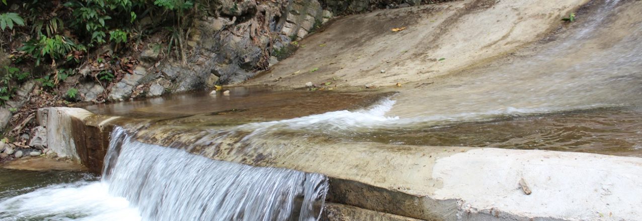
North of La Conquista, in the next water basin, 30 farming families face a similar situation. In 1999, heavy flooding completely destroyed the small cement dam and partially damaged the water intake valve of their irrigation framework. The irrigation system was never repaired.
In the decades since, these two communities in the municipality of La Jagua de Ibirico have made do with the broken-down infrastructure, applying homemade solutions to damaged pipes and wrangling water into the network’s tubes. The two rivers—whose concession titles had since expired and were left off the rural development agenda—continue to course down the steep mountains, making their way to the mighty Magdalena River hundreds of kilometers away.
“For years, we’ve been trying to find ways to convince the government to take our case and rehabilitate the irrigation district. And that means phone calls to at least three different institutions, back-and-forth travel to Valledupar, knocking on doors, and waiting for answers,” says Rafael Antonio Vaquero, leader and spokesman for the families who use the El Triángulo irrigation district in La Conquista.
In 2015, the USAID-funded Land and Rural Development Program and Cesar’s departmental government began a multilayered partnership and created a roadmap to improve the government’s capacity to plan and implement rural development projects. The strategy involves capacity development interventions together with key infrastructure and agriculture investments across the region.
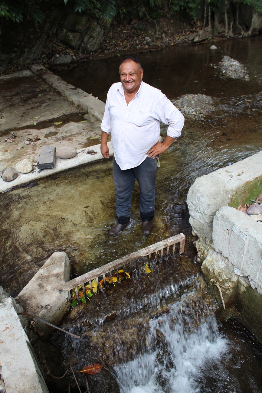
High on the department’s to-do list is the rehabilitation of Cesar’s 13 small-scale irrigation systems, an endeavor that will benefit nearly 600 families and open over 1,100 hectares of farmland to regular irrigation. USAID financed the engineering studies and designs of the irrigation projects, representing nearly a quarter of the total investment.
The first five irrigation systems—including the two communities in La Jagua de Ibirico—were completed in April 2017, after an investment of approximately $1,600 million pesos (US$640,000). The remaining eight projects are expected to be fully functional by the end of 2018.
It is mid-morning in Kiponzelo village and already the sun weighs heavily on the Tanzanian landscape. As noon approaches, 23-year-old Gaspar Bangi picks his way through the scrub, trailing one of several surveying teams at work in the community.
Guided by a local farmer, Bangi skirts the boundary between two fields, pausing every so often to register a coordinate on his Android tablet. After 15 minutes, his progress is displayed on screen: Overlaid on a satellite image, the farmer’s plot is neatly outlined from above—the first step in submitting an official land claim.
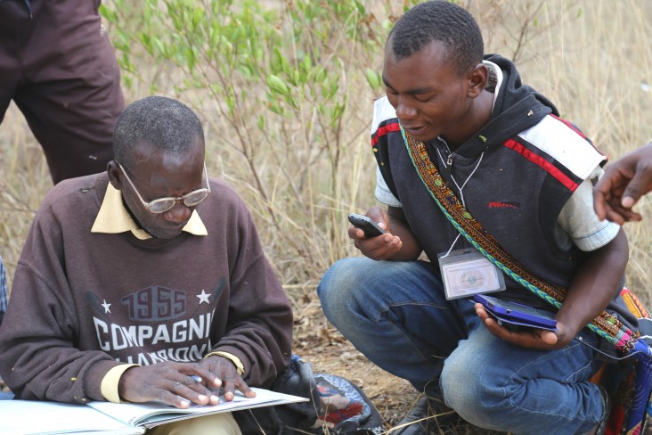
Gaspar Bangi, right, cross-checks data with an adjudicator from the Kiponzelo field surveying team. Photo credit: USAID
Like most rural communities in Tanzania, Kiponzelo has a traditional system of land ownership, where property lines are a matter of conjecture, and land is often transferred through undocumented negotiations. That’s changing, however, thanks to teams like Bangi’s.
Using the mobile application to secure tenure, or MAST, para-surveyors can plot coordinates to an accuracy of 1 meter. Photo credit: USAID
He is known as a para-surveyor—a local recruit able to accurately map land using informal training and non-traditional tools. Think mobile apps and smart devices rather than measuring tape and tripods. Together with a pair of adjudicators who mediate conflicts when competing claims arise, Bangi is out to register every last land claim in Kiponzelo.
It’s only their first plot of the day, and in a village with hundreds of claims, Kiponzelo’s surveying teams have a long road ahead.
Meanwhile, in Kinywang’anga, another village just down the road, workers haul boxes filled with hundreds of bright blue certificates for distribution. Known as certificates of customary rights of occupancy (the Tanzanian equivalent of a deed), each one issued to a villager will provide legal recognition of their right to a piece of land.
As the first community to partner with the Feed the Future Tanzania Land Tenure Assistance activity, residents of Kinywang’anga are among the first rural citizens to receive such documentation. This provides a number of benefits: indisputable proof of one’s claim, the peace of mind to invest in the land, and a documented means to sell, inherit or transfer land.
“We used to have a lot of conflict between farmers,” said village chairman Adam Garime. “They simply didn’t know where one person’s land ended and another’s began.”
More than 350 experts and delegates gathered in Manila to exchange best practices and new approaches in land reform during the Conference on Sustainable Land Governance on February 8 to 9, 2017. The conference was organized by the U.S. Agency for International Development (USAID) through its Strengthening Urban Resilience for Growth with Equity (SURGE) Project, in partnership with the United Nations Human Settlements Programme (UN-Habitat) and the World Bank. It served as the most recent platform that elevated the discussion of sustainable land management and administration at the national level in the Philippines.
The two-day event featured a range of panel discussions on policy frameworks, urban land constraints, assets management for local government units, commercial pressures on land markets, technology solutions, resilient land management, and gender and social inclusion in property rights.
U.S. Ambassador to the Philippines Sung Kim, Philippines Department of Finance Secretary Carlos Dominguez III and USAID Mission Director Dr. Susan Brems graced the event.
“We are presented with a remarkable opportunity to work together towards sustainable land governance. Secure access to land is key to promoting broad-based, inclusive and sustainable growth of the Philippines,” said U.S. Ambassador to the Philippines Sung Kim.
The country continues to tackle challenges in land governance brought about by overlapping land management and administration policies, high incidence of fake double titles or rights recognition and outdated land use plans.
Nearly half of the Philippines’ 24.2 million land parcels remain untitled, according to the 2004 Land Administration and Management Project funded by Australian aid partnership with the World Bank. Among these untitled land parcels, the Asian Development Bank found that families and communities live on as many as 7.8 million residential parcels without secure land rights.
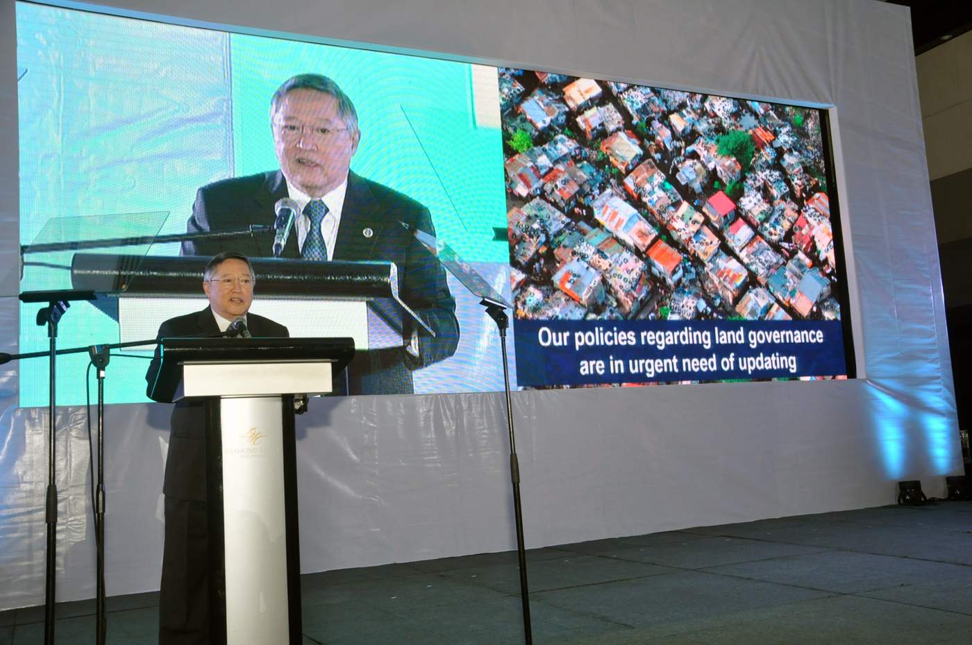
“As our population increased rapidly over the last few decades with our land policies hardly keeping pace, the phenomenon of landlessness has become more severe,” said Secretary Dominguez during his speech.
“Many of our settlements are vulnerable, our cities are congested, our forested areas have been stripped to make way for human habitation. We are truly facing a land governance crisis and must respond decisively on this,” he added.
Click here to watch the full speech of U.S. Ambassador Kim, and here to watch video insights of conference delegates.
**USAID leads conference on sustainable land governance**
More than 350 experts and delegates gathered in Manila to exchange best practices and new approaches in land reform during the Conference on Sustainable Land Governance on February 8 to 9, 2017. The conference was organized by the U.S. Agency for International Development \(USAID\) through its Strengthening Urban Resilience for Growth with Equity \(SURGE\) Project, in partnership with the United Nations Human Settlements Programme \(UN\-Habitat\) and the World Bank. It served as the most recent platform that elevated the discussion of sustainable land management and administration at the national level in the Philippines.
The two\-day event featured a range of panel discussions on policy frameworks, urban land constraints, assets management for local government units, commercial pressures on land markets, technology solutions, resilient land management, and gender and social inclusion in property rights.
U.S. Ambassador to the Philippines Sung Kim, Philippines Department of Finance Secretary Carlos Dominguez III and USAID Mission Director Dr. Susan Brems graced the event.
> _We are presented with a remarkable opportunity to work together towards sustainable land governance. Secure access to land is key to promoting broad\-based, inclusive and sustainable growth of the Philippines, said U.S. Ambassador to the Philippines Sung Kim._
The country continues to tackle challenges in land governance brought about by overlapping land management and administration policies, high incidence of fake double titles or rights recognition and outdated land use plans.
Nearly half of the Philippines 24.2 million land parcels remain untitled, according to the 2004 Land Administration and Management Project funded by Australian aid partnership with the World Bank. Among these untitled land parcels, the Asian Development Bank found that families and communities live on as many as 7.8 million residential parcels without secure land rights.
“As our population increased rapidly over the last few decades with our land policies hardly keeping pace, the phenomenon of landlessness has become more severe,” said Secretary Dominguez during his [speech](https://www.youtube.com/watch?v=azSmiI6ZaKU&feature=youtu.be).
“Many of our settlements are vulnerable, our cities are congested, our forested areas have been stripped to make way for human habitation. We are truly facing a land governance crisis and must respond decisively on this,” he added.
Click [here](https://www.youtube.com/watch?v=7dHayBmEBjA&feature=youtu.be) to watch the full speech of U.S. Ambassador Kim, and [here](https://www.youtube.com/watch?v=T24qSewgMok&feature=youtu.be) to watch video insights of conference delegates.
Sustainable Urban Land Coalition advocates for reforms, government supports move
The Conference on Sustainable Land Governance also hosted the launch of the Sustainable Urban Land Coalition, which called on the government to improve and make more accessible programs and services to fast track the development and adoption of land policy and institutional reforms.
The coalition, made up of more than 20 key representatives from national and local governments, business, international development and civil groups, announced their ten\-point call to action on the last day of the event. The group emphasized to rationalize the mandates of land related agencies, prioritize the implementation of a massive national titling program, expedite resolution of land\-related cases, and strictly enforce compliance of local government units on property valuation regulations, among others.
The SURGE Project facilitated the creation of the coalition, as part of USAID’s work in improving local land tenure security and land information management in USAID’s Cities Development Initiative \(CDI\) partner cities in the country.
In response, Office of the Cabinet Secretary Deputy Executive Director Jonas George Soriano, during closing remarks, said the call to action is timely as the new government is moving towards all the points raised in the adoption of a sustainable land governance to address the countrys land sector concerns.
We are appealing to our friends from the local government units to push for changes in the government. If you want change, the President is asking the mayors and the governors to lead the way, he said.
Meanwhile, National Economic and Development Authority \(NEDA\) Undersecretary Adoracion Navarro stressed that there is a need to strictly implement existing rules for effective land administration such as timely titling of lands and taxing idle lands sufficiently so that owners will put these lands to appropriate uses, which until now remains a big challenge.
Institutional challenges on the other hand, also remains a challenge, such as multiple administration agencies, multiple laws, multiple land processes and multiple standards in land valuation, she added.
We hope the next steps of this conference will be guided by the policy directions of the Philippine Development Plan. The conference provided solution\-oriented sessions, and we need to take advantage of technologies to improve management and access to land information, and on how computer\-assisted disaster risk models can assist in land use management decisions at the local levels, said Navarro.
The Philippine Development Plan \(PDP\) 2017\-2022 was approved by the NEDA Board on February 20, 2017. According to [NEDA](http://www.neda.gov.ph/2017/02/21/neda\-board\-approves\-philippine\-development\-plan\-2017\-2022/), the PDP is the first medium\-term plan to be anchored on a national long\-term vision, the _AmBisyon 2040_, which represents the collective vision and aspirations of Filipinos. To set the direction for future growth, the PDP is adopting a national spatial strategy recognizing that population, geography and cities are engines of economic growth. It aims to decongest Metro Manila, connect rural areas to key growth areas and to improve linkages between settlements for higher resilience against disasters \(_[NEDA](http://www.neda.gov.ph/2017/02/21/neda\-board\-approves\-philippine\-development\-plan\-2017\-2022/)_, 21 February 2017\).
The Sangguniang Bayan of Linapacan in the Calamian Group of Islands in Palawan, Southern Luzon recently approved a revised tourism code that requires tourists to pay an environmental fee.
Linapacan is one of Palawan’s tourist attractions, known for its clear aquamarine waters, powdery white sand and diverse aquatic life. It is dubbed as one of the _35 Clearest Waters in the World to Swim in Before You Die_ by American news site Daily News Dig.
The revenue from the environmental fee will be used to protect, conserve and manage the town’s natural environment. It will fund projects such as rehabilitation of marine and upland resources, effective environmental law enforcement, and solid waste management.
The imposition of environmental fee from tourists was adopted by the municipality based on the results of a willingness\-to\-pay study conducted by USAID through its Ecosystems Improved for Sustainable Fisheries \(ECOFISH\) Project.
ECOFISH is conserving marine biodiversity, enhancing ecosystem productivity and improving fisheries and related livelihoods in eight marine key biodiversity areas in the Philippines using an ecosystem\-based approach to fisheries management \(EAFM\) to achieve social, economic and ecological sustainability.
Business owners enjoy faster business registration as cities become more competitive
It used to take us three to five days to get a business permit and there were no clear systems or steps, shared Arsenia Seydandiego, who runs a pension house in Puerto Princesa City in Southern Luzon. Seydandiego is one of more than 130 travel\-related micro and small entrepreneurs in Puerto Princesa City. Every year in the month of January, business owners all over the country flock city halls to apply for business permits.
The renewal process was much easier this year. I hope that the city will keep improving its processes, said Seydandiego.
Fatima Lyn Catingub, who operates a photo services and studio business, shared a similar feedback. I was able to get my permit in less than a day. Everything is more organized and systematic.
About 7,470 business permits were issued during the business registration period in January, an increase to last years 6,794, generating more than Php116 million worth of revenue for the Puerto Princesa City Government.
The faster business registration was made possible through the collaboration of the Puerto Princesa City Government with USAIDs SURGE Project. The project re\-designed the citys business registration procedures to reduce the processing time and number of steps.
Puerto Princesas improved business permits and licensing system supports the goal of the national government to make more efficient the delivery of government services and eliminate corruption. In August 2016, the Departments of Trade and Industry, Interior and Local Government, and the Information and Communication Technology signed a Joint Memorandum Circular \(JMC\) to further streamline the business permits and licensing system in the country.
USAID has been supporting the streamlining of the business registration process of its Cities Development Initiative \(CDI\) partner cities since 2012. Zamboanga City in Western Mindanao also reaped the benefits of streamlining its business registration with the help of SURGE. More than 10,000 business permits were issued during the 29\-day operation of its newly\-established Business One\-Stop\-Shop \(BOSS\) in January this yeara 400 percent increase compared to the same period in 2016. The City Government credits this increase to the efficient BOSS and streamlining of the previous 18 steps for new businesses and 20 steps for renewal to just two steps each.
In Tagbilaran City, Bohol, Central Visayas, business owners received their permits in three hours, compared to waiting for a week during the previous year, after the City Government with assistance from SURGE cut the number of steps from 14 to three and launched its online business permit application form. This resulted in processing more than 4,000 business permits in the first month of 2017 alone, nearly reaching the total number of permits issued for the entire year of 2016.
By improving ease of doing business that benefits business owners and local governments, USAID contributes to promoting a business\-friendly environment and investment climate that can boost the competitiveness of second\-tier cities.
Cagayan de Oro introduces online system for assessing and paying taxes
Taxpayers in Cagayan de Oro City, Misamis Oriental, Northern Mindanao, can now pay property taxes and other government fees online by accessing the online tax payment and billing system on the City Governments official [website](http://www.cagayandeoro.gov.ph/).
This newest innovation allows taxpayers with any Visa branded card to pay property taxes, building fees, traffic violation fees, and market stall rental, wherever internet connection is available.
> We want our constituents and taxpayers to find it easy to conduct business and pay taxes. With this new online system, they can have their taxes assessed remotely and pay for them even from the comfort of their homes or workplaces, said Leonil Mistula, Chief of Computer Division of Cagayan de Oro City Treasurers Office.
Aside from paying online, taxpayers can also view and print their tax billing as the system is capable of processing real time online tax assessment. New business permit applications and renewals can also be processed using the system. Soon, Mastercard branded cards and most Bancnet\-affiliated ATM cards may also be used similarly. Globe and TM mobile subscribers can continue using their GCash to know their assessed amounts and to pay their taxes and fees from anywhere.
This innovative system is part of the City Government’s move to expand its electronic payment offering for Cagayan de Oro taxpayers. It first introduced mobile payments for real property and business taxes in 2014.
Since it was launched, more and more taxpayers are using the online and mobile systems because of the convenience and cost savings that these innovations offer.
Shayryl Mae Ramos, a business owner, tried the online system to renew her business permit and found it easy to use. With this facility, I can pay my taxes and fees quickly and save time in the process.
USAID’s E\-PESO Activity supported the local government in developing its program to provide electronic payment options to constituents. E\-PESO helped conceptualize the online payment system, forged partnerships between the City Government and appropriate payment service providers, and facilitated smooth project management, implementation and collaboration during the development phase. E\-PESO Activity is working with national government agencies, local government units, and the private sector to increase adoption of e\-payments and achieve inclusive economic growth.
Cagayan de Oro and Iloilo delegates to join global forum on urban resilience
Delegates from the cities of Cagayan de Oro and Iloilo will join more than 300 leaders and experts from around the globe to participate in the 8th Global Forum on Urban Resilience and Adaptation on May 4 to 7, 2017 in Bonn, Germany.
Organized by ICLEI, the forum will focus on urban resilience and adaptation to climate change challenges through sessions on localizing global frameworks, disaster risk reduction planning and policy, financing resilience, risk transfer and insurance, and mechanisms for measuring, reporting and accelerating action for resilience building, among others.
Iloilo City Mayor Jed Patrick Mabilog and Mary Ann Gumban, Dean of the College of Management of the University of the Philippines Visayas, will represent Iloilo City, while Eileen San Juan, Local Economic and Investments Promotion Ofcer of the Cagayan de Oro City Government, and Atty. Dionel Albina, Director of Innovation and Technology Solutions of the University of Science and Technology of Southern Philippines, will represent Cagayan de Oro City. The delegates were able to avail of fully\-funded scholarships for the trip.
The forum is part of the Resilient Cities congress series. It was first launched in 2010 in Bonn with the goal of forging partnerships between local government leaders and climate change adaptation experts to pursue solutions for adaptation challenges in urban environments.
The Cagayan de Oro and Iloilo delegates will also join a pre\-conference training on the Educational Partnerships for Innovation in Communities \(EPIC\) framework in conjunction with the Resilient Cities 2017 on May 3, 2017 in Bonn. The EPIC framework, previously known as the Oregon Model, was pioneered by the University of Oregon in the United States in 2009. The framework is known for its scalability and replicability across cities and universities, by matching city needs with university capacityovercoming the gap between knowledge and practiceto come up with innovative solutions to local quality of life issues.
The city\-university delegates are expected to replicate the EPIC model in their cities with the urban development learning centers that will be established by the SURGE Project. The knowledge hubs are envisioned to foster urban development, climate\-resilient land use and infrastructure planning, and sustainable water and sanitation services.
Zamboanga City out\-of\-school transform into ‘outstanding youth’
A batch of 185 youth completers in Zamboanga City received their certificates from USAID’s Mindanao Youth for Development \(MYDev\) Program and the Philippines’ Technical Education and Skills Development Authority \(TESDA\), after completing various livelihood skills trainings that will help improve their employment options.
The past weeks and months have shown everyone that you are ready to transform your own lives. You have invested a lot of time and effort to get to where you are now, from being out\-of\-school youth to now being outstanding youth, said USAID Office of Education Director Brian Levey as he addressed the youth completers in Zamboanga City.
Each of you has the power to promote peace in your communities and advance growth for all. I urge you to take advantage of the opportunities that await, Levey added.
USAID, through its MYDev Program, partners with the TESDA and local service providers such as the Zamboanga\-Basilan Integrated Development Alliance, Inc. \(ZABIDA\) to enable Mindanaoan out\-of\-school youth to have equitable access to relevant livelihood skills training and basic education through the Department of Educations Alternative Learning System \(DepED\-ALS\).
To date, MYDev has engaged more than 13,000 out\-of\-school youth in workforce and community development activities to gain skills and competencies and become productive members of their communities.
Cities Development Initiative
USAID is working to strengthen the economic competitiveness and resilience of secondary cities outside of Metro Manila through its Cities Development Initiative \(CDI\). The CDI seeks to advance the development of secondary cities as agents of growth that is inclusive, environmentally sustainable and resilient. Depending on the most urgent needs of the city, USAID provides a range of technical assistance, drawing from resources in economic growth, health, energy, environment, governance, and education to assist the cities achieve resilience and inclusive growth.
The CDI is a crucial component of the broader Partnership for Growth and Equity, a White House initiated whole\-of\-government partnership between the U.S. Government and the Government of the Republic of the Philippines. The partnership aims to shift the Philippines to a sustained and more inclusive growth trajectory on par with other highperforming emerging economies. Currently, USAID has six CDI partner cities: Batangas, Cagayan de Oro, Iloilo, Puerto Princesa, Tagbilaran and Zamboanga. Legazpi City in Albay, Southern Luzon and General Santos City in South Cotabato, Southern Mindanao are the two upcoming CDI cities.