USAID and IUCN Partner to Advance Gender in the Environment

Noting World Water Day and reflecting on International Women’s Day movements and Women’s History Month in a number of countries, USAID and IUCN examine their partnership on Advancing Gender in the Environment (AGENT), which aims to improve development outcomes by strengthening environmental programing through gender integration and achieving gender equality outcomes.

Originally published on IUCN’s blog.

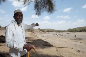
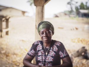
Around the world, women play a critical role as natural resource managers –often tilling land and conserving biodiversity while managing household food and energy needs. This close relationship with the environment also means that women face higher risks and suffer disproportionate burdens from environmental impacts and degradation. This is due also in large part to entrenched socio-cultural biases, such as women and girls being primarily responsible for the majority of unpaid care work like cooking and water collection.

These considerations emphasize that gender equality and women’s empowerment–particularly when it comes to ensuring that women and men have equal opportunities in accessing, benefiting from and participating in environmental decision-making–are essential for effective conservation and sustainable development.

A few weeks ago, marking International Women’s Day, IUCN’s Director General made a strong statement on the importance of women in conservation and sustainable development. Today, we are joining advocates from around the world to also mark Women’s History Month and noting the importance of women on World Water Day. We’ve recently expanded our USAID-International Union for the Conservation of Nature (IUCN) partnership into a broader program that enhances environmental programming in a wide range of sectors through the robust integration of gender-responsive approaches and actions throughout USAID programs focused on biodiversity, energy, land rights, urbanization and forestry, among others.

Through Advancing Gender in the Environment (AGENT), USAID Transforms communities by ensuring that environmental programs advance a more sustainable and equitable future for all by recognizing women as agents of change; valuing the diverse knowledge, experiences and capacities of women and men alike; and working to bridge gender gaps.

Over the last year, USAID and IUCN conducted research, and created knowledge products and tools, on the status of women and relevance of gender issues across the environmental sector. When studying national energy policies and frameworks, we found that less than a third of 192 frameworks from 137 countries identified issues that have gender dimensions–i.e. some policies note that women suffer from energy poverty disproportionately–and/or included objectives and strategies that have gender considerations. Furthermore, when women are mentioned, they are often characterized as potential stakeholders or beneficiaries and seldom as innovators or leaders in solutions.

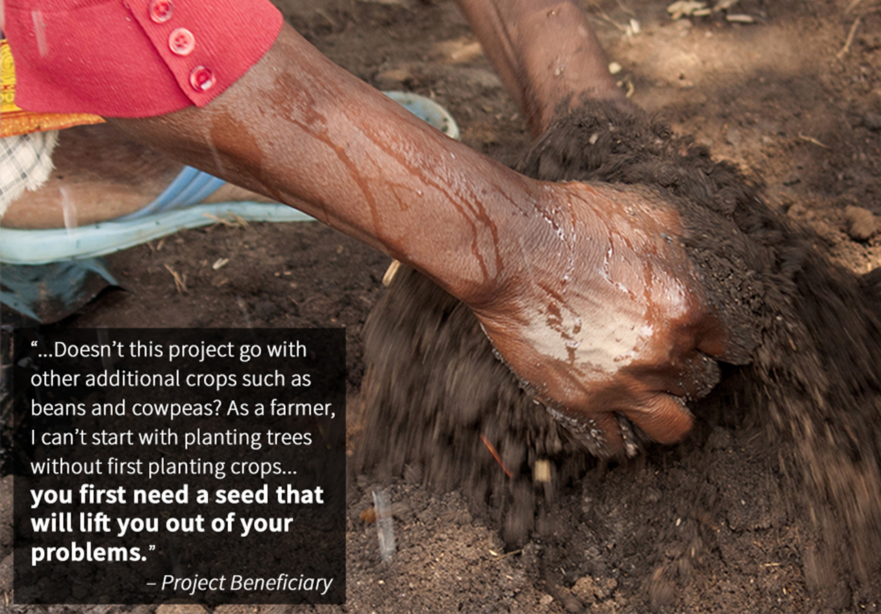
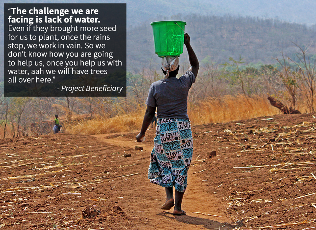
AGENT is underscored by the knowledge that gender equality and women’s empowerment are powerful levers for change: women are vital to conservation and resilience-building efforts and contribute valuable perspectives. For example, in Malawi, when local communities were asked what trees they would like to have planted, men were the majority of respondents, and they requested trees that provide non-renewable sources of income like timber and charcoal. However, when efforts were made to ensure women were surveyed, they asked for fruit-bearing and medicinal trees that provide added nutrition, health benefits and income–all without cutting down trees, thereby helping ensure the success of reforestation objectives.

We know from these kinds of experiences that gender equality and women’s empowerment are intrinsically linked to achieving sustainable development. Yet, as highlighted, critical gender inequalities and gaps persist that limit the ability of women to access markets, capital, training and technologies.

Women also do not have the same rights as men when it comes to customary or legal rights to land, property and resources. This reduces their access to critical means for survival and resilience. Data demonstrate a solemn reality on this issue; women do not have the same legal rights as men to own and access land in over 100 countries. Also, in 90% of 143 economies studied have at least one law restricting women’s economic equality.

Women are often underrepresented or restricted from participating in environmental decision-making and their contributions, innovations and leadership are frequently overlooked. The result is a lost opportunity for environmental initiatives to achieve multiple benefits, scale impacts and increase effectiveness.

Over the next year, AGENT will build new evidence on many important topics, such as why women’s empowerment and participation matters in the power sector, the connections between gender-based violence and the environment, and which gender issues are most prevalent in urban services. Platforms and curated resources are supporting forest and biodiversity programs, and networks of experts will be convened to share best practices and identify new areas of research.

USAID and IUCN are committed to filling critical information gaps on gender and environment, and will work to ensure that strategies and approaches for environmental sustainability are more effective and benefit all people. We are equipping our projects, programs and partners with data, analysis and tools. By doing this, we are working to ensure USAID Transforms by advancing a sustainable future — one that delivers gender equality and women’s empowerment outcomes.

Read the original article on IUCN’s blog.

7 Ways USAID is Strengthening Land Rights

In dozens of countries, we’re addressing a wide range of issues, including conflict minerals, women’s rights and policy reform

Around the world, millions of people, communities and businesses lack secure rights to one of their most important economic assets — land.

Up to 70 percent of land in developing countries is unregistered and, in many countries, the systems that govern land access and property rights are weak or ineffective. For women, who generally have less access, control and ownership of land than men, this insecurity impacts them disproportionately.

Weak property rights and poor land management represent fundamental barriers to our top priority at USAID — advancing free and prosperous societies that progress beyond the need for foreign assistance. Also, given the role it plays as a source of wealth and power, land is often at the center of violent conflicts.

The evidence is clear that strong property rights are an essential foundation for economic growth and responsive democratic governance. And from Colombia to Kosovo, experience has shown that resolving land disputes and clarifying property rights can help reduce tension, create lasting stability and set the stage for productive investments and economic growth.

So, what is USAID doing to advance land rights around the world? The answer is — a lot!

We are working in dozens of countries to address a wide range of land and property rights issues — from conflict minerals to women’s rights to policy reform. Here are seven examples of some of USAID’s most promising and effective programs from across the world:

Land surveyors document property boundaries in Meta, Colombia with the support of USAID. / Jeremy Green, USAID

1. Formalizing property rights in post-conflict Colombia

Land issues were at the heart of Colombia’s long-running violent conflict, displacing an estimated 6 million people and leaving large portions of the country essentially ungoverned. Now, with a landmark peace agreement in place, USAID is working to help resolve critical land issues by supporting the Government of Colombia to formalize property rights across the country, organize the national land registry and return land to those who lost it in the civil war.

A woman in Tajikistan proudly displays the crops growing on her land. / Sandra Coburn, The Cloudburst Group

2. Enabling a land market to take root in Tajikistan

Transitioning from Soviet-style collective farms to property rights for individual farmers and a fully functioning land market are essential steps for unlocking Tajikistan’s economic growth potential and setting the country on a path to greater self-reliance. USAID is supporting land policy reforms and capacity building programs that are enabling a nascent land market, in which individual land use rights can be bought and sold, to take root.

A Tanzanian youth proudly displays USAID’s Mobile Application to Secure Tenure, a simple smartphone-based mapping tool for documenting land rights. / Freddy Feruzi for USAID

3. Documenting land rights in Tanzania with a mobile app

In rural Tanzania, USAID is using an inexpensive mobile phone-based mapping app to document land rights. Traditional land surveying equipment and processes can be very expensive and time consuming. To map and document all of the unregistered areas in rural Sub-Saharan Africa using traditional methods would take decades and cost billions. USAID’s low-cost solution has produced remarkable results — 15,000 land certificates issued to date, many to women who had been locked out of land ownership in the traditional system.

A pastoralist points to his herd of animals in Afar, Ethiopia. / Antonio Fiorente for USAID

4. Reducing tensions between farmers, herders in Ethiopia

Disputes over land access and grazing rights have long been a source of conflict between farmers and herders in Ethiopia. Since 2014, USAID has been working with pastoral herding communities to certify their rights to rangelands, building on successful previous work certifying farmers’ land use rights. Clarifying and documenting the rights of each group is helping reduce tensions and create incentives for investments and economic growth.

In Liberia, as in much of the world, women have less access and control of land than men. / Ben Ewing, The Cloudburst Group

5. Ensuring Liberian women’s land rights

Even when countries enshrine protections for women’s land rights in national laws and policies, traditions and customs can block women from actually exercising their rights. That’s why USAID is working with Government of Liberia and community leaders to address the complex mix of social and institutional barriers to women’s land rights that persist despite the country’s progress on legal reforms. This nuanced approach is working to change behavior on the ground, not just amend laws on the books.

Artisanal miners sifting for diamonds from a deposit outside of Bobi, Côte d’Ivoire. / Moustafa Cheaiteli for USAID

6. Reducing conflict over minerals

Competition over scarce minerals like diamonds and gold has driven destabilizing conflicts in countries like Cote d’Ivoire, the Central African Republic and the Democratic Republic of the Congo, with property rights struggles often at the core of these disputes. USAID is working in these three countries to reduce conflict over minerals, including by clarifying property rights and access to subsurface resources for small-scale miners.

A community in Zambia’s Eastern Province proudly displays the maps resulting from USAID-supported community participatory mapping efforts. / Sandra Coburn, The Cloudburst Group

7. Using participatory community mapping

When it comes to land rights, sometimes the best solutions come from the ground up. In Burma, Ghana, Paraguay, Vietnam and Zambia, USAID is using bottom-up participatory community mapping to directly engage land users who have traditionally been overlooked. This will help empower land users themselves with the tools and understanding to better control and manage their own resources.

Read the full piece on Medium.

Full Rights for All: USAID Works with the Government of Liberia and its Partners to Address Gender Dimensions in Land Governance

Addressing gender disparities in the context of land reforms is not easy. Effectively addressing gender issues takes time and effort, which can sometimes make it more expensive in the initial stages of a project or program. However, evidence shows that integrating gender throughout land reform interventions not only increases benefits for women, but strengthens the intervention overall. Meaningfully including gender into land reform approaches often requires a change in behavior among decision-makers and program participants that, in some cases, may take years, even decades. In the meantime, land reforms can sometimes move faster than changes in gender stereotypes that impede women’s land rights. If land reform efforts and the donors that support them do not urgently and specifically focus on the inclusion of gender issues, these reforms may solidify and perpetuate land rights inequities for women and girls.

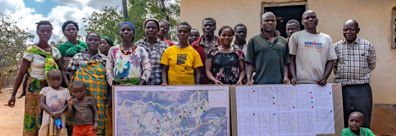
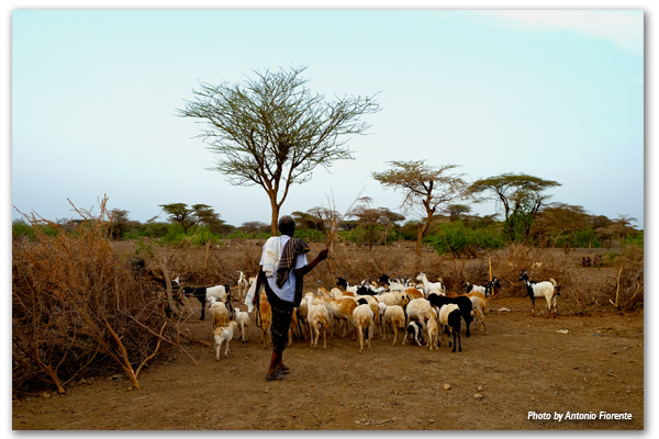
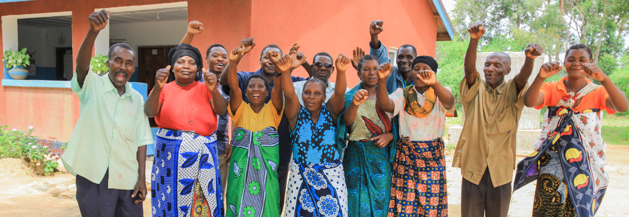
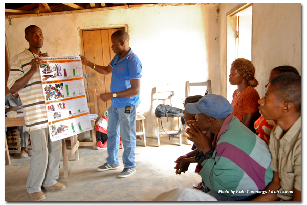
In Liberia, the community organizers for USAID’s Land Governance Support Activity (LGSA) program on community self-governance understand this. In a packed meeting room in LGSA’s office in January 2018, women and men community organizers engaged in an interactive gender and women’s land rights training, sharing stories, challenges and approaches to addressing gender discrimination in customary land governance. The discussions grew lively as participants tackled difficult issues and challenged their own beliefs around gender and land rights. In the midst of a discussion on whether special efforts should be made to secure women’s rights to land, one woman organizer coined the phrase “full rights for all,” which the group enthusiastically agreed should be the goal of all community-level efforts to implement Liberia’s 2013 Land Rights Policy.

Achieving full rights for all requires a deep understanding of the status quo, including who does and does not have rights within both formal and customary systems. To fully understand this context, LGSA and its partners recently completed report on Women’s Land Rights in Liberia. The report draws on past and recent USAID-led research on customary norms, as well as legal analysis, including statutes related to land, family matters, succession, immigration, and Supreme Court case law related to land and gender. In addition, the report incorporates 2017 field research, conducted in three counties by a joint team from LGSA, Landesa, the Female Lawyers Association of Liberia, and the Women’s NGO Secretariat of Liberia. Key findings from the study include:

  1. Women’s access, use, and control of land differ from, and are less secure than, those of men. Rural women depend on accessing and using community land for their housing, livelihood, and welfare, but face discrimination and barriers not experienced by men. This makes their land and property rights insecure, particularly in customary settings. Most women access land through their male relatives, and do not approach chiefs directly for land. Women’s use of land is often temporary and limited to planting seasonal crops.
  2. Laws and practices around marriage reinforce land-related gender biases. The laws governing women’s land rights are inconsistent, do not achieve their intended purpose of treating all “wives” equally, do not treat men and women equally, only cover privately owned land, and do not cover all relationships where land rights matters arise. Civil marriages are rare, customary marriages are on the decline, and marriage informality is increasing. Women in de facto unions do not have recognized rights upon separation or abandonment, even when they have contributed to the family property and its maintenance.
  3. The law regulating inheritance contains critical gaps. Liberia’s laws on inheritance vary for civil and customary marriages, and the latter appears only to apply to private land, which excludes much of the land held within customary marriages. In much of the interior, inheritance of land is customarily reserved for men. In practice, women in customary land tenure systems are not entitled to their husband’s land; if the husband dies, the wife is expected to re-marry a member from his family and to transfer family property to him.
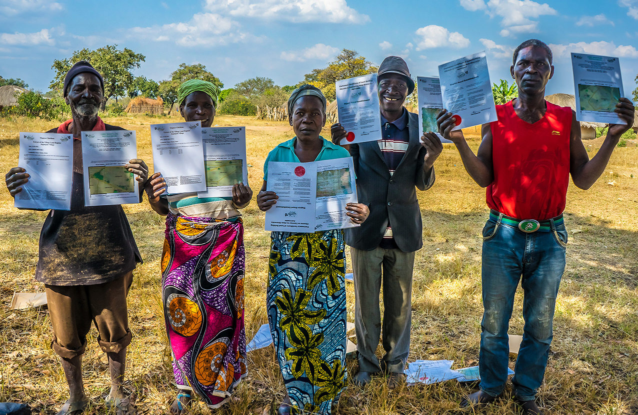
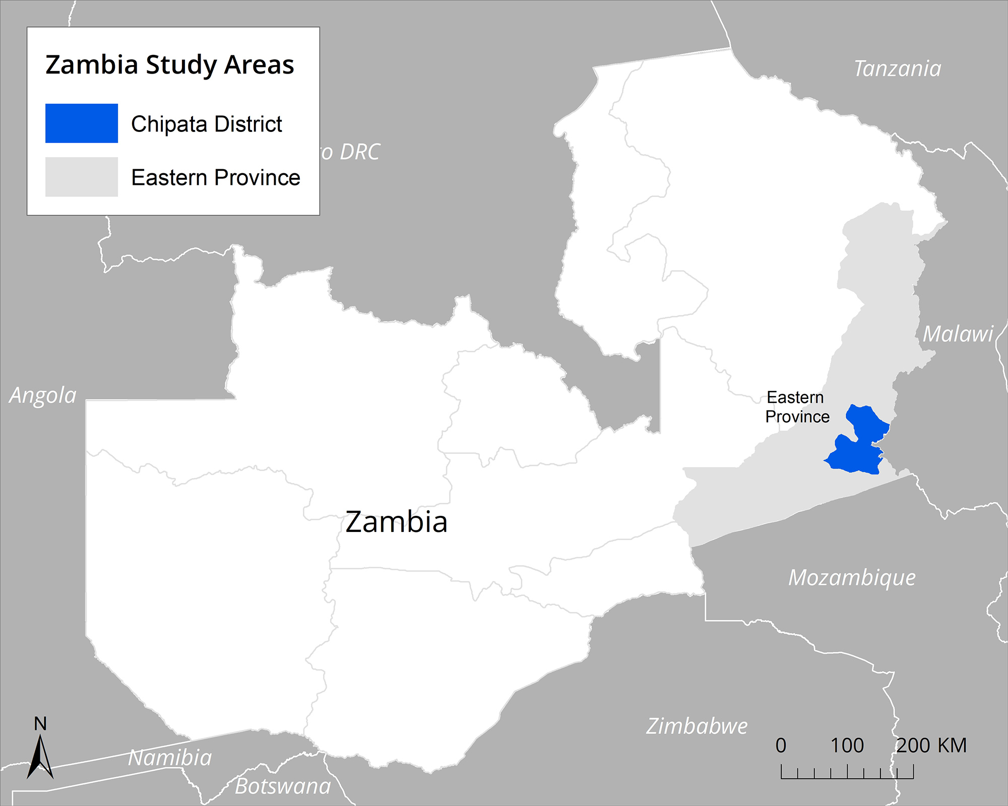
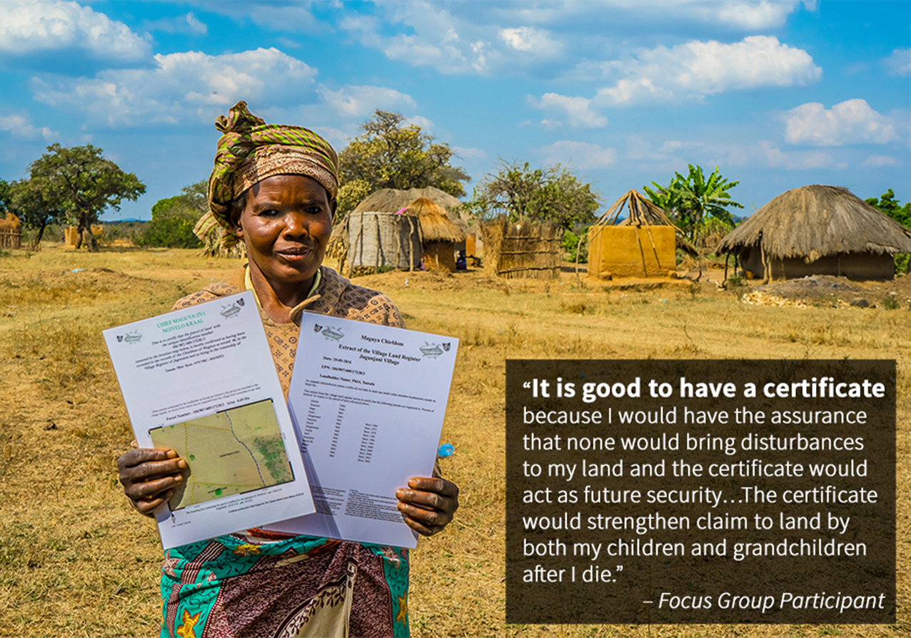
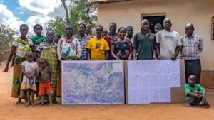
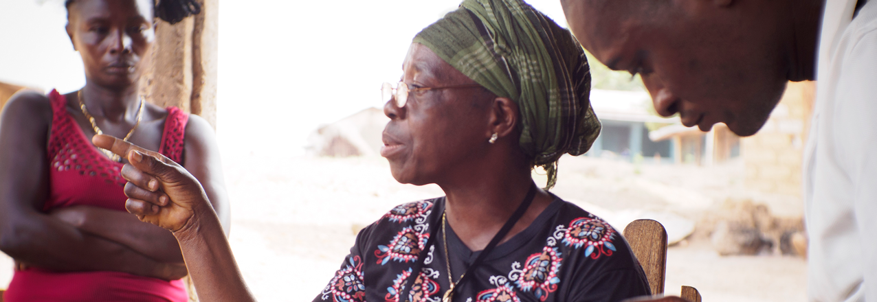
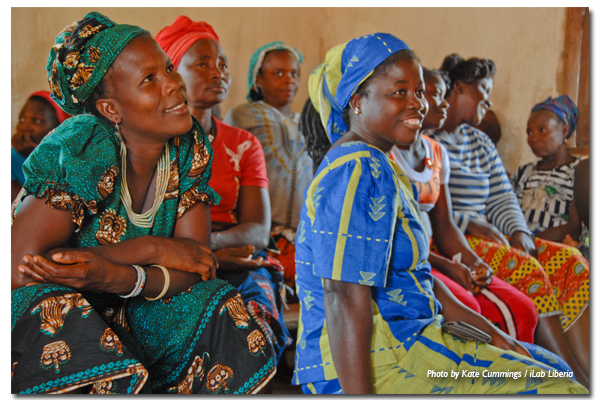
  4. Women’s participation in land governance is low, and in certain cases absent, in both statutory and customary governance systems. Women are disadvantaged in both statutory and customary land governance systems due to underrepresentation, customary norms requiring male accompaniment, lack of consultation and information, low recognition of women’s legal rights to land and inheritance, and the dual system of land governance, both of which contain biases against women.
  5. Access to justice and dispute resolution systems for land are largely biased against women. While the formal court system is out of reach for most rural women as compared to men – requiring language skills, education, money, travel time and access to lawyers that most lack – customary justice institutions, run almost exclusively by men, often reflect customary biases against women and fail to deliver gender-equitable outcomes.
  6. Women in concession areas face unique, gender-specific challenges to land rights. In all the three counties researched, the women affected by concessions mentioned that they were faced with scarcity of food and could not gather herbs to treat the ill members of their families. The concessions drastically disrupted women’s lives through destruction of farmlands, pollution of drinking water, and restrictions from accessing the forests which, among others, provided food, medicinal herbs, and crops for the market.

While more research must be done to inform gender-equitable implementation of Liberia’s Land Rights Policy, the LGSA report on Women’s Land Rights in Liberia is part of a growing movement among donors, civil society, and the Liberian Land Authority to seriously consider gender disparities in the land reform process and their impact on sustainable development. Like the LGSA community organizers, people representing a range of institutions in Liberia increasingly realize that moving forward toward community land governance without a gender-responsive plan in place would compromise the end goal of the reforms, including gains in productivity, and food security.

As Liberians chart a path forward toward gender-equitable and responsive land governance, USAID will support the shared vision of socially inclusive land reform that could become a model for other countries and contexts. The Women’s Land Rights Study represents an important milestone in this regard.

Learn more about USAID’s work on land rights in Liberia.

Formally Recognizing Pastoral Community Land Rights in Ethiopia

For hundreds of years, pastoralists in Ethiopia’s lowlands have relied on strong customary land tenure systems to survive. Historically, legislation has failed to clearly define communal rights to rangelands, and the specific roles and responsibilities for both communities and local government to administer and manage these resources. This legislative deficiency prevented pastoral communities from fully exercising their constitutional rights to land (Ethiopia’s Constitution broadly recognizes pastoral communities’ right to access land and prevents their involuntary displacement). Past legislation also created an institutional vacuum in which government officials no longer consulted community leaders on decisions to convert pastoral rangelands to plantation-style irrigated agriculture. Restricting access to pastoral land has devastated livelihoods by severely curtailing access to dry season pastures, depleting wet season pastures and degrading rangeland resources leading to bush encroachment and shrinking livestock herds.

USAID’s Land Administration to Nurture Development (LAND) project has been working with the Ethiopian government to certify pastoral communal land use rights, negotiating a resolution to a long-held impasse between government and pastoral communities. In 2014, the project began collaborating with Ethiopian government officials in the Oromia regional state to pilot methodologies that would formally recognize communal pastoral landholdings.

LAND started by reviewing international experience in protecting pastoral land rights in 11 countries, including eight in Africa. The project also studied customary organization and management of rangelands by pastoral groups in Oromia and the successful methods developed to date. The project also determined that strengthening pastoral land rights required legislation that recognized and defined rights to communal rangeland held and used by a group of pastoralists.

The ideal legislation had to allow for a legal entity to hold group title to such landholding on behalf of a community, specify procedures to map the boundaries of the landholding, and define the different responsibilities of local government and communities to manage the land and its natural resources. The hardest obstacle to developing this legislation was obtaining agreement between government officials and the pastoral communities over the size of the communal pastoral landholding to be registered and certified.

The pastoralists in the Guji and Borana pilot areas wanted their customary dheedas (traditional grazing areas) to be the unit of landholding to be certified and registered. But dheedas can cover hundreds of thousands of hectares and straddle multiple administrative boundaries. Oromia officials were reluctant to certify a landholding this massive in the name of a single community. Further, they argued that the dheeda had to be subdivided per administrative boundaries to be more effectively administered and managed by local land administration officials. The pastoral communities steadfastly argued that the government must recognize their constitutional rights to land based on customary possession and certify the uncontested boundaries of their landholdings, as was done previously in the highland regions.

LAND facilitated learning workshops and negotiations between the parties to resolve the impasse. It provided government with evidence-based research demonstrating that administrative boundaries do not accommodate access to seasonal pastures and the mobility necessary for viable livestock production. After nearly three years of negotiations, Oromia officials accepted the communities’ arguments and developed, with assistance from LAND, legislation providing the legal basis to register and certify community landholdings and enable customary institutions to function as Community Land Governance Entities (CLGEs) that will hold title to communal land, manage rangeland resources and represent the community in dealings with third parties, including the government and the private sector.

In November 2017, LAND assisted three communities to establish their land governance entities in compliance with the legislation. LAND trained community members on their roles and responsibilities under the legislation, and on the procedures to demarcate and register the boundaries of their dheeda landholdings. LAND will further support the governance entities through training to help them establish more transparent and accountable governance practices, and build skills in financial management and negotiations with government agencies and third parties.

USAID’s assistance to Oromia regional state to produce legislation that strengthens land rights of pastoral communities and build government capacity to implement the legislation will enable the federal Ethiopian government to replicate and scale up these interventions nationally to help secure pastoral land rights, prevent rangeland degradation, improve productivity of rangeland resources and increase economic opportunities for Ethiopia’s 12 million pastoralists.

The Malbe dheeda customary leader, Mr. Dima Doyo summed it up well, “The Borana community’s grazing system and its customary institutional leaders have been neglected by the formal administration, and this negligence has caused numerous rangeland problems. The recent recognition of our governance system has already empowered us to take some important measures and manage our rangeland resources in a better way.”

This blog post is made possible by the support of the American People through the United States Agency for International Development (USAID). The contents of this blog post are the sole responsibility of Tetra Tech and do not necessarily reflect the views of USAID or the United States Government.

The Interface between Surface and Sub-Surface Rights in the Artisanal Mining Sector in West and Central Africa

The artisanal mining sector in West and Central Africa is a rapidly expanding economic force employing millions of young people, often those who are the most vulnerable. Numerous ancillary informal economies are associated with the export of what are commonly known as “conflict minerals” such as diamonds, gold and coltan. Women grow crops and process food for the labor force of young men digging deep into the ground to pull out the ore and precious metals and stones. Shopkeepers and other merchants sell tools and supplies to the communities built up around the rich yet dispersed mineral resources of the regions. Complex flows of capital and credit reach the most remote parts of the continent to pre-finance the extraction and sale of conflict minerals. Few recognize the importance of property rights in these flourishing economies.

Two USAID activities – the Property Rights and Artisanal Diamond Development Project II (PRADD II) project, which works in Côte d’Ivoire and the Central African Republic, and the Capacity Building for Responsible Minerals Trade (CBRMT) project, which works in the Democratic Republic of the Congo – know that securing rights and access to subsurface minerals is critical to sustainable resource management and transparency. Based on years of experience, PRADD II and CBRMT developed and refined approaches and techniques to help governments formalize land ownership to two asset classes – the bundle of surface rights (land, trees, water, etc.) and the sub-surface rights often viewed by the state as its exclusive domain. The formalization process is complex because there is often a disconnect between national law and the reality on the ground. Even though land policy and laws may transfer ownership of land to the state itself, and then to mining companies through concessions, rural populations often contend that customary tenure arrangements still prevail and that both surface and sub-surface resources belong to them.

There’s no easy way out of this conundrum, but the PRADD II and CBRMT experiences show that both the state and customary authorities must be brought into the process of resource tenure formalization. This is particularly true for post-conflict countries, where the authority and legitimacy of customary authorities over these resources often supersedes the power of the state. In post-conflict environments the state is commonly weak and is unable and/or unwilling to clarify and formalize the institutions and rules governing access to mineral resources, in part because these resources are often illegitimately funding the purchase of weapons and ammunition (by special interests that hold considerable power and authority over government itself).

Imagine the case faced by many villagers in West and Central Africa. Farm families have invested significant labor in clearing the land, planting crops and harvesting. Most of the work is done by women. One day, a wife notices that a stranger is digging a deep and narrow pit along the shores of a stream passing through her rice fields. When she asks, “Why are you digging this deep hole,” the stranger replies, “I am exploring for diamonds and gold. I have received the authorization of the chief to prospect and this seems to be a good site.” Several weeks later, to her surprise, a large team of young men is digging a deep pit into her fields. “Why are you here?” she asks. “Your husband has given us authorization to dig for diamonds in this place because the prospector found signs of diamonds.” When the wife confronts her husband about the trampling of her fields by the diamond digger, he replies, “Don’t worry, I have negotiated with the chief and the head of the work team that we will receive one third of all diamonds found in this place. We’ll be rich, your trampled fields are no loss.”

As is often the case, once diamonds are found in an area, hundreds of people invade the area to try their luck. If the site is indeed productive, it becomes well known throughout the country. Outside investors are sometimes attracted to the area to try their luck as well. At this point, the diamond diggers might be surprised when an agent of a foreign owned company arrives one day to say, “I have a government issued permit in my hand. I own the concession under this land, and this site is now mine. You are to leave immediately.” The diamond diggers refuse, and go to the local authorities to complain. The regional representative of the Ministry of Mines might throw up his hands, “Well, you know, the law states that all sub-surface mining rights belong to the state, so you really are illegally mining the land and you have no rights. The concession permit is valid so you must depart immediately or we will bring in the police to evict you.” Deeply disappointed, the villagers return home to plan how to respond to the threat of expropriation. And so, the tensions grow. The outcome is uncertain.

Formalizing supply chains for artisanal minerals, including through the formalization of rights and access to subsurface resources, is an important step to establishing responsible supply chains. USAID, through PRADD II and CBRMT, is a pioneer in assisting governments and the private sector in this complex endeavor. However, these USAID projects reveal that this approach can lead to the exclusion of some actors (including the state), particularly those who have long benefited from an opaque tenurial status and the associated lack of clearly recognized and secured rights. When customary authorities are inadvertently excluded, they mount surprisingly effective forms of protest and resistance. Angry villagers have sabotaged diamond mining companies in the Central African Republic because operators failed to respect areas set aside for artisanal mining. Similarly, village diamond miners in Côte d’Ivoire brought a diamond mining company to its knees by threatening to destroy buildings and equipment unless the concessionaire’s permits were opened up to artisanal mining. This type of proactive resistance is an increasingly common sign of the growing power of organized West and Central African rural populations to defend their perceived rights to customarily-owned lands.

A valuable lesson from PRADD II and CBRMT is the understanding that more attention should be focused on how to manage conflicts over who controls and manages rights of access to both surface and sub-surface natural resources. Training in conflict management cannot be directed solely to government officials; such capacity building initiatives must also include powerful traditional authorities, artisanal miners, civil society and actors within the private sector.

Tajikistan’s Path to Prosperity Depends on Creating an Accessible, Equitable Market for Land

Tajikistan is on the cusp of achieving its vision of a fully-functional market that allows land-use rights to be bought and sold. The transition from a post-Soviet system of regulation and control to market-based principles represents the culmination of over a decade of donor-supported commitment and effort to unlock significant economic growth potential in Tajikistan and support the country’s transition away from donor assistance.

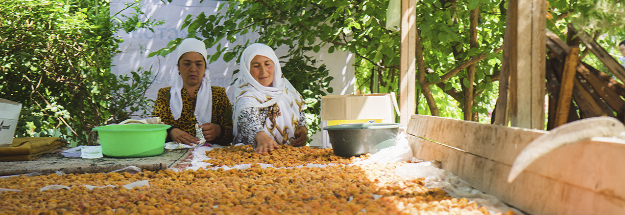
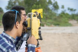
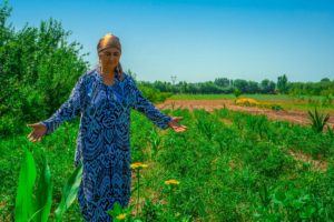
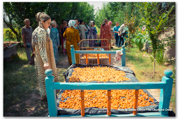
Tajikistan’s arable land is limited, covering just seven percent of its territory. Without a land market, land cannot easily be transferred from less to more efficient types of use, hindering efforts to alleviate the country’s significant rural poverty and food security challenges. Tajikistan’s robust agricultural sector accounts for 57 percent of employment and nearly a quarter of the national GDP. The emergence of a land market is critical to spurring equitable economic growth, and empowering entrepreneurial farmers to either expand their land holdings or lease them.
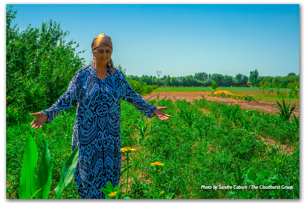
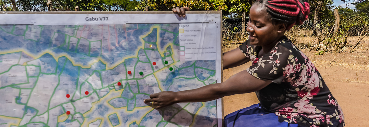
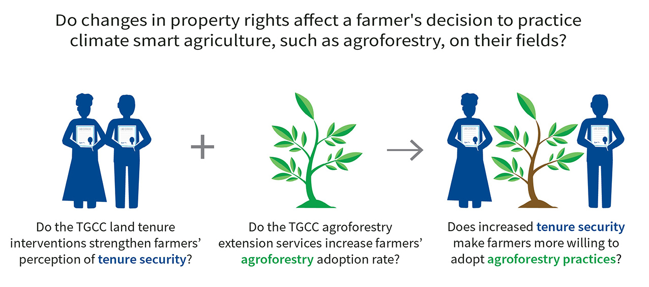
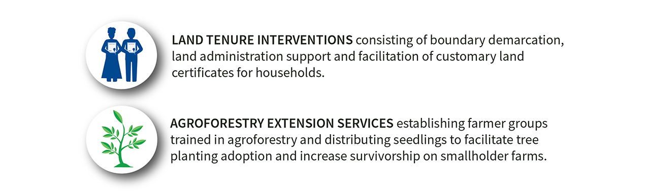
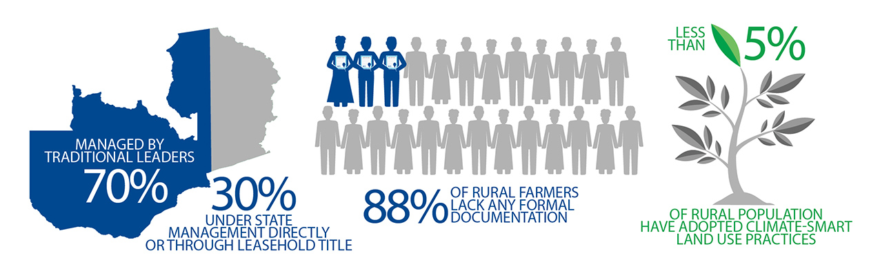
These new opportunities are particularly relevant to Tajik women, who make up around two thirds of Tajikistan’s agricultural workforce. After the fall of the Soviet Union, Tajik men left the country in droves in search of better economic opportunities abroad, leaving behind female family members to care for the farms. Donor support, led by USAID, has consistently prioritized the establishment of a legal framework for protecting land holdings, and helping women to overcome adversity as they exercise their land use rights.

Informing to Empower

Land in Tajikistan is owned by the government, with individuals holding rights to use the land. Following independence from the Soviet Union in 1991, the country’s agriculture sector was dominated by large-scale collective farms, which were gradually reorganized into dehkan farms — smaller farms held by an individual family or group of shareholders who willingly joined their land together. With the support of the USAID-funded Land Reform and Farm Restructuring Project (LRFRP), the 2016 Law on Dehkan Farms clearly defines dehkan farms as legal entities and provides better protection of legal rights of farmers that will support the emergence of a market in land use rights.

While donor efforts have helped make new legislation gender-equitable, Tajik women face barriers in taking advantage of their new rights. In some cases, it’s because they lack access to information about the new rights they have, or how to exercise them. In other cases, it is the result of cultural norms which lead local authorities to block attempts by women to register their farms.

To overcome these barriers, USAID-supported projects borrowed from the land reform experience of Tajikistan’s neighbor, the Kyrgyz Republic, by establishing a network of local volunteer experts: tashabbuskors. Modeled on the Kyrgyz demilgechi network, tashabbuskors serve as local land reform experts with whom farmers can consult on a variety of issues, such as disputes with neighbors and settling alleged tax debt. When an issue requires legal support, tashabbuskors can guide the farmer to a local Legal Aid Center to receive professional legal support. Through the Legal Aid Centers and tashabbuskor network, both LRFRP and the ongoing Feed the Future Tajikistan Land Market Development Activity (LMDA) help women and men understand and defend their land rights as land users under the emerging land use market.

Documenting Property Rights

In Tajikistan, ownership of land use rights is documented through certificates issued by the State Unitary Enterprise for the Registration of Immovable Property (SUERIP). However, complicated documentation requirements and unclear procedures have historically frustrated efforts by Tajik women to register property rights. In addition, as SUERIP offices are predominantly staffed by men, cultural norms will cause some women to send a male relative to register land they own. Without their name on the certificate, women are unable to exercise their rights as a landholder.

The tashabbuskor network helps women register their land by providing information and building confidence in how to file their paperwork. Moreover, the Feed the Future Tajikistan Land Market Development Activity is working with SUERIP to hire and train more female registrars, helping create an environment more suited for the agency’s clientele, as well as supporting efforts to improve registration office procedures to save time and cost.

The Emerging Market

By the end of 2016, following the passage of the new Law on Dehkan Farms, large-scale collective farms made up less than one percent of arable land in Tajikistan, and registered small-holder dehkan farms made up 81 percent. In addition to ensuring the rights of dehkan farms as legally-recognized entities, the law advanced the ability for landholders to leverage land use rights in civil transactions, such as leasing and mortgage. Once final legal instruments are in place, farmers in Tajikistan will be able to transact land use rights. This could include a farmer mortgaging land to provide a mechanism for financing investment, or a farmer having the opportunity to lease or sell the rights to his or her property upon retirement.

The success of the land market depends on a supportive enabling environment and the sustainability of the underlying institutions. The modernization of SUERIP offices and dissemination of information through the tashabbuskor network is only the beginning. The National Association of Independent Appraisers has been established to develop the professional capacity of Tajikistan’s nascent land valuation service providers. The taxation of dehkan farms is under review to ensure fair and equitable taxation of farm activities. A sustainable model of free or low-cost legal aid to farmers whose land use rights are challenged is being developed and implemented. As these initiatives progress and come together, a viable market for land use rights is within reach, advancing Tajikistan further along the path toward greater economic self-reliance and resiliency.

How Technology is Transforming Land Rights in Tanzania

As part of the Feed the Future initiative, USAID is helping the Government of Tanzania to improve communities’ understanding of land rights, support village land use planning, and clarify, document and certify property rights. USAID anticipates that this program – the Land Tenure Assistance Activity (LTA) – will reduce land-tenure related risks and lay the foundation for sustainable and inclusive agricultural investment for both smallholders and large-scale commercial investors. The program is a positive example of how a USAID investment is catalyzing innovation and partnerships for economic prosperity and self-reliance in Tanzania.

By the end of 2019, LTA is expected to have registered – for the first time – over 50,000 parcels, benefiting over 14,000 Tanzanian villagers.

At the heart of the program is USAID’s Mobile Application to Secure Tenure (MAST), a suite of innovative approaches, inclusive methods, and mobile technology tools to efficiently, transparently, and affordably document rights to land and other resources. In addition to Tanzania, USAID is working with other governments and communities to use MAST in Burkina Faso, Myanmar, and Zambia.

Evolution of MAST

These days, smartphones and tablets are everywhere, even in some of the most remote villages around the world. To leverage these technologies to meet the challenge of providing affordable, accessible land administration services to rural areas, in 2014 USAID began working with the Tanzanian government and local residents to pilot MAST in Ilalasimba, a small village in Iringa District. The initial pilot was a proof of concept – to test whether the idea of using low cost mobile technology to map and register land rights would work and could be affordably scaled-up to the rest of the country.

Central to the pilot was the assistance of and input from both the local government and community members themselves, in particular local youth who functioned as “trusted intermediaries,” helping to teach other villagers about MAST. Beyond just technology, the pilot project raised awareness among villagers about their land rights, with a special emphasis on women’s land rights. Only then did the project team map, record, and register those rights using MAST. As USAID/Tanzania’s Hal Carey explains, villagers were “interested and excited about [MAST] because it was an opportunity to participate in land governance…for women, it meant an opportunity to secure tenure for their children; for everyone, it meant access to finance. Everyone saw the potential, although there was some skepticism.”

In that first village – Ilalasimba – the pilot team mapped, recorded, and registered 910 parcels using MAST, benefiting 345 families. Soon after, the District Land officials issued official land certificates – known in Tanzania as Certificates of Customary Rights of Occupancy (CCROs) – for each parcel. The number of registered parcels increased to 1139 for the second village and 1886 for the third. Importantly, despite early resistance from many men to the registration of women’s land rights, the pilot’s education, training, and outreach activities resulted in parity in land registration between men and women. For example, in Itagutwa village, 33% of the parcels were registered solely in women’s names, while 32% of parcels were registered jointly in women and men’s names.

Now, with their land certificates in hand, residents of the MAST pilot villages enjoy greater clarity of their rights, including their parcel boundaries, enhanced tenure security, and stronger incentives to make long-term investments on their land. For example, families are using the certificates as collateral to invest in their businesses.

For USAID and the Tanzanian Government, the initial MAST pilot generated many lessons and produced a commitment to continue improving and scaling MAST, given its relative efficiency, low-cost, and user-friendly tools, compared with more traditional adjudication approaches that utilize labor intensive approaches and required expensive equipment and specialized inputs. The initial MAST pilot was judged a success for improving tenure security and in establishing and reinforcing participatory and transparent governance mechanisms at the village level which, in turn, have the potential to lead to greater smallholder and large-scale commercial investments in land.

USAID’s Land Tenure Assistance Activity expands MAST

Based on the success of the initial pilot, USAID launched the Land Tenure Assistance (LTA) activity in 2015 to scale-up the work to a much larger area. Under LTA, USAID has refined MAST’s technology and methods to deliver CCROs as well as village land use plans, which are a precondition for the issuance of land certificates under Tanzania’s Village Land Use Act. As Carey explains, “the [initial] tool had some shortcomings.” However, USAID “took the lessons learned from the MAST pilot and revised the application itself for more accountability…accuracy, and efficiency.”

Through 2017, the LTA program has achieved promising results, including:

  • Registering 14,747 CCROs, covering 20,000 hectares of land in 13 villages;
  • Empowering women to claim their land rights: 48% of all claimants were women;
  • Lowering the cost per parcel from $20.57 at project inception to $7.85;
  • Helping to establish 13 women’s groups and strengthen 32 others;
  • Training 17,714 individuals on land tenure and property rights;
  • Supporting the upgrading of 10 village registry offices;
  • Creating a radio program on land registration and the LTA project on five radio stations; and
  • Launching a youth sensitization program in secondary schools.

Semaly Kisamo, also from USAID/Tanzania, noted that MAST is a “very participatory process with villagers themselves participating. It’s generating ownership, sustainability, and trust… communities trust [each other] more. They are engaging and coming together to resolve issues. They are very appreciative of the project.”

The Government of Tanzania is now exploring opportunities to roll out MAST nationwide. While the Government looks to build a national land information system, which will focus first on the registration and administration of urban land, MAST offers a relatively low-cost, efficient, and user-friendly tool for formalizing customary rights in rural areas. As such, MAST provides an effective and sustainable tool that can easily be made compatible with the national land information system. It may prove beneficial to the Government in contributing to the activities focused on promoting transparency in the administration of rural lands, increasing tenure security, and ultimately enhancing the investment climate in Tanzania.

The Government recently decided that the Land Tenure Support Programme, which several European donors support in Tanzania’s Kilombero District, will use MAST and the same implementation protocols as the LTA program to support the systematic adjudication.

To learn more about MAST, see the MAST Learning Platform, a knowledge portal with documentation, tools, lessons learned, and best practices from existing MAST projects. The MAST Learning Platform also will feature upcoming MAST activities to be implemented under the USAID-supported Land Technology Solutions Project (LTS) and other USAID programs.

Land, Front and Center in Colombia

The history of land rights in Colombia is a centuries-old tale of colonialism, highly concentrated land ownership and unsuccessful agrarian reforms. Fifty years of civil strife have left vast sections of the country’s land undocumented, vulnerable to land record manipulation and outright lawlessness. Under the landmark peace agreement, the Government of Colombia has committed to addressing the land issues that have so often been at the heart of the nation’s conflicts – by formalizing property rights across the country, organizing the national registry and recovering lands that belong to the state.

In a warehouse on the outskirts of the capital, the nation’s property registry authority—the Superintendence of Notary and Registry (SNR)—stores over 80,000 paper-based property ledgers, some dating as far back as the 18th century. In 2015, the Constitutional Court ordered the government to restore, transcribe, digitize and conserve the records, seeking to modernize the disorganized and unreliable land administration system that had persisted for generations.

In addition to organizing the historical documents, the court ordered the SNR to determine how much land had been acquired irregularly (without formal documentation) and continued to be held unofficially. A year-long investigation showed that at least 30 percent of the nation’s territory—some 5 million hectares of land—was acquired irregularly.

“The state had no idea,” explains Clara María Sanín, a land expert working with the SNR. “Colombia’s history has been characterized by a government incapable of protecting its territory, a centralized administration that allowed faraway, rural regions to do what they want with land ownership.”

Now, in the post-conflict era, the national government has pushed rural land reform to the forefront of national dialogue by creating a new land administration authority, the National Land Agency. The agency is mandated to begin an ambitious land formalization campaign—in response to the fact that six out of every ten parcels in Colombia are informally owned—and coordinate rural development strategies with its sister agencies: the National Development Agency and the Agency for Territorial Renovation.

As the three agencies maneuver in unprecedented ways to ensure that sustainable investments reflect an integrated development approach, USAID, through its Land and Rural Development Program, plays a key role as facilitator. On its surface, USAID’s program acts as a conduit between national, regional and municipal administrations, improving intergovernmental coordination and making it easier for sub-national government agencies to mobilize domestic resources to address land issues and rural development. At a deeper level, the program is fostering critical public policy and governance changes that are improving Colombia’s land regulatory framework.

Piloting Massive Formalization

In partnership with the National Land Agency and the National Planning Department, USAID is spearheading a high-profile land formalization pilot in the municipality of Ovejas, a priority municipality in the nation’s post-conflict environment that was devastated by two decades of guerrilla and paramilitary violence. The pilot—which will soon title 3,000 parcels—is streamlining the collection and processing of property and cadastral information in order to reduce costs and provide government land agencies with integrated and reliable land data. The government is monitoring the Ovejas pilot carefully as it looks to learn about the most promising technologies and approaches as it prepares to undertake its own national land titling campaign.

“In the past, the government formalized property in an absolutely isolated manner. This pilot changes the way we do things in rural land administration. In Ovejas, we are focused on resolving all types of land conflicts, from parcel to parcel. The strategy is new, it is massive and it requires a higher degree of institutional coordination than we have ever seen,” explains Juliana Cortés, director of land tenure at the National Land Agency.

The Ovejas pilot is part of the government strategy to move away from a demand-driven land administration policy to one in which the government assumes the cost of first-time formalization. By doing so, it will alleviate major time and cost burdens that prevent most low-income rural landholders from seeking a valid title. Once a property is registered, future title transfers will be much less time and cost intensive.

State Presence

To get to this point, the USAID program has worked for nearly five years on creating an environment where government entities are more willing to share information and coordinate efforts to strengthen land tenure, improve land use and catalyze rural development.

“By framing land tenure with institutional strengthening, USAID is testing a new approach that no longer patches holes along the way. We believe the Colombian government to be capable of land administration—we merely support them in certain activities and put effective tools in their hands in order to ease the process,” explains Marcela Chaves, USAID/Colombia’s land tenure expert.

At the core of strengthening Colombia’s land institutions is access to information and the use of IT systems to manage and ultimately protect the country’s land and property data. The information gathered through the pilot is stored in a central database that merges former data collection systems, and is shared with the property registry authority. At the same time, USAID is assisting in the digitization of over four million land documents, which represent one-fifth of the country’s area.

“One of our biggest challenges in formalizing land is the ability to count on and trust the information that we have. What we have now is basic data that is not specific enough to make clear decisions in the public policy forum,” says Cortés.

Better land tenure policies and systems are already catalyzing rural development. In the new, land-conscious Colombia, municipalities are prioritizing titling public properties, such as schools, to stimulate rural investments with national funding. Beyond land tenure, this innovative USAID program is using its rapport with government entities to broker public-private partnerships, in which more than half of the funds are from the domestic government.

Making domestic public entities—rather than USAID—the face of development continues to increases the public’s confidence in their leaders and institutions. In a country long wracked by corruption and war, a little bit of confidence goes a long way.

From the Ground Up: Participatory Rights Documentation for Healthy Landscapes

Much of the world’s rural landscapes are technically managed by national governments with limited recognition of, or support for, the rights and management responsibilities of the rural poor who live in these areas. In an era of large-scale land acquisitions for global commodity production, this has led, in some cases, to governments allocating vast tracts of land and resources to companies with limited or no consultation of the people affected. These cases pose risks to all stakeholders, including: potential eviction or loss of livelihoods to the communities; reputational risk and operational challenges to companies (including responsible businesses); and the undermining of public confidence in government. Participatory documentation of land and resource rights, using state of the art technology and robust, inclusive processes, is creating an enabling environment to address existing land and resource conflicts, avoid future disputes and create improved land use plans for the future.

Since 2014, USAID’s Tenure and Global Climate Change (TGCC) program has piloted bottom-up participatory approaches to document and, in some cases, achieve government recognition of community land rights in five countries. Working in the diverse locations of Paraguay, Ghana, Zambia, Vietnam and Burma, USAID identified and tested a range of approaches to document land rights to inform conflict resolution and improve planning.

USAID found that, when it comes to addressing land rights challenges, sometimes the best information can’t be collected from satellites, or often even from government offices in capital cities. The information has to come from the ground-up, often through participatory dialogues with the land users themselves. Effective approaches ranged from documenting parcel-level rights for individual farms to clarifying boundaries between communities or documenting broader indigenous group claims.

For example, in Zambia, TGCC carried out household-level land certification of customary land rights, documenting the rights of over 50,000 individuals across more than 15,000 parcels of land. In Burma, by comparison, the allocation of vacant, fallow and virgin land to domestic and foreign investors has been so dramatic in recent years that TGCC found that rapid documentation of village tract boundaries and community land uses was effective in providing a degree of security to both land holders and investors. In Paraguay, TGCC worked through a Federation of Indigenous Peoples groups to consolidate and digitize over six hundred existing land claims into an open platform that commodity financers can use to asses deforestation and land conflicts risks in their investment decisions.

In many cases, rights documentation may not seek to identify one owner, but rather identify many overlapping users of a landscape to help improve management. For example, in Vietnam, TGCC used participatory coastal resource assessments to map overlapping resource rights of different stakeholders including line, net and boat fishermen, as well as aquaculture farmers and shell gleaners within the same coastal mangrove forests. The results ultimately improved mangrove co-management regimes through the development of coastal spatial plans. In other cases, rights documentation sought to clarify tenant rights to make improvements on the land. In Ghana, TGCC recognized that a huge portion of cocoa farmers (in some cases, over 70 percent) were effectively prohibited from participating in industry-funded cocoa intensification / rehabilitation efforts by their existing long-term tenancy arrangements. In response, USAID provided support to document tenant-landlord agreements in a way that promotes farm rehabilitation and reduced deforestation through partnerships with global chocolate and commodity companies: The Hershey Company and ECOM Agroindustrial.

With an increasing recognition of the value of bottom-up land documentation, there has been a wave of technology-based solutions that allow communities to map their own rights. This democratization of technology has allowed communities to move from paper-based participatory mapping to smartphones that can collect boundary points or even draw parcel boundaries directly on a screen over satellite imagery. Tools and platforms, such as the Social Tenure Domain Model, Open Tenure, Cadasta and USAID’s Mobile Applications to Secure Tenure (MAST), are offering low cost solutions to collect and in some cases administer land tenure information. TGCC deployed these tools and platforms, relying on a range of MAST solutions to push forward inclusive land documentation processes.

While mobile solutions undoubtedly reduced costs and increased data quality, they did not replace the most time consuming (and thus costly) elements of land tenure documentation: deep community engagement, trust building, participation and validation of results. In the end, these pieces were the centerpiece of developing transparent and legitimate products. This mix of attention to social processes and standardized tools increased quality and consistency of data collected, and have allowed for the products to be used by the communities themselves, private sector investors, other donors and government.

Impact Evaluation of the Tenure & Global Climate Change Project in Zambia

USAID’s E3/Land and Urban Office supported the design and implementation of a rigorous impact evaluation of the Tenure and Global Climate Change (TGCC) project in Zambia (2014-2017). This project explored the relationship between secure customary land tenure and development goals related to climate change adaptation and mitigation. Prior to the evaluation, there was little or no evidence on whether granting customary documentation to a farmer makes her or him more likely to adopt climate smart agricultural practices.

The overarching policy question and theory of change that motivated this evaluation is:

The USAID TGCC Zambia project was a 3.5-year intervention that supported agroforestry extension services and worked to increase customary tenure security at the village and household levels in the Chipata District of Zambia’s Eastern Province. The project supported USAID development objectives of reduced rural poverty through improved agricultural productivity of smallholders, improved natural resource management and improved resilience of vulnerable households. The TGCC project interventions included:

The evaluation was designed as a four-arm randomized control trial to assess the direct and joint impacts of the agroforestry extension services and land tenure interventions on various outcomes. Villages were randomly assigned to receive one of the following activities:

  • Land tenure interventions
  • Agroforestry extension services
  • Both agroforestry extension services and land tenure interventions
  • No intervention of either kind (control group)


Zambian ContextMethodsBaseline FindingsEndline FindingsKey FindingsTheory of Change

ZAMBIAN CONTEXT

Land tenure security and property rights governance issues represent a central focus in Zambia for a range of rural development initiatives to address agricultural livelihoods and poverty reduction. Customary land represents the majority of land in Zambia and is allocated and administered by traditional authorities, led by a chief and based on the application of customary practices. Smallholders commonly have no documentation of their land rights, which can result in complex land disputes over boundaries, defense of land rights or reallocation of land by chiefs or headmen. This is an especially pressing issue in the rural areas of Zambia, where insufficient access to arable land is a recognized driver of conflict. Both traditional leaders and village members are increasingly attuned to a need for documentation to assist in long-term land management.

To encourage food security, Zambian agricultural policy has encouraged climate smart agriculture, and a number of organizations have actively promoted conservation agriculture and agroforestry, especially in Eastern Province. However, uptake of climate smart agriculture practices, in particular agroforestry, remains limited, despite the expected benefits to Zambia’s smallholder farmers who struggle with low yields, unreliable access to fertilizer and vulnerability to climate change.

While there has been a great deal of USAID and other donor research on constraints facing smallholder farmers, the influence of resource tenure and the effects of tenure security on smallholder investment in long-term land productivity in the country is still not fully understood. As the Government of Zambia develops a new land policy and launches a land audit, national land titling program and new forest and wildlife acts, it is important to demonstrate cost-effective models for customary land documentation, administration and management that strengthen the role of local institutions and result in sustainable land and resource management.

EVALUATION METHODS

The evaluation team collaborated closely with the TGCC project prior to develop a robust evaluation design. The impact evaluation is designed to assess the direct and joint impacts of the agroforestry extension intervention and tenure security strengthening intervention on five main types of outcomes:

  • Tenure security
  • Agroforestry uptake and survivorship
  • Land governance
  • Field investment
  • Long-term agricultural productivity and livelihood improvements

The evaluation study area included four chiefdoms in the Chipata District of Eastern Province, Zambia. The chiefdoms are: Mnukwa, Mkanda, Mshawa, and Maguya.

The evaluation was designed as a four-arm randomized control trial, the gold standard of evaluations, in which villages were randomly assigned to receive project interventions across the four chiefdoms in the Chipata District. As shown in the graphic below, villages received one of the following activities:

  • Land tenure interventions
  • Agroforestry extension services
  • Both agroforestry extension services and land tenure interventions
  • No interventions of either kind (control group)

The evaluation assesses the impact of the TGCC project in Zambia on household and field-level outcomes using four primary sources of baseline (2014) and endline (2017) data from 285 communities. These data sources include household surveys (2,896), village leader surveys (271), key informant interviews (568), focus group discussions with women, youth and land-constrained households (62) and project monitoring and evaluation data collected by TGCC and the evaluation team.

For more information about the evaluation design, please see the TGCC Zambia Impact Evaluation Design Report.

PERCEPTION OF TENURE SECURITY

Prior to TGCC, households felt secure that their fields would not be taken away from them from: family members, the village headman or neighboring villages. This expectation held true for the short-term and the future. The general security of land is demonstrated by less than 1% (N=55) of households indicating having any land reallocated in the past.

At the same time, households showed concern over their future security. Forty percent (N=1,409) of households believed it likely that the chief or government would give up at least one of their fields for investment purposes. Over 90% (N=3,224) expressed they would like to obtain paper documentation for their farmland. Focus group participants also indicated this strong desire for paper documentation and believed that this documentation would strengthen tenure security by providing proof of ownership, promoting dispute resolution and solidifying claims to land.


CONFLICT & DISPUTES

Even though people felt secure about their land, disputes over fields still existed, particularly over field boundaries and inheritance. Overall, the total number of disputes over fields were low with only about 11% (N=1,007) of fields reported as disputed.

AGROFORESTRY 

Planting agroforestry trees is encouraged as these trees fix nitrogen in their roots and leaves, improving soil fertility and reducing farmers’ need to purchase chemical fertilizers. Better soil quality leads to improved crop productivity and increased yields. The long-term benefit is improved livelihoods for farmers.

Baseline results indicated that there was a low rate of agroforestry uptake with only 11% (N=383) of households practicing agroforestry across 5% (N=404) of fields in the study. Fields were defined by how they were used for cultivation—for example a field used for maize cultivation versus a field that has been left fallow. Results suggested this low uptake rate may have been driven by a lack of access to seedlings and farmers’ lack of knowledge of the benefits that planting trees may provide. While the majority of these fields were planted with agroforestry trees to improve the fertility of their soil, only about half of the fields had seen benefits at baseline data collection.

The most popular type of agroforestry species planted across the villages was the Musangu (pictured below), followed by Sesbaniaseban and Gliricidia trees.

LAND GOVERNANCE & MANAGEMENT

Overall, households agreed that they were satisfied with their community leaders and land governance over a variety of metrics including their leader’s transparency about their decisions, fair allocation of land across households and accountability for their decisions. Focus group participants also indicated that they felt the land allocations were transparent and just.


The most common land management rule regulates the grazing of livestock on communal land. Nearly 90% (N=225) of headmen report their village has a rule about grazing livestock on communal lands and over 80% (N=181) of headmen reported that at least half of the households in the village follow grazing rules. After grazing, tree cutting was the most prevalent rule, followed by rules about fires or burning. Most headmen reported that their communities have a good understanding of the rules.

For more information about the baseline findings, please see the TGCC Zambia Baseline Impact Evaluation Report.

PERCEPTION OF TENURE SECURITY

There is strong evidence that the TGCC process of boundary demarcation and expectation of receiving paper documentation substantially increased perceptions of tenure security.  At both baseline and endline, households were asked to assess the short-term (1-3 years) and long-term (4+ years) likelihood that each plot of land would be reallocated or encroached by various entities including their chief, a neighbor or family. These short-term and long-term measures were combined to create an index for perception of tenure security as shown below.

Households in villages that received the land tenure interventions are more likely to express confidence that their farmland is secure from internal and external sources of encroachment or reallocation. As seen in the graph below, the percentage of households fearful of encroachment or reallocation decreased across various entities.  Households across every treatment group demonstrated a large decrease in their fear of unauthorized land reallocation or expropriation by chiefs. It’s also apparent that households’ greatest fear at endline was that other households will try to use their field.

Focus group participants also revealed that households believe that the primary drivers of this increased sense of tenure security are having well-known and clearly defined boundaries through the demarcation process in combination with paper evidence of their customary land holdings.

Roughly 80% (N=488) of households that received the land tenure intervention believe that having a customary land certificate will make it less likely for their land to be taken, both now and in the future, as shown in the graph below.

Overall, as seen during baseline, disputes were low. Households believe that customary land certificates have reduced disputes about inheritance (39%, N=195) and even more believe they will do so in the future (52%, N=255).

AGROFORESTRY UPTAKE & SURVIVORSHIP

For the overall household sample, the agroforestry extension services were successful in motivating greater uptake of agroforestry as shown in the map below.

In villages that received the agroforestry extension services, vulnerable groups such as female-headed households, youth, elders, poor and land-constrained groups also show significant uptake in agroforestry across fields. The graphic below shows the increase in the average number of agroforestry trees per field across all treatment groups by each vulnerable group. For example, female-headed households receiving both the agroforestry extension services and land tenure strengthening interventions moved from an average of 0.06 trees per field at baseline to 0.28 trees per field at endline.

For the overall study sample, there is no evidence of improved benefits for households that received the additional land tenure support compared to those that only received agroforestry extension services. However, the study finds marginal benefits to linking land tenure and agroforestry for female-headed households, poor and elder respondents. This finding provides limited support to the argument that, at least for vulnerable groups, stronger property rights affect a farmer’s decision to practice agroforestry.

In communities where the agroforestry extension services were offered, roughly a third of households had at least one household member participate in the program. Of the households that did not participate, one key reason was that they were unable to attend the initial meeting. Focus group participants also indicated that they did not participate because they preferred a program that provided inputs such as seeds.

Musangu tree is the most common tree species planted across every treatment group. It can be grown amidst any crop, but the program encouraged farmers to plant their fields where Musangu seedlings were being grown with low-growing crops such as groundnuts, to ensure that the seedlings would get enough sunlight. The second most common species of agroforestry tree is Gliricidia, which is normally planted along the perimeter of a field as a type of hedge.

The expected benefits of planting agroforestry trees such as Musangu trees are well known to households in Chipata district. The most common expected benefit cited both now and in the future is improved soil fertility. As shown below, the number of households who expect to see this benefit in the future for their Musangu tree is about double the number of households who currently see the benefit, indicating that households understand that the benefits of agroforestry accrue in the future. 

Despite understanding the benefits, some households are still skeptical that these benefits will actually materialize for them, both now and in the future.  At present, 38% (N=228) of households that received agroforestry extension services see no benefits to their Musangu trees. This number drops substantially when households are asked about benefits they expect in the future (13%, N=71). Additionally, agroforestry adoption also does not appear to strengthen household’s perception of tenure security. Almost no households believe that planting agroforestry trees strengthens land tenure or raises the value of their land for collateral, either now or in the future.

Within areas receiving agroforestry extension services, seedling and tree survival rates are low. Across all years of the program, over a third of households who engaged in agroforestry report that less than 25% (N=183) of their Musangu and Glyricidia seedlings survived.  Seedling survival declines over time and is the lowest in 2016, after the agroforestry extension services were withdrawn. The map below shows average survivorship rates by village across all treatment groups.

The most common challenges to agroforestry seedling survival include a lack of water for seedlings, fires burning trees, pests killing the trees and animals grazing in the field. Despite additional program efforts to construct wells and boreholes, focus group participants noted the continued lack of water.


Photo by Jeremy Green / The Cloudburst Group

The difficulties with seedling survival show that despite interest in, and knowledge of, agroforestry, sufficient labor and time inputs remain an essential missing piece for smallholders.

INVESTMENTS IN FIELDS

An important finding is the weak but positive evidence of a link between strengthening customary tenure and enhanced field investments. There is statistically significant evidence of improved labor or cost intensive long-term field investments (an index comprised of planting basins, rotating crops, fallowing and fertilizer application) for households receiving the land tenure intervention. This long-term field investment index in addition to the percent of households that feel secure by treatment group is shown below.

However, the standalone results for fallowing might also indicate that households do not feel as secure as some of the perception of tenure security results indicate. For example, leaving fields fallow is particularly important for soil fertility, but is often feared because uncultivated fields are more likely to be reallocated or encroached on than cultivated fields. As shown below, fallowing is low across all treatment groups indicating that households may still fear that their land will be reallocated if their field is not in use. Additionally, the graph indicates significant variation in the types of field investments undertaken across the study area.

LAND GOVERNANCE & MANAGEMENT

TGCC sought to clarify resource tenure over private, community, and open access resources, and supported dialogue over community resource rules. TGCC worked with each community to document their land and resource governance rules. However, there is no change in household’s perceptions of land management decision making or their satisfaction with customary leaders. Satisfaction with customary leaders was relatively high at baseline, which may explain the lack of statistically significant findings on this issue.

However, there appears to be positive impacts on satisfaction with community leaders for female-headed households. As demonstrated in the graphic below, there is a clear shift from the total number of female-headed households at baseline with low satisfaction of their community leaders to a higher level of satisfaction at endline across all treatment groups compared to the control households.

KEY FINDINGS

  • There is strong quantitative evidence that TGCC has a positive impact on household perceptions of improved tenure security. Households receiving informal customary certificates report approximately a half point increase on a six-point index measuring their perceived security of tenure from unauthorized land expropriation.
  • However, there is no evidence that strengthening land tenure motivated increased agroforestry uptake for the household sample, although there is evidence of a link between stronger land rights and other labor and cost intensive field investments.
  • The results show increased rates of agroforestry adoption, although the actual tree planting and seedling survival rates remain low.
  • Vulnerable subgroups may have experienced additional benefits. The study finds several positive tenure and agroforestry adoption impacts for female-headed, youth, elderly, poor and land-constrained households.
  • As expected, the analysis found no evidence of a TGCC impact on crop yields or livelihoods as these are long-term impacts requiring an additional round of data collection.

POLICY RECOMMENDATIONS

  • The findings support the scale-up of TGCC’s documentation and boundary demarcation approach in Zambia and program piloting, and potential scaling, in other customary land systems in Africa.
  • The benefits of the agroforestry extension should be reexamined and other climate-smart agriculture activities considered, such as minimum tillage or crop rotation, given the large labor investment and challenge to keeping seedlings alive.
  • If the agroforestry extension is continued, future programs should consider strengthening land management rules that would limit seedlings being grazed by cattle or burned by fires, and ensure villages have access to water for the nursery. Introducing incentives for seedling survival or adding monitoring visits might also increase the success of the program.

DID THE THEORY OF CHANGE SUCCEED?

This impact evaluation provides evidence to assess TGCC’s program effectiveness and theory of change. As shown in the graphic below, receiving the land tenure intervention in addition to the agroforestry extension services does not generate increased agroforestry adoption over the extension services alone. While the land tenure intervention had a positive impact on perceived tenure security and the agroforestry extension services had a positive impact on agroforestry uptake, there is no evidence to support the hypothesis that combining the interventions led to greater rates of agroforestry uptake in the short-term for the overall household sample. These short-term results may indicate that households need to feel secure for some time before they begin adopting more time and labor intensive investments.

Overall, the evaluation does not find evidence of a program impact on long-term outcomes such as seedling survival, agricultural productivity, or livelihood improvements. This is not surprising given the short three-year time period between baseline and endline data collection. There is strong reason to expect that the project effects in the long-term may differ from those in the short-term. It may take time for households to trust that the guarantees of land tenure will be honored. Households that adopt agroforestry may subsequently abandon it. These longer-term indicators should be potentially explored during subsequent rounds of data collection with the same households that took part in the baseline and endline surveys.

EVIDENCE-BASED PROGRAMMING

The new knowledge generated from this impact evaluation will be used to make more evidence-based decisions, ensuring that USAID continues to make targeted and sustainable investments in future programming. Another round of data collection would provide further understanding about the long-term impact and benefits of the TGCC project in Zambia. This will promote a better understanding of the TGCC program’s full policy potential and value for money, and inform other stakeholders’ decisions to take the program to scale in Zambia and other African countries with similar customary land systems.

All photos by Sandra Coburn / The Cloudburst Group, unless noted otherwise.