


Overview
The Lao People’s Democratic Republic (Lao PDR) is a landlocked country whose river valleys, uplands and forests sustain farming, fishing and diverse rural livelihoods. Land is owned by the national community and administered by the state; people and organizations hold rights to use it. Commercial agriculture, mining, roads, hydropower and urban expansion can generate income and infrastructure while placing pressure on land and resources used by households and villages.
The 2019 Land and Forestry Laws and subsequent instruments provide avenues to recognize longstanding use, including in forestland. Their practical value depends on accessible procedures, accurate maps and meaningful opportunities for affected people to establish claims before land is allocated to others. Land Law; Forestry Law.
Key Issues
- Recognize overlapping household, village and seasonal rights, including fallows and shared forests, before approving concessions or changing land classifications.
- Make land registration and dispute resolution accessible in local languages and ensure that women and poorer households can participate in decisions.
- Connect compensation to replacement land, access to water and forest products, and sustained livelihoods, not only to payment for visible assets.
- Publish reliable information about land allocations and monitor projects, environmental impacts and benefit sharing over time.
Country Context
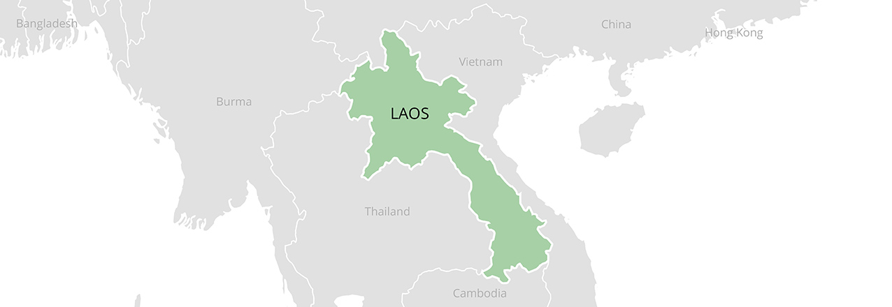
Laos borders Cambodia, China, Myanmar, Thailand and Vietnam. The Mekong and its tributaries link lowland rice production, fisheries, transport and hydropower to watersheds in the uplands. Rural people combine cultivation, livestock, fishing, gathering, wage work and migration. Ethnic communities have varied histories and local institutions; a single description of customary tenure cannot represent them all.
Conflict and wartime bombing have long-term effects on access to land. Unexploded ordnance makes cultivation and construction dangerous in contaminated areas. The national mine-action authority reported that 2,717 hectares were cleared in the first half of 2025; clearance expands safe use but does not itself determine who holds the land. UNDP, 2025.
Legal Framework
The 2019 Land Law, No. 70/NA, replaced the 2003 law. It treats land as belonging to the national community, represented by the state, and regulates allocation, registration, use, transfer, valuation and recovery. Land-use rights can be durable, inheritable or transferable under applicable conditions; they should not be confused with unrestricted private ownership of the land itself. Foreign investors generally use leases or concessions subject to legal conditions.
The 2019 Forestry Law, No. 64/NA, governs natural forests and forestland separately from planted trees. Instruments listed as implementing the Land Law include the 2022 land-titling instruction, the November 2024 forestland tenure order and August 2025 participatory guidance. A legal provision or an instrument is not evidence that rights have already been documented in every village.
Tenure Types
Land-use rights arise through allocation, recognition of longstanding use, transfer, inheritance and other lawful means. A formal title provides evidence of registered rights, while temporary documents, tax records, village testimony and physical use may also matter in an adjudication. The rights attached to a particular parcel depend on its classification, the holder and the applicable document.
Collective use of village forests, grazing areas, cemeteries and water sources can coexist with household fields and gardens. It is therefore misleading to map only individual house plots and treat the remainder as unused. Agreements can specify who may harvest, graze, cultivate or manage land and how outsiders gain access. Documentation needs to capture these relationships rather than assume that one parcel always has one user. World Bank, customary tenure assessment.
Customary and Community Tenure
Customary systems vary across communities and ecological settings. Village authorities and families may recognize cultivated fields, fallows, burial grounds, forest products and seasonal access through local rules and knowledge. Shifting cultivation involves cycles of cultivation and fallow; land resting between crops can remain essential to a household’s future production and a community’s food security.
The Land Law recognizes certain customary use, but recognition of individual claims and protection of communal resources are distinct questions. The 2024 forestland order establishes procedures for identifying and recognizing eligible rights; FAO lists a 2025 participatory guideline as an implementing instrument. Whether mapping, classification and certification actually protect the full range of customary uses depends on local implementation. Communities should be able to describe boundaries, seasonal uses and competing claims before decisions are finalized.
Women’s Land Rights
Women’s land rights are shaped by inheritance, marriage, family practices and registration. Practices differ among ethno-linguistic communities: a pattern of daughters inheriting land in some places should not be assumed to apply everywhere. Women can appear on a title individually, jointly or as a spouse; each form matters for decisions about sale, credit and inheritance.
The World Bank reports that more than 300,000 titles were issued under the Enhancing Systematic Land Registration Project by April 2026 and that 71 percent included women’s names. This is a project result, not the share of all land controlled by women. A separate 2026 World Bank brief notes that registered names do not by themselves reveal informal rights or bargaining power within households. Accessible meetings, independent advice and documentation of both spouses’ interests remain important. World Bank project results.
Land Administration
Land administration involves central, provincial, district and village authorities, with responsibilities divided among land, agriculture, forestry, planning and investment institutions. Recent institutional changes make current agency mandates important when applying for a service. District staff and village representatives play a practical role in identifying users, surveying boundaries and resolving objections.
Systematic registration can reduce the cost of documenting rights when teams visit communities, disclose maps and hear objections. Its quality depends on survey accuracy, understandable notice and routes to correct errors. Rural households may need help assembling evidence, particularly where records are missing, names differ across documents or land is shared. A title does not resolve an overlapping concession or forest classification unless the underlying conflict is addressed.
Land Data and Registration
Laos has expanded registration, but the number of titles issued is not the same as the number of people whose complete livelihood areas are protected. The 2022 customary-tenure assessment summary reported government estimates of approximately 1.5 million registered plots out of 3.5 million. These were estimates at that time, not a current national registration rate.
Useful public data would connect cadastral parcels with land classifications, concessions, forest boundaries, environmental approvals and grievance outcomes. Such layers should show their date, coverage and uncertainty. Publishing maps without safeguards can also expose sensitive household information or omit unregistered users. Communities need opportunities to review and correct mapped claims before maps guide allocation.
Land Conflicts and Dispute Resolution
Disputes can concern boundaries, inheritance, overlapping allocations, compensation, forest classification and the conversion of farmland for investment or infrastructure. Village mediation may provide an accessible first step, but its effectiveness depends on impartiality and the ability of women, migrants and less influential households to be heard. Cases may proceed through administrative or judicial channels where local resolution fails.
Grievance procedures work best when people can see project boundaries, challenge valuations, obtain reasons for decisions and appeal without retaliation. A signed attendance sheet is not the same as informed agreement. Independent advice and translation can make the difference between formal consultation and effective participation.
Acquisition and Displacement
Development projects can displace people physically or restrict the resources on which they rely without moving their homes. Land recovery and compensation must be understood together with resettlement rules and project-specific commitments. Fair assessment should account for crops, trees, homes, shared resources, water access and the income lost while replacement livelihoods are established.
Nam Theun 2 illustrates the complexity. Its resettlement framework addressed households affected by project land and the reservoir, while a later independent evaluation assessed long-term social and environmental outcomes. Dam-affected communities include downstream users whose fisheries, riverbank gardens or water access can change even when their homes remain in place. One project’s safeguards or outcomes should not be generalized to every dam.
Urban and Peri-Urban Land
Urban expansion, transport corridors and rising land values put pressure on peri-urban farmland and settlements, especially around Vientiane and provincial centers. Titles can support investment and transactions, but registration does not guarantee affordable housing or protect tenants and other users absent from the record. Conversion can also change drainage and expose downstream neighborhoods to flooding.
The 2026 Country Climate and Development Report links rapid, unplanned urbanization to flood risk and recommends catchment-level planning, drainage maintenance and attention to wetlands. Planning decisions should account for residents’ rights and allow time for objections and negotiated solutions.
Agriculture and Pastoralism
Lowland paddy rice, upland cultivation, gardens and livestock are central to rural livelihoods. Farmers also grow coffee, rubber, cassava and other commercial crops. The 2019/2020 agricultural census counted 644,098 agricultural households under its stated definition. Its definitions changed from the preceding census, so comparisons need care.
Livestock often graze on shared land or crop residues rather than in fenced pastures. Conversion of commons, roads and forest restrictions can narrow access to fodder and water. For swidden farmers, shortened fallows can reduce soil recovery; prohibitions or allocation rules that overlook the full rotation may further undermine livelihoods. Mapping fields, fallows and common access together makes land-use plans more realistic.
Investment and Concessions
Concessions and leases can bring capital, roads and employment, but they also change who can use land. A boundary drawn as state land may overlap gardens, grazing areas, fallows, forests or water sources that local people use without formal titles. A robust assessment begins with those uses and considers the combined effects of several projects, not only the footprint of one concession.
The Forestry Law provides for socioeconomic studies, consultation and environmental and social assessment in forestland concession procedures. The practical test is whether these processes occur before commitments are made, whether affected people understand alternatives, and whether contracts, payments and compliance can be scrutinized. Jobs and compensation should be assessed against lost resources and long-term opportunity costs.
Water and Hydropower
The Mekong and its tributaries support irrigation, drinking water, fisheries and hydropower. Abundant annual water resources do not guarantee reliable access in every season or location. Upstream dams and changes in flow can affect fish migration, sediment, riverbank cultivation and downstream water quality; water governance therefore crosses village and national boundaries.
The 2026 World Bank climate report highlights water-use efficiency, dam safety and changing climate risks. Meaningful assessment includes downstream users, reservoir shorelines and the cumulative effects of multiple projects. Compensation for a field alone may not replace fishing, gathering or water access.
Forests and Trees
The Forestry Law distinguishes protection, conservation and production forestland. These administrative categories do not always correspond to tree cover on the ground: a mapped forest area may include farms, fallows, settlements or degraded land. The law recognizes natural forests and forestland as national property, while trees planted by eligible individuals and organizations can be their property under the law. Customary use of forest products is subject to management plans and legal rules. Forestry Law, Articles 4, 64 and 66.
Village livelihoods depend on timber, fuelwood and non-timber products such as bamboo, rattan, food and medicinal plants. Protection can succeed when local rights and responsibilities are clearly defined and benefits are shared; exclusionary enforcement can instead shift costs to the people who depend on forests. Plantation expansion, infrastructure and extraction can also change access and biodiversity.
Climate Change and Carbon
Floods, droughts, erosion and heat interact with insecure land and water access. Households with secure, usable fields and diverse resources are better placed to invest in soil conservation and adapt cropping. The 2026 climate report calls for integrated landscape management, forestland rights recognition and stronger dam safety alongside urban flood management.
Under a 2021 agreement, the Forest Carbon Partnership Facility committed to pay for verified emission reductions from a program in six northern provinces, up to the amount and period specified in the agreement. This was a payment agreement, not proof that the full amount was paid. World Bank, 2021. Carbon programs should identify customary users, explain restrictions and distribution rules, and provide accessible grievance channels; a carbon benefit does not automatically establish a land title.
Minerals and Mining
Laos has copper, gold, potash, coal and other mineral resources. Industrial mining and smaller-scale extraction affect land, water and nearby settlements in different ways. The government’s legal register lists the revised 2017 Minerals Law, while a 2018 prime ministerial order addresses the administration of mineral activities. A mineral authorization should be considered alongside land rights, environmental obligations and compensation requirements.
Artisanal and seasonal mining can supplement rural incomes. The historical USAID profile reported surveys in which women formed a large share of small-scale miners; those localized findings should not be treated as a current national estimate. Practical priorities include safer working methods, access to markets, safeguards against water pollution, rehabilitation and monitoring after closure. USAID, 2013.
Political Economy
Land decisions are closely connected to development finance, infrastructure and state revenues. The ability to allocate land and approve investment gives public agencies considerable influence, while local users may have less access to legal advice, maps and negotiating power. Public revenue and export earnings do not necessarily show how costs and benefits are distributed among districts, households and generations.
The World Bank’s June 2026 economic assessment identifies continuing debt and fiscal vulnerabilities. Transparent concession terms, consistent environmental oversight and public reporting of compensation and revenue can improve accountability without assuming that any one instrument will resolve unequal bargaining power.
Priorities for Action
- Map household and collective rights, including seasonal uses, before investment approvals or forestland reclassification.
- Fund accessible registration, independent advice, translation, dispute resolution and correction of cadastral errors.
- Give women and diverse ethnic communities meaningful roles in decisions about land, forest management and compensation.
- Assess cumulative hydropower, mining and plantation impacts on water, livelihoods and food security; monitor restoration after projects begin.
- Publish usable land and concession data and track whether compensation and benefit-sharing commitments reach affected people.
Sources
Laws and official instruments
- Land Law No. 70/NA (2019) and related implementing instruments, FAOLEX.
- Forestry Law No. 64/NA (2019), government trade portal, unofficial English translation.
- Prime Minister’s order on forestland tenure (2024), UNEP and FAOLEX.
- Government legal document register, including the 2017 Minerals Law.
- Order on administration of mineral activities (2018), government trade portal.
Research, project evidence and statistics
- Assessment of Customary Tenure Systems in Lao PDR, World Bank, 2022.
- Formal Land Rights for Women in Lao PDR, World Bank, 2026.
- Land registration project results, World Bank, 2026.
- Lao Census of Agriculture 2019/2020, executive summary.
- Nam Theun 2 resettlement framework and independent project evaluation, World Bank.
- Country Climate and Development Report, World Bank, 2026.
- Forest Carbon Partnership Facility agreement, World Bank, 2021.
- Mine-action update, UNDP, 2025.
- Lao Economic Monitor, World Bank, June 2026.
Historical reference
Update Log
October 2026: Updated the legal framework and information on customary and forestland rights, women’s land documentation, agricultural livelihoods, hydropower, climate risks and resource governance.
Confidence Assessment
High confidence in the broad legal framework and in statistics attributed to the cited census and project reports. Moderate confidence in generalizations about customary practice and implementation, which vary across communities and over time. Registration totals and project results describe the coverage and dates stated in their sources; they do not measure all unregistered rights or the quality of their protection.