
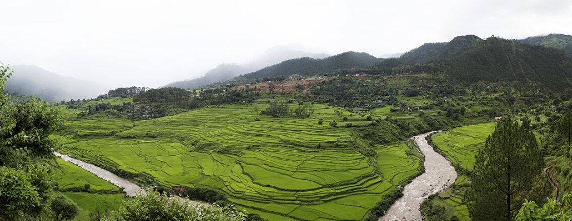
When countries need to make sustainable decisions about how best to use their land, they need highly detailed and current information—but accurately measuring how much of a country is forested or not (including land used for farming or undergoing urban expansion) can be incredibly difficult. More and more countries like Nepal are using satellite technology to address this challenge and create their own land monitoring systems.
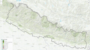
Nepal’s National Land Cover Monitoring System (NLCMS) represents a pivotal achievement and is poised to significantly enhance the country’s climate data and efforts to cut emissions and adapt to climate change. This system holds immense importance for assessing and overseeing the ever-changing landscape, which is crucial for the sustainable stewardship of Nepal’s natural resources.
Since 2018, SERVIR HKH has been continuously collaborating with Nepal’s Forest Research and Training Centre (FRTC), the nationally mandated agency for forest cover data, to develop an operational NLCMS for Nepal.
The NLCMS uses publicly available satellite imagery like Landsat combined with robust methodologies to regularly generate annual land cover data for the entire country. Data from the land cover map, which includes the forest cover extent, is used to generate estimations of land-based greenhouse gas emissions from forest loss.
Why land data matters to Nepal
FRTC uses the land cover maps for national and international reporting on forest cover change and preparing a long-term strategy for achieving Nepal’s Nationally Determined Contribution (NDC) targets for addressing climate change. It also serves as a foundational dataset to advance evidence-based planning and policy development.
The NLCMS addresses the challenges of long-term data gaps by providing consistent geospatial data crucial for various sectors such as forestry, climate action, and research. NLCMS data played a pivotal role in setting climate targets for Nepal’s commitments to the Paris Agreement and is being extensively used in forest degradation mapping, climate change action, and academic research.
Bimal Kumar Acharya, Senior Remote Sensing Officer from FRTC states, “The NLCMS results are useful in the planning and policy-making processes of Nepal’s federal, provincial, and local governments. It is also useful for reporting on Nepal’s national and international obligations.”
NLCMS land cover data has become the national data to help the government and members of civil society to understand the geographic distribution of different land cover types present in Nepal. The Government of Nepal, through FRTC, has adopted this system, establishing it as a credible and authentic data source for official use. The National Statistics Office uses the data and map for generating land cover statistics for international reporting, such as for the Second NDC, which was developed based on this data.
Collaboration for success and sustainability
Continuous capacity strengthening with relevant stakeholders in Nepal has been critical to the success and final endorsement and implementation of the NLCMS. The partners in Nepal have invested time and personal resources to efficiently contribute and co-develop the system and advance a sustainable pathway for the NLCMS to be an essential platform for years to come.
Computing resources and expertise from SERVIR’s Applied Sciences Team member Peter Potapov from the University of Maryland significantly enhanced the value of the land cover map through the incorporation of Tree Canopy Cover, Tree Canopy Height, and various other data layers. These additional datasets have played a pivotal role in improving the overall accuracy and precision of the data included in the NLCMS.
“Our approach to co-developing the NLCMS product by partnering with the National Agency (FRTC) and Applied Science Team (University of Maryland) brought cutting-edge technologies and built the capacity and confidence of national stakeholders on the use of the new mapping method and the land cover data. The web-based, easy-to-use interface of the product is built utilizing a cloud processing platform and openly available time series satellite images, making the product efficient and replicable relatively easily at significantly low costs for any country annually anywhere in the world, ensuring the sustainability for the longer term.” – Rajesh Bahadur Thapa, Science and Data Lead, SERVIR-HKH

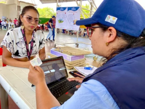
 With USAID support, Colombia’s National Land Agency delivered 83 land titles to families who have voluntarily substituted illicit crops in the municipality of Cáceres, Antioquia. The property titles correspond to over 1,200 hectares of rural land in the heart of Bajo Cauca, a zone affected by years of violence and narcotrafficking.
 Secure land tenure
 As part of the Rural Property and Land Administration Plan (POSPR) being implemented in Chaparral, USAID Land for Prosperity (LFP) partnered with Colombia’s Land Restitution Unit to host a series of workshops to empower rural women about their property rights, land ownership, the care economy, and gender-based violence. These workshops, called nucleos de exigibilidad, were piloted first in Ataco during POSPR implementation. During the sessions, 30 female leaders who are participating in land restitution and formalization processes shared their views of their territory and learned about gender-based violence with a focus on patrimonial and economic violence. The women met three times to discuss crucial topics for their personal growth and the one of their communities, as an opportunity to strengthen their leadership and promote gender equality in Southern Tolima.
 The strategy was originally implemented in the municipality of Ataco and was recently extended to Chaparral, with the aim of building the capacity of these women so they can multiply their knowledge with their communities and neighborhoods. The work between the URT and LFP coordinates two important public policies: the one for rural property and land administration, and the one for land restitution.
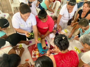 The participants showed an unbreakable commitment in this process, becoming agents of change in their communities. Edna Liliana Castro, resident of the Guanábano Brasilia village, has stood out not just as a farmer but also as an influential leader, playing a valuable role in the implementation of the POSPR as a community volunteer. Community volunteers are vital, as they encourage the communities to participate, and disseminate the POSPR methodology and objectives so that people understand the benefits of titling their land.
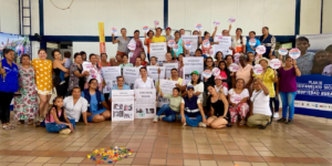 The last session of the workshops coincided with International Women’s Day, and during the event the women held a discussion with public officials from government entities such as the Agency for Rural Development, the Rural Development and the Community Development and Health Municipal Secretaries, and the Municipal Council. The women were grateful for the opportunity to advocate and take action in favor of their rights, both in rural and urban environments.
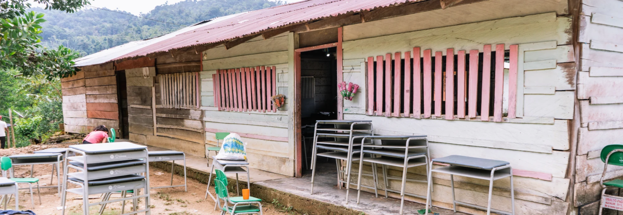
 “
“
 Despite the success, convincing the private sector to invest in rural land formalization remains a monumental challenge. Land for Prosperity examined the landscape by looking at nearly 2,000 companies in its eight target regions, and then narrowed down the list to 164 potential partners. A total of 77 companies replied to the proposal and engaged in dialogues and presentations on the subject.
 Interview with a same-sex couple who requested a joint title to formalize their property in Chaparral, Tolima.
 What is the story of your parcel and how did you purchase it?
 Mauro: It means a lot to us. In rural areas, homosexuality is sometimes negatively perceived, but our idea is to settle down and to be economically stable in the countryside. We want to access benefits such as loans to continue expanding our productive project and become a business. We want to be role models, show the community that the countryside can be profitable not just through production, but also through transformation. We don’t want to be seen just through discriminatory eyes, we want to show that we are capable of doing things better than a straight couple.
 Mauro: We want to tell them that, regardless of differences, as same sex couples we have the same rights and abilities. We should work together and show the world that homosexuality is not something out of the ordinary. Submitting an application for joint titling is a way to confirm our equality, to give visibility and promote the acceptance of diversity by the wider society, when it comes to land access.
 When Yudy Jiménez divorced her husband three years ago, she did not know the “rules of the game.” The couple, who was married for over 14 years, tried to divide their assets: her ex-husband kept the farm, and she kept the house.
 With the presence of social workers, Yudy felt supported as a single mother and as the owner of her parcel, and despite the pressure of her ex-husband, she completed the application to receive her property title in her name.
 In her role as a community volunteer, Yudy helped to identify conflicts like the one she had with her ex-husband. “I remember when a couple fought because the husband wanted to apply for individual titling. I was there to teach them about the care economy and the women’s rights to joint land titling,” said Yudy.
 “I am proof that women can also play this role. I have spread the message to the entire community, visited every farm, and ensured that everyone, including women, can participate and benefit from land formalization.” – Adela Méndez, Potrerito de Aguayo
 This year at the Cacao of Excellence Awards, Colombian cacao beans garnered the world’s attention. Competing with more than 220 cacao samples from over 50 countries, Workakao, a farmer-owned cooperative based in Meta, was awarded a gold medal and shared the big stage with 18 of the world’s top cacao producers.
 Workakao’s winning sample was the result of hard work to improve quality, yields, and processing through a Public-Private Partnership (PPP) that was facilitated by USAID in 2021. Motivated by the stakeholders of the PPP, Workakao has encouraged its 900+ cacao farming families to sell their “wet” cocoa beans to its collection center, enabling the cooperative to standardize post-harvest processing and achieve a consistently higher-quality bean after fermentation.
 In the wake of the historic moment, USAID’s Land for Prosperity Activity wanted to take advantage of the momentum. Farmers under additional USAID-facilitated PPPs in the cacao value chain traveled around the country for multi-day experience-sharing workshops to learn more about how Workakao and Meta-based producers are improving cacao processing and marketing as well as how to improve the integration of youth and women into the value chain.
 “We were immensely happy because the gold medal represents the work of our entire cacao community. It also has injected us with strength and hard work, because the real commitment starts now. We need to be able to sustain the quality of our cacao and give our products an added value, so the benefits reach our communities well into the future.”
 “We have learned so much on this journey. We have learned that we need to prioritize quality in order to reach buyers willing to pay a better price. Workakao is an example for all of us to continue working towards that quality,” explained Arcelia Prieto, a cacao farmer in Norte de Santander and member of Asoprocanor (Association of Cacao Producers from Norte de Santander and Catatumbo).
 The women-led strategy also takes into account other aspects of their lives and business such as who will replace them and take over their cacao plantations. The long history of illicit economies in the region and the border with Venezuela have made it difficult to keep children safe and insulated from risky behavior and illegal activities. To confront this harsh reality, the women have incorporated their children into the cacao plantations to teach them essential farming techniques and how the bean is processed.
 “If you ask me, chocolate meets all your nutritional needs. It will make you strong and improve your memory. Look at me, this is life, and I am happy,” Betsabeth said.
 It is believed that cacao first grew in the Amazon basin and then spread north and south throughout the Americas, including to the Aztec and the Mayan civilizations, who developed successful processing techniques. For them, the plant was a symbol of wealth, and its beans were used as currency.
 Over the last four years, Land for Prosperity has facilitated the creation of seven PPPs related to the cacao value chain that include over 33,600 farmers, 41% of which are women. In many parts of Colombia, such as Tumaco’s Pacific coast and the mountains of Northern Cauca, women represent half of the workforce.

 With the recent implementation of the Rural Property and Land Administration Plan (POSPR) in Chaparral, the Ivanazka Lemanyá de Calarma community is one of the seven Pijao indigenous groups who are submitting applications to the government to establish reservations. In total, the seven applications encompass 16 parcels covering 1,800 hectares.
 Before working on the applications of the seven reservations, Land for Prosperity carried out Free, Prior, and Informed Consent sessions with 11 communities that represent more than 2,500 people. After giving their consent, each community elected an Ancestral Guide to act as a point of contact for all communication and harmonization between the communities and the team implementing the POSPR, which is backed by Colombia’s National Land Agency (ANT).
 An Opportunity for Indigenous Communities
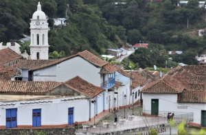 The sleepy municipality of El Carmen was declared a National Heritage Site in 2005, but tourists did not start streaming in until 2016 when the government signed a Peace Accord with the FARC rebel group. Isolated in the lush mountains of Norte de Santander, the long-lasting conflict paradoxically served as a cushion to conserve its cobblestone streets and colonial houses, making it one of the country’s most authentic pueblos mágicos.
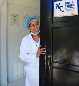 For years, the residents of Guamalito and El Carmen had to travel two hours south to Ocaña to receive professional health care services. Last year, outgoing mayor, Wilfredo Gelvez, purchased a parcel neighboring the current health clinic in Guamalito as the hospital’s new home. But without the Municipal Land Office, administering the new piece of land would not have been so straightforward. In this case, the Municipal Land Office played a key role in managing the two parcels and transferring the land in the name of State-run Regional Noroccidental Abrego, which provides health services in El Carmen.
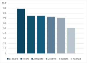
 These stories are indicative of how land tenure issues lie below many investments in essential public services and infrastructure in Colombia’s rural municipalities. In Santander de Quilichao, the largest municipality in Northern Cauca, a region known for land conflicts and violence, land informality rates hover above 50 percent. More than half of all parcels do not have registered land titles.
 Recently, Santander de Quilichao’s Land Office and its 5 employees focused efforts on lifting a $3.5 million USD housing project off the ground. The Villa María housing complex, which is already connected to public services, is expected to provide a secure home for over 400 vulnerable families while providing a park and sports field for families. Santander de Quilichao’s Land Office already delivered the first 100 land titles to Villa María residents and expects to deliver the other 300 property titles in coming months.
 “At an individual level, I am more confident and certain about the things I want to do with the women’s mentorship project I implement. The training helped me believe in myself and realize that I have the skills to work on women’s empowerment and I can and am learning more every day!”
  “The Women’s Leadership and Empowerment training deepened my understanding of factors that keep women out of natural resource management and how to address these challenges and increase impacts of our programs. I am now able to adapt my work and reach out to the vulnerable groups, which is allowing our program to have a broader reach.”
 “Through the training, I gained insights into the specific risks and challenges that women face in relation to land ownership and access. This knowledge enabled the National Land Titling Program to design and implement targeted strategies to mitigate these risks,
  “Before I came on the training, my challenge was how to deal with negative social norms. We saw men in uniform abuse power, which in some cases negatively affected our work, but it was difficult to find the entry points. The training was timely. It gave me the skills to engage law enforcement officers and navigate the social norms to bring in more women in our work.”