There is a quiet assumption embedded in almost every climate intervention that touches farmland. It runs through NbS project designs, food systems traceability platforms, RE siting frameworks, and carbon market methodology documents alike. The assumption is this: that the person named in land document, mostly referred as land record, is the person whose decision or behaviour determines what happens on that land.
This assumption is almost always wrong. And the consequences of that wrongness — for climate outcomes, for community equity, and for the long-term integrity of the interventions themselves — are more serious than most practitioners have reckoned with.
Land Is Not What the Title Says It Is
“Land is not simply a resource or a commodity. It is a social, legal, ecological, cultural, and political question.”
This is not philosophical throat-clearing. It is the most practical thing a climate practitioner must hear. Every intervention that treats land as a commodity, a carbon sink, a supply chain input, or a renewable energy site is making a category error from the outset if it ignores the social, legal, ecological, and political web of relations that actually governs what that land does, and who it does it for.
The formal land record, the Record of Rights, the cadastral map, the land parcel boundary in a GIS system — captures some details about a named individual, parcel and the state, more with a transactional objective. It tells, who can sell the land, mortgage it, and receive compensation if it is acquired. What it does not tell, and what it was never designed to tell you, is who actually farms it, who grazes it between crops, who depends on it for their livelihoods or culture, who protects the watershed or forest that feeds it water, nutrition and pollination, and who will bear the consequences when a climate shock, a carbon project, or a solar farm arrives.
The Five Invisible Stakeholders on Every Farm
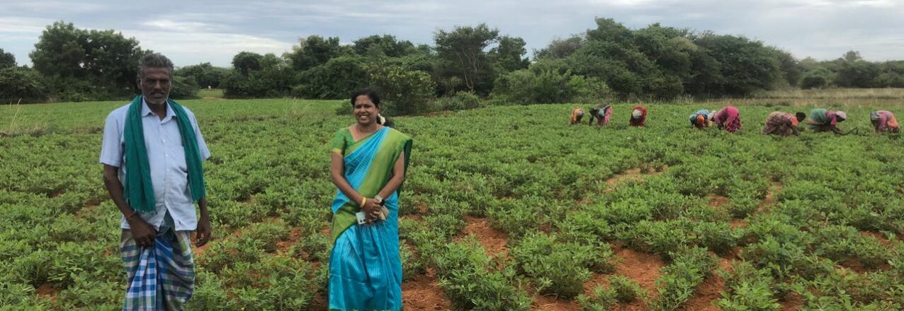
In any piece of agricultural land in South Asia — a rainfed plot in the Gangetic plain, a terraced field in the hills of Nepal, a smallholder farm on the edge of a forest in Bangladesh. The land record or document may show a single owner. The reality on the ground is almost always a layered, overlapping web of at least five distinct groups of people with real, substantive relationships to that land — none of whom may appear in the record.
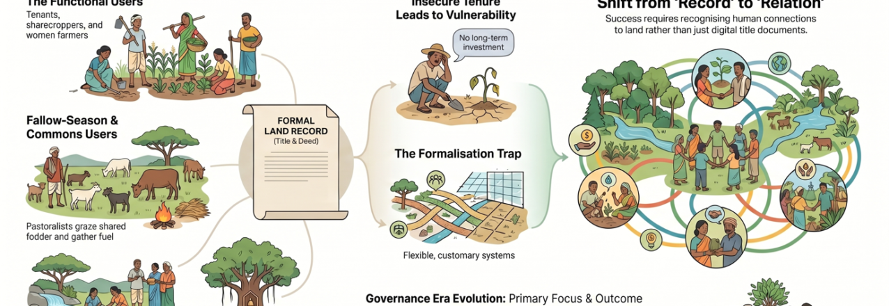
- The tenant, the sharecropper, the woman farmer, the agricultural labourer: These are people who till the soil, contribute to decisions about what to plant, manage soil health, and extract the harvest. They exercise genuine, functional tenure – access, use, manage and extract the land. Their care, persistence, adaptability and what we might recognise as local ecological knowledge, are precisely the kind of engagements, that climate resilience depends on. Yet they are invisible in the public farm service program who transfers subsid/grant to bank account of recorded land owner, to the carbon project developer who consults the land record, invisible to the food company conducting supplier due diligence, and invisible to the RE developer seeking consent from the “landowner.”
- The fallow-season users : When the crop is harvested and the land lies fallow, it does not stand empty. Landless and herders bring their animals to graze. Village youth use it as a playground. Families gather fodder and fuel. Women collect seasonal produce. The land is, in this period, a commons — accessed, managed, and depended upon by people whose names never appear in any title document, but whose livelihoods are directly at stake when a solar park fence goes up or a carbon project recommends change in land use.
- The upstream contributors : Perhaps the most conceptually challenging group: people who do not use or access or directly derive any benefit the agricultural land at all, but whose actions on other land directly conditions on it, making it usable as a farm land. The community that protects the commons- the wetlands, pasture land in the village landscape mosaic or care the forests on the ridge above, supports the moisture regime, the pollination, the nutrient flow, and the microclimate of the farmland below. They are, in the most meaningful ecological sense, the ignored tenure holders of that farmland’s productivity — but neither tenure law nor project design has any category for them. NbS interventions that reward the forest community and the farmer separately, without recognising this connection and relationship, risk breaking the very ecological chain they are supposed to protect.
- The power-holders: On many landscapes, the person who actually determines what happens on the land is neither the titled owner nor any of the productive users above. It is a local power-broker: a village leader, a trader, a money-lender, a political figure who controls access, dictates terms, often decide the crop choice and takes a share of the surplus. Any traceability system, carbon registry, or value chain initiative that conducts due diligence with the formal landowner while ignoring these power relations is conducting due diligence on a fiction.
- The emotionally and ecologically connected: The final category is the most easily dismissed and perhaps the most consequential for the long term: communities whose connection to a piece of land is mediated not through use or ownership but through a sacred tree, a migratory species, a water source, an ancestral memory. These communities may have no legal claim and no day-to-day management role, yet their connection is threatened, when the tree is felled for a solar project, when the grassland that supports their sacred species is converted to a carbon plantation. Then they become active and powerful actors in shaping what that land does and does not permit. Ignoring them in project design does not make them disappear; it makes them opponents.
Is Formalisation a Trap for NbS and Carbon Markets?
Here is where the argument becomes most urgent for practitioners in NbS, carbon markets, and RE transitions specifically.
The default response to tenure complexity in climate project design is formalisation: map the land, title the owner, document the rights, create the contract. This feels like due diligence. It feels like inclusion. It is frequently neither. Rather on ground, it would lead to exclusion, injustice; often triggering conflict and adding risk to very resilience and permanence that such climate investments look at.
What this Means for Climate and Food Intervention?
For practitioners across the four domains, here are what the implications look like.
For NbS designers and implementers: Your theory of change almost certainly passes through tenure. If your intervention involves changing land use — planting trees, restoring grasslands, creating buffer zones, shifting from annual crops to perennials — you are changing the tenure, the land-people relations, for every one of the five invisible stakeholder groups described above, whether you intend to or not. Tenant or women farmers will lose access to land they depend on or will be required to put more labour, without any matching benefits. Fallow-season users run the risk of being excluded from areas the project now controls. Upstream communities will find their traditional forest management reclassified as a carbon asset belonging to someone else. Designing for tenure complexity is not a safeguard add-on to an NbS project. It is the intervention that any NbS investment must not ignore, if they aim intended result.
For traceability practitioners: Your supplier due diligence and traceability systems are reading land records and mistaking them for ground truth. The smallholder farmer who appears in your system as the “landowner” may be farming on land they share with a tenant, borrowing land from a relative, or managing a plot whose actual productive decisions are controlled by a trader-creditor. Deforestation-free commitments, living income benchmarks, and regenerative agriculture certification all require understanding not just who owns the land on paper, but who works it, who depends on it, and who has the power to change what happens on it. Traceability without tenure intelligence is traceability without integrity, and may not serve the purpose otherwise.
For renewable energy developers and siting teams: The social licence problem that has slowed RE deployment across South Asia is substantially a tenure problem. Projects that consult the titled landowner and bypass the tenant, the fallow-season user, and the power-holder do not have community consent — they have a signed document. The difference becomes apparent when construction begins. More fundamentally, RE siting that converts productive agricultural or agroforestry land — particularly land with high tenure complexity and multiple invisible users — creates climate injustice even as it delivers climate mitigation. The question is not just whether the land is “available.” It is whether the transition is tenure-just?
For carbon market developers and climate finance practitioners: This may be the most urgent message of all. Carbon and climate finance that treats tenure as a compliance checkbox — something to tick before the real work of carbon accounting begins — will fail ecologically and socially. Projects that skip genuine tenure due diligence do not just risk community resistance. They risk undermining the very ecological conditions their carbon claims depend on. A community whose customary tenure arrangements have been disrupted by a REDD+ or NbS project does not continue to manage the forest the way they did before. The carbon is not permanent. It never was, because the governance was never secure. Tenure due diligence is not a legal formality. It is the ecological foundation of carbon integrity.
The Framework That Is Imperative
This 360 degree framing brings a spectrum that is worth taking seriously as a practical planning tool. At one end: relational land systems, where land is identity, stewardship, and collective accountability. At the other: transactional land systems, where land is a commodity, a carbon asset, a market instrument. Most landscapes in South Asia occupy a hybrid, contested middle ground — and the most important insight is that both relational and transactional approaches can reproduce inequality if poorly designed.
The question for practitioners is not which end of the spectrum to push toward, but how to design interventions that genuinely strengthen the relational systems that underpin social justice and ecological resilience while providing the security and recognition that transactional engagement requires.
This is not a both-and compromise. It is a fundamentally different design logic — one that starts by asking, before any project document is written: who actually governs this land, under what conditions and terms, and with what consequences for climate resilience if we intervene?
The evolution of land governance thinking in most countries, can be mapped in four words: from Revenue (colonial-era extraction) to Reform (rights-based redistribution) to Record (digitisation and formalisation) to Relation (the recognition that governance is ultimately about people and their connections to land, not about documents).
Most climate projects are operating at the Record stage and calling it progress. The work ahead is to move to Relation — and to do so with the urgency that the climate timeline demands.
A Closing Provocation
Aldo Leopold wrote that conservation is harmony between people and land. The word he used was (wo)men, a deliberate correction that places the gendered dimensions of land access at the centre of the conservation project.
Harmony, in the context of climate action on farmland, means recognising that the land being intervened on is already full — full of relationships, dependencies, histories, and ecological knowledge that your project design did not create and cannot replace. The question is whether such external intervention will work with those relationships or against them.
Every climate project that lands on farmland without understanding the tenure relations governing it is not just missing an opportunity. It is, in the most specific and measurable sense, a climate risk.
The land record is not lying out of malice. It was never designed to tell what you need to know in the climate contexts. The work of climate-responsive land governance is to build the tools, the protocols, and the institutional will to see what the present record cannot show — and to govern accordingly.
This blog draws on Pranab Ranjan Choudhury’s session on Land Tenure, Land Use and Climate: A Nexus Perspective, delivered at the Summer School on Climate Responsive Land Governance, Dhulikhel, Nepal, April 2026, and on the multi-tenure framework he has been arguing for as a way forward for climate actions.