Ask the Expert: An Interview with Yaw Adarkwah Antwi, Tenure and Global Climate Change – Ghana

Yaw Adarkwah Antwi has more than 20 years of experience in land tenure and administration policies and holds a Ph.D. in Sub-Saharan Africa Urban Land Markets and an M.A. in Property Valuation and Law. Antwi has helped to develop land policies, particularly on the topics of land tenure, land management and agricultural development, in Liberia, Ghana, Nigeria, Sierra Leone and, within the COMESA region, Kenya and Sudan. Antwi is currently the country lead and senior land tenure expert on the Improving Tenure Security to Support Sustainable Cocoa project funded jointly by USAID and Hershey’s.

Tell us about the Tenure and Global Climate Change Project in Ghana.

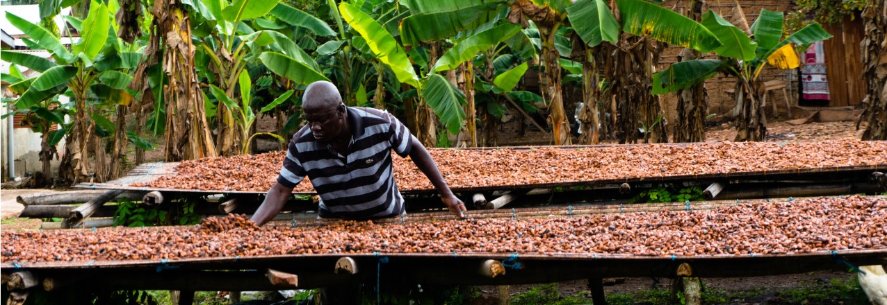
Starting in 2016, Hershey’s and AgroEcom Ghana Ltd (ECOM), a supplier of cocoa to Hershey’s, began collaborating with USAID’s Tenure and Global Climate Change (TGCC) Program to gain a better understanding of how to address the complex challenge of deforestation around smallholder cocoa farming in Ghana. This initial work resulted in an assessment and recommendations for a future pilot, captured in the report Land and Natural Resource Governance and Tenure for Enabling Sustainable Cocoa Cultivation in Ghana. Over the period from February to December 2017, a pilot in Nyame Nnae, a cocoa farming community in the Asankrangwa district of Ghana, was initiated to clarify and document rights to land and trees, and to develop a financial model for cocoa rehabilitation. Through this pilot, we sought to encourage tree planting on existing cocoa farms to reduce pressure on the forest fringe.

Why is this work important?

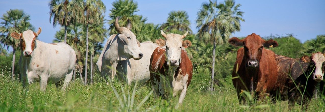
Worldwide, forests are being lost at an alarming rate driven by the expansion of internationally traded commodities. In response, companies have begun to remove deforestation from their supply chains, catalyzing the creation of the Tropical Forest Alliance 2020—a global public-private partnership aimed at reducing commodity induced deforestation. In Ghana, cocoa produced by smallholders has been the leading agricultural product driving deforestation for many years. Cocoa is a critically important commodity because it provides significant economic benefits that include jobs, improved livelihoods and social welfare, expanded tax base, higher family and corporate income and foreign exchange earnings growth. Cocoa production has been on the decline due to land and tree tenure insecurity, an elderly cocoa farming population, over-aged cocoa trees, high costs of cocoa tree removal, high incidence of pest and diseases and poor farm management practices.

In 2016, Ghana’s Cocoa Board announced plans to more than double cocoa output to 1.6 million tons by 2026. Ghana’s Intended Nationally Determined Contribution to the Paris Agreement on Climate Change specifically includes a 45 percent reduction of greenhouse gas emissions from the cocoa landscape. These two objectives require a new approach to sustainable cocoa production that controls forest cutting, builds back secondary growth forests on fallow cocoa lands, and increases cocoa productivity. Expansion of shaded cocoa systems would help Ghana achieve its greenhouse emission and cocoa production targets, improve the livelihood and resiliency of Ghana’s cocoa farmers and increase the sustainability of the global cocoa value chain, thereby benefiting global producers and consumers.

What are key achievements/successes from TGCC’s Ghana work?

We began field implementation of the pilot in April 2017 and concluded in December 2017 and achieved the following outcomes:

  • Mapped the boundaries of the community and individual cocoa farms, and clarified and documented rights between 190 landholders and farmers in Nyame Nnae community including 120 (63 percent) males and 70 (37 percent) females.
  • Working with migrant and indigenous farmers, documented three types of customary land tenure arrangements and negotiated agreements that reinforce the rights of farmers in seeking landowners’ consent to replant cocoa trees.
  • Successfully tested alternative dispute resolution systems of Asankrangwa Stool to reduce conflict and strengthen application of local systems for future documentation efforts.
  • Working with ECOM staff, developed a financial model for cocoa rehabilitation that shows it is possible to pay-back rehabilitation costs in three years while boosting farmer income and food security.
  • Developed and successfully piloted a model of public-private partnership between USAID, Hershey’s, and ECOM that leveraged 1:1 private sector investment with field implementation costs along with other support that included office space, vehicles, planning assistance and provision of extension personnel.
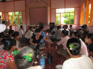
  • Provided training to community, traditional authorities and ECOM extension staff that proved effective and are transferable to future cocoa rehabilitation efforts.
  • Developed and piloted a comprehensive model of land rights documentation, alternative dispute resolution, finance, community and traditional authority engagement and cocoa rehabilitation for purposes of further refinement, replication and scaling up.
  • Assisted ECOM to successfully include tenure as a variable in their supply management and monitoring system.

What were the key lessons learned by TGCC, particularly those that can be applied to other activities?

  • The project successfully demonstrated that a public-private partnership linking tenure documentation, alternative dispute resolution, community engagement and financial modelling with cocoa rehabilitation was feasible. Upon completion, farmers were happy that the process protected rights of both indigenous landholders and migrant farmers including men, women, and youth. Traditional authorities from Asankrangwa district appealed for expanded participation of farmers to create peace in the community and for partners to replicate and scale up cocoa rehabilitation efforts. They further offered their leadership to advocate and support future projects with traditional authorities in other areas.
  • The process of building tree tenure security, which takes into account deforestation, cocoa productivity, environmental quality and farmer livelihoods, can take many years. Trees and cocoa systems need maturation before many of the pilot outcomes can be realized. An evolving policy and high costs of tree tenure documentation were seen as unsustainable, requiring more strategies to lower costs and address perverse incentives that lead to loss of tree cover.
  • The project studied how public goods and services (seedling supply, extension services, land administration and dispute resolution) can be covered given cocoa value chain constraints and tight government budgets, particularly as these costs are beyond private sector expertise and support. The project noted the necessity for dialogue and cooperation between the private and public sectors to develop strategies for lowering costs and designing innovations that promote sustainable cocoa cultivation. This cooperation can help improve the livelihoods of Ghana’s cocoa farmers, improve the profitability of the chocolate industry, provide consumers worldwide with high quality chocolate sourced from Ghana and use forest resources sustainably.

Where can I find more information on the project?

More information can be found on this TGCC project in Ghana here:

Ask the Expert: An Interview with Ryan Sarsfield, Global Forest Watch

Ryan Sarsfield is the Latin America commodities manager with World Resources Institute’s Global Forest Watch (GFW) team. He works to reduce the environmental impact of key commodities in Latin America through collaboration with corporate and NGO partners and the development of tools to reduce deforestation and supply chain risk.

Tell us about the development of the “Tierras Indígenas” indigenous lands platform in Paraguay under the Tenure and Global Climate Change program:

This activity under USAID’s Tenure and Global Climate Change (TGCC) program developed an interactive platform that provides maps and critical information about lands and territories of indigenous peoples and communities in Paraguay. The activity focused on the intersection of land tenure, deforestation and the private sector, which is a tricky place to work given the complexity of these issues and how they interact. In Paraguay (like so many places in the world), commercial agriculture is expanding into previously intact ecosystems – Paraguay’s Chaco forest, in this case – and this expansion is both an economic boon to some, and a cause of environmental degradation and land dispossession to others. In particular, the expansion has created land conflicts with the indigenous people of the Chaco, who have seen much of the region’s forest turned to cattle ranches over the last 15 years. As the country’s agricultural exports grow, so will the demand for agricultural production that is socially just and environmentally sustainable. This poses an interesting question: How would a well-meaning company in the beef sector go about reducing their exposure to these risks, and indeed reduce negative impacts of their investment on the ground?

Through our work, it became clear that one of the essential “raw materials” for responsible investment was data, specifically map data about indigenous lands in Paraguay, along with the varied levels of legal status or recognition that these lands exhibit. My day-to-day engagement with companies usually focuses on forest and deforestation data, which comes from satellites and is delivered via World Resources Institute’s Global Forest Watch platform. But it was clear that a locally managed platform would be best suited fill the gap on indigenous data. Under the Tenure and Global Climate Change program, we forged an excellent partnership with the Federation for the Self-Determination of Indigenous Peoples (FAPI) in Paraguay, and they led the development process of a mapping platform built on Global Forest Watch’s technology called Map Builder, which they continue to manage now that the project has wrapped up.

Why is this work important?

FAPI and its members already had a great deal of digital map data, and in fact, so did the government, but these data simply weren’t freely available. The general trend towards precise digital land mapping has been a great advance, but the creation of the maps is only one part of the process. How can data be distributed publicly and transparently, and how can potential users access the data, analyze it and best use it to positively influence the conditions on the ground?

As FAPI developed the project with its members and other partners, including 12 indigenous groups, it became clear that they saw the project as a medium to express their perspective on their own lands, and a means to reach audiences in Paraguay and abroad. At the same time, companies and financiers connected to the beef industry expressed their interest in having better indigenous data to work with as they carried out due diligence on their investments. Large-scale commercial agriculture and indigenous peoples are hardly allies in Paraguay, but in this case, the shared goal of obtaining better data was a helpful alignment.

What are key achievements/successes from this Tenure and Global Climate Change activity?

  • The Tenure and Global Climate Change team’s local partners launched the platform in late November 2017, called Tierras Indígenas Paraguay, which is now live online. More than 120 people attended the launch of what is the first publicly accessible online map of Paraguay’s indigenous lands, and the data was also featured on the global indigenous and traditional lands platform LandMark, filling a gap in Paraguay’s data.
  • Behind the platform itself, though, is the collaborative effort and data management that made it possible. FAPI and its collaborators have already taken steps to continue the development process, and this ongoing management is what will make Tierras Indígenas Paraguay an enduring asset and useful tool. As more data is collected, the status of individual lands change, and the pressures on their communities evolve, the platform has the potential to maintain and even increase its usefulness.

What were the key lessons from this TGCC activity? 

  • As the project sought to apply geographic and information systems (GIS) and technical assets (Global Forest Watch’s Map Builder) to a politically sensitive and enduring challenge at the local scale (the lack of publicly available indigenous data), working with the right local partner was far and away the key to bridging this gap and successfully carrying out the project goals. FAPI was ideal in serving as a trusted convener for their indigenous member organizations (magnifying the reach of the project). They were savvy and connected regarding national politics around indigenous land issues and skilled in managing partner meetings and media outreach.
  • Projects that increase data transparency and availability may be successful on their own terms, but will only be effective means to an end if users are aware of the data, accept the value of the work and make use of it. Outreach across many avenues was, and continues to be, critical to a successful and ongoing use of the platform. The platform was launched in a well-attended event that included indigenous groups, the private sector (meatpacking companies, banks, etc.), Paraguayan ministries and a range of domestic and international civil society organizations and received extensive press coverage in Paraguay and abroad.

Where can I find more information on the project?

More information on USAID’s TGCC activity in Paraguay can be found on Land-Links.org here

Ask the Expert: An Interview with Emiko Guthe, Tenure and Global Climate Change – Burma

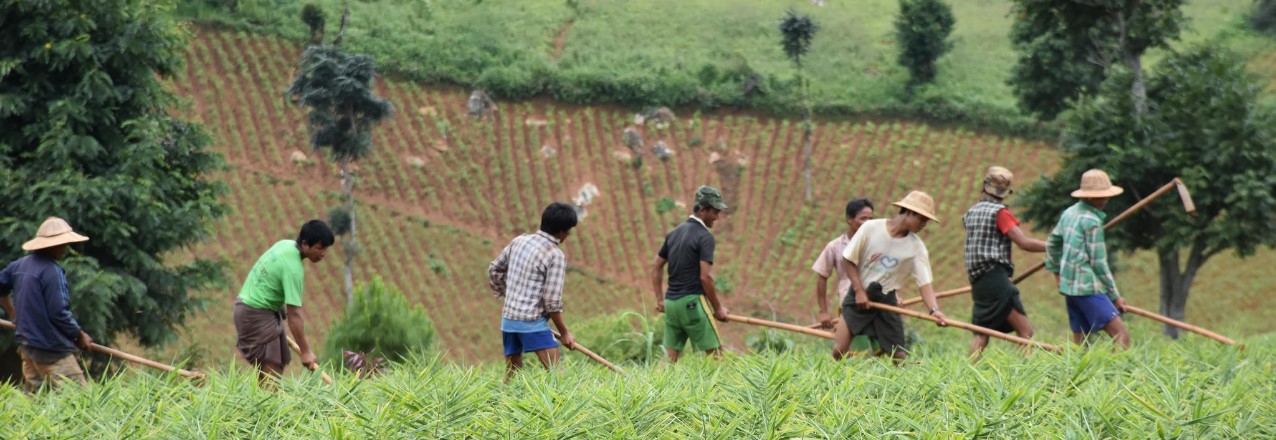
As Burma Country Coordinator, Emiko Guthe managed Tenure and Global Climate Change (TGCC) project Burma pilot activities by helping to coordinate participatory mapping efforts, which documented community land resources in eight locations. A GIS specialist by training, Guthe brought her experience supporting mapping efforts to many international development projects in Burma.

Tell us about a little about Burma and USAID’s land tenure work there.

Burma is currently experiencing very rapid economic transformation, which poses both risks for the environment, as well as economic opportunities for the country’s diverse population. Land and natural resources are at the center of change, but the legal framework that governs land administration in Burma is complex, confusing and politically sensitive. Unclear laws and policies translate on the ground to a lack of clarity in roles and responsibility for land governance. Land administration is non-transparent and has not historically incorporated the perspectives of local communities.

USAID’s Tenure and Global Climate Change project in Burma, called the Land Tenure Project (LTP), began in 2014 to initiate steps toward a more sustainable land management system in support of equitable economic development. Underpinning all activities are principles of inclusive, public participation to encourage transparent and evidence-based dialogue amongst government, rural communities and civil society. Working on legal change as well as with rural communities, USAID tested and modeled participatory processes with many stakeholders in country.

Why is this work important?

In a nascent democracy, USAID demonstrated the value of including diverse perspectives for policy development and land related decision making processes. By encouraging dialogue amongst interested parties, stakeholders gain the skills and experience to develop sound laws and policies, negotiate conflicts around land and understand their rights. By training local organizations to address land-related challenges, they gain key capabilities to help communities on a path toward economic prosperity.

What are key achievements/successes?

USAID’s TGCC Burma program supported development of Burma’s new National Land Use Policy, which utilized an unprecedented process of public consultation to adopt international good practices. Endorsed by the government in 2016, the policy lays the groundwork for more sustainable land management and promotes people centered development around participatory decision making.

The project also tested the National Land Use Policy in practice at eight pilot sites in four states and regions of Burma. These pilots tested participatory mapping approaches that document community land resources. Local partner teams produced village resource boundary and land use maps for 59 villages and established 52 community representative committees.

To ensure that the new and current legislation was known both to government and constituents, we held legal awareness training seminars at different sites. Overall, we met with over 600 local government authorities in 15 village tracts and helped to improve their understanding of roles and responsibilities under the current legal framework for land.

What were the key learnings?

  • Complex and confusing laws and policies govern land in Burma and this translates to government roles and responsibilities that are not clear for communities. There is a strong need to harmonize and streamline the land legal framework.
  • Communities, especially rural villages, lack access to accurate, up-to-date information about their land rights. Traditionally, communities have had very little interaction with local authorities and do not look to government as service providers. Civil society groups often fill this void, but non-transparent land administration systems make access to information and data difficult. Communities need awareness raising and guidance on how to navigate a complicated land governance system.
  • Mapping initiatives in Burma are historically opaque, mandated from top levels of government, and rarely, if ever, take into account community knowledge or perspectives. The government needs support to integrate participatory approaches into mapping and resource documentation initiatives.

Where can I find more information?

To learn more about TGCC work in Burma click on the resources:

What else should people know about this work?

Burma is at a very early stage in developing sustainable land management systems and there is huge demand for this work!

What’s New on LandLinks – 23 February 2018

In lieu of our weekly scan of recent land tenure and resource management media items, we are highlighting the latest content on LandLinks at the end of each month. In case you missed it, here is a roundup of the new content on LandLinks, from USAID land-related project documents to blogs by our land experts, and more:

USAID LandLinks Blogs & Events

  1. Gaining Ground in 2017 (1/30/18)
  2. USAID Land Champion: Zemen Haddis, PhD (2/6/18)
  3. Webinar: Mangrove Forest Restoration and Management: Social & Governance Dimensions (2/15/18)
  4. Land Tenure and Property Rights MOOC 3.0 (1/8-4/15/18)

Colombia: Land and Rural Development Project (LRDP)

  1. Historical Land Decree for Women (2/7/18)
  2. Cassava and the Next Generation (2/23/18)

Land-Potential Knowledge System (LandPKS)

  1. LandCover: A Mobile Tool for Vegetation Monitoring (2/21/18)

Tajikistan: Land Market Development Activity (LMDA) Project

  1. LMDA Success Story: Simplified Registration Offices for Immovable Property Rolled Out in Nine Districts of Khatlon Region (1/30/18)

Ukraine: Agriculture and Rural Development Support (ARDS) Project

  1. ARDS Success Story: Land of Plenty: Helping Communities Realize the Benefits of Rural Land (2/21/18)
  2. ARDS Video: Land Management in Consolidated Territorial Community of Kipti (2/21/18)

Cassava and the Next Generation

A partnership in cassava attempts to strengthen production and address the generational labor gap.

Mario Enamorado noticed a positive change in the appearance of the cassava from his last harvest. The change, he surmised, came after participating in a Farmer Field School, where he learned methods of organic preparations and green fertilizers and pesticides. He admits it has not been easy to make changes. He is 68 years old, and for the past 50 years, he has been using agrochemicals to combat pests, because that is what his father did.

These farmer field schools represent one of the strategies of a Public-Private Partnership in the cassava value chain—signed in March 2017—with the support of USAID to increase opportunities for some 140 farmers in Montes de María. The partnership targets cassava for industrial use, and is developing rural capacities in production and processing, in coordination with private sector allies, Almidones de Sucre and the cassava growers’ federation, Colfeyuca. In addition, the partnership has a wide range of support from the public sector, including Sucre departmental government, Sincelejo Chamber of Commerce, and national training organizations like SENA and Corporica (the National Institute for Agricultural Research).


ARDS Video: Land Management in Consolidated Territorial Community of Kipti

The Agriculture and Rural Development Support (ARDS) project supports broad-based, resilient economic growth through a more inclusive, competitive and better governed agriculture sector that provides attractive livelihoods to rural Ukrainians. The project consists of three components:

  • Improve enabling environment and governance of the agricultural sector;
  • Increase investment, productivity, employment, and incomes in the agricultural sector; and
  • Improve welfare of rural communities and marginalized producers.

A result of the Ukrainian Government decentralization program is the establishment of 665 Consolidated Territorial Communities (CTCs), new rural units comprised of small communities, with decision-making powers and budgets transferred from central state authorities.

Land resources are the main source for rural economic development and CTC budget revenues, but 95 percent of CTCs described limited abilities to manage land.

Understanding that effectively managing land is both a challenge and growth opportunity for CTCs nationwide, ARDS designed and supported a pilot project to establish a CTC-level electronic land management system combined with the creation of local economic development strategies. The pilot in the Kipti CTC, a typically-sized CTC comprised of 12 villages, 5,500 people, and 29,5000 hectares, had three goals: obtaining and archiving data on quality and quantity of land resources; creating a plan for efficient land use that addresses CTC needs and is compliant with environmental legislation; and increasing land use efficiency, enabling CTCs to manage community-owned land.

Learn more about USAID’s Agriculture and Rural Development Support project in the Ukraine.

LandCover: A Mobile Tool for Vegetation Monitoring

The Land Potential-Knowledge System (LandPKS; landpotential.org), a joint USAID-USDA program, is creating mobile applications that help land managers collect, store, and analyze data in order to inform decision making, agricultural production, and vegetation monitoring and restoration. It does this through the use of the LandPKS Mobile app, which is free to download and use for both Android and iPhone. The LandPKS app currently has two modules: LandInfo and LandCover.

The major goal of the LandCover module is to assist users with collecting vegetation cover data using a point-intercept method. LandCover is designed to be a simple, user-friendly substitute for traditional paper monitoring sheets for vegetation cover. The only equipment needed is a meter/yard stick and the LandPKS app installed on a smartphone. First, the user designates a center point of the plot. Next, the user walks 5 meters/yards in one direction from the center, drops the stick, and enters which vegetation types directly touch the stick at 5 points along the stick, measures plant height, and establishes if there are canopy or basal gaps. This is then repeated at 10, 15, 20, and 25 meters/yards along that given transect. Lastly, this process is repeated in the 3 remaining transect. Overall, this method yields 100 points of vegetation cover data per plot in about 20 minutes.

Screenshot of the LandCover data entry screen and the different types of cover that are collecting with the LandCover module.

Importantly, results are calculated immediately on the phone about cover type, plant cover, canopy height, and gaps. In addition to receiving results on the phone, users can also access their data on our open-source data portal at portal.landpotential.org. Further, a user can enter vegetation cover data for the same plot at various intervals and immediately get results about trends in vegetation cover. LandCover can be used globally, and the module is currently being used extensively in the rangelands of Namibia and Kenya.

There are several important advantages of using the LandCover module for measuring vegetation cover. First, it gets rid of paper forms that can be lost or damaged. Second, results are delivered immediately to a user without the need for extensive data analysis. This benefit was mentioned by rangeland managers in Samburu County, Kenya, who told the LandPKS team that now they can see results directly on the phone themselves, instead of waiting months to maybe get results back from their headquarter offices. This makes it easier and more efficient for real-time vegetation monitoring and decision making. Third, the LandCover module makes vegetation restoration efforts easy to monitor. This has important implications for both maintaining wildlife habitat and encouraging the growth of fodder species for livestock. Lastly, the LandCover results help natural resource managers make more sustainable decisions about their land, which can lead to greater productivity and less environmental degradation. Download the LandPKS app to try out the LandCover module today! For more information about LandPKS please visit our website at landpotential.org or e-mail us at contact@landpotential.org.

Land Matters Media Scan – 16 February 2018

Here are the recent land tenure and resource management media items:

USAID

  1. USAID Land Champion: Zemen Haddis, PhD (2/6/18)
    Source: USAID LandLinks
  2. Historical Land Decree for Women (2/7/18)
    Source: USAID Colombia LRDP

Upcoming Events

  1. Land Tenure and Property Rights MOOC 3.0 (1/8-4/15/18)
    Source: USAID LandLinks
  2. Helping Smallholders Make the Most of Maize Through Loans and Storage Technology: Evidence from Tanzania (2/22/18)
    Source: Agrilinks

Reports and Publications

  1. Housing, land and property rights and peace agreements: Guidance for the Myanmar peace process (2/7/18)
    Source: Relief Web
    Related report: Housing, land and property rights and peace agreements: Guidance for the Myanmar peace process
  2. Hindering instead of helping in Uganda (2/8/18)
    Source: CIFOR
  3. Compensation for Expropriated Community Farmland in Nigeria: An In-Depth Analysis of the Laws and Practices Related to Land Expropriation for the Lekki Free Trade Zone in Lagos (2/11/18)
    Source: Land Portal Foundation
    Related report: Compensation for Expropriated Community Farmland in Nigeria: An In-Depth Analysis of the Laws and Practices Related to Land Expropriation for the Lekki Free Trade Zone in Lagos

Global

  1. Land Rights: A Crucial Strategy for Combatting Climate Change (1/29/18)
    Source: Land Portal Foundation
  2. PepsiCo is moving from policy to practice (2/6/18)
    Source: Oxfam
  3. Lincoln Institute of Land Policy launches global campaign to promote land value capture (2/7/18)
    Source: PR Newswire
  4. Killings and threats against land rights defenders soar in 2017: rights group (2/6/18)
    Source: Thompson Reuters Foundation

Indigenous Peoples

  1. Brazilian Supreme Court ruling protects Quilombola land rights for now (2/13/18)
    Source: Mongabay
  2. Brazil: Land fight simmers over Brasilia’s Shrine of Shamans (2/6/18)
    Source: Thompson Reuters Foundation
  3. Indonesia: No Better Time for Indonesia’s Indigenous Communities to Reclaim Land Rights (2/8/18)
    Source: World Resources Institute
  4. Nigeria’s ‘cattle colony’ problem (2/8/18)
    Source: Al Jazeera
  5. The Philippines: Palace defends investors’ entry into Lumad land (2/4/18)
    Source: Inquirer.net

Africa

  1. Agriculture feeding Africa’s economic transformation (2/5/18)
    Source: The Guardian
  2. Kenya: State to seize 77,000 acres of unclaimed land (2/13/18)
    Source: Standard Digital
  3. Kenya: So much land, yet so many people hungry (2/3/18)
    Source: The Star
  4. South Africa: Addressing shortcomings of land tenure reform in customary land rights (2/15/18)
    Source: EE Publishers

Americas

  1. Scorched earth: Colombia’s ‘refugee farmers’ returning to land (2/9/18)
    Source: Mongabay

Asia

  1. Afghanistan: Govt Defines First Ever Five-Year Land Rights Policy (2/15/18)
    Source: TOLO News
  2. Cambodia killings show rising risk to Southeast Asian land defenders (2/6/18)
    Source: Thompson Reuters Foundation
  3. Cambodian Court Upholds Conviction of Prominent Land Rights Activist (2/7/18)
    Source: U.S. News & World Report
  4. China’s ‘No. 1 Document’ to continue land reforms as part of revitalization strategy (2/4/18)
    Source: Global Times
  5. India: Here is why states must legalise land leasing (2/7/18)
    Source: Financial Express
  6. India: Why the Budget may not benefit the female kisan (2/12/18)
    Source: Times of India
  7. India aims to deliver groundbreaking agricultural blockchain (2/14/18)
    Source: Finder
  8. Nepal: How an all-women farm in Nepal is giving hope to mothers and children (2/2/18)
    Source: Pacific Standard

Pacific

  1. Papua New Guinea: UN human rights chief laments PNG land grab problem (2/12/18)
    Source: RNZ

Webinar: Mangrove Forest Restoration and Management: Social & Governance Dimensions

On February 15, 2018, USAID LandLinks and a panel of experts hosted an interactive online discussion on Mangrove Forest Restoration and Management: Social and Governance Dimensions, starting at 9:00 am EST.

Mangrove activities have primarily focused around the biophysical and ecological dimensions of mangrove planting and protection; while the social dimensions of mangrove restoration, including governance and tenure arrangements, have largely been left on the margins. This webinar will open the conversation about the preconditions that are necessary to successful mangrove management, and provide a learning space that encourages broad participation and discussion between USAID missions, implementing partners and the global community of mangrove experts.

The panel of mangrove experts in the field included:

  • Global Study of Mangrove Governance: Dr. Esther Mwangi from the Center for International Forestry Research (CIFOR);
  • Vietnam Coastal Spatial Planning and Mangrove Management Experiences: Dr. Nayna Jhaveri from USAID-funded Tenure and Global Climate Change project;
  • Ghana Coastal Sustainable Landscapes Experiences: Dr. Steve Dennison from United States Forest Service (USFS); and
  • Mozambique USAID-funded Coastal City Adaptation Project (CCAP) Experiences: Dr. Salomao Bandeira, Maria Olanda Bata and Casimiro Antonio.

Historical Land Decree for Women

Colombian municipality becomes the first to guarantee land ownership rights of women by decree.

THE STRUGGLE 

For more than 200 years, women around the world have been fighting for their rights. In Colombia, women gained citizenship only in 1954, and three years later, a woman voted in an election for the first time. Ever since, Colombian society is sharpening its awareness that women have economic, social, and cultural rights, as well as men.

Today, the struggle for equality continues. Women are victims of discrimination and face barriers in accessing their rights—among them, the formalization and titling of their properties.

In December 2017, the municipality Santander de Quilichao—located in Cauca Department in southcentral Colombia—and its mayor, Hernando Mendoza Bermúdez, made a historic step in land rights and women by singing into decree that “measures are taken in regard to land-related rights for women.”