


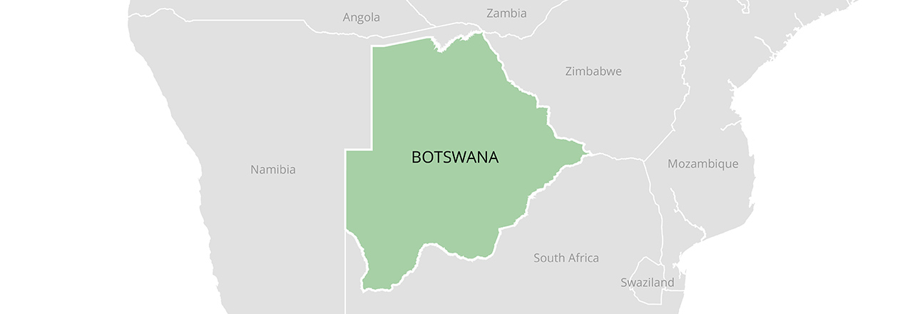
Overview
Botswana’s land governance combines customary institutions, statutory land boards, state land administration and private freehold. The country’s arid and semi-arid climate makes access to water and the ability to move livestock central to the value of land. Rights to a residential plot, a cultivated field, a borehole and surrounding grazing land can belong to different people and be administered through different procedures. Rapid urban growth, changing land values, conservation and mineral development have added pressure to institutions originally organized around more dispersed settlements.
The Tribal Land Act, 2018, which commenced on April 20, 2022, gives land boards responsibility for tribal land and provides a framework for allocation and registration. Citizenship and gender are important to formal access, but possession of a legal entitlement does not itself supply a serviced plot, guarantee an accessible water point, or settle competing claims. Botswana’s policy challenge is to improve administration while protecting shared resources and people whose use is difficult to capture in an individual parcel record.
History and Land Categories
Colonial rule divided territory among reserves, Crown land and freehold estates. Independence in 1966 did not erase these divisions. Tribal land, state land and freehold land remain distinct administrative categories, although the mix of rights within them is more varied than those labels suggest. Earlier land legislation transferred formal allocation functions from chiefs to land boards, which began operating in 1970. Chiefs and customary authorities continue to matter in local affairs, but statutory procedures govern the powers assigned to boards. The 2018 Act replaced the earlier Tribal Land Act; its commencement in 2022 is the relevant date for the newer framework. Botswana DailyNews; Tribal Land Act.
Freehold and state land have their own histories of acquisition, registration and use. Freehold can be bought and sold, subject to applicable law. State land may be allocated under grants or leases. On tribal land, a grant is distinct from the collective interests and statutory trust arrangements applying to the wider area. The historical distinction between these categories is important when assessing an individual claim, a proposed investment or the applicable authority.
Law and Institutions
The Tribal Land Act vests tribal land in land boards in trust for citizens and establishes their powers over grants, administration and land use. Boards operate within a statutory system rather than simply as representatives of a single chief or locality. The government’s tribal-land allocation service says citizens aged 18 or older may apply for unallocated land in any tribal area. An application, however, is not a completed allocation: availability, planning and administrative decisions shape the result.
The difference between a law, the rules made under it and the institutions’ capacity to apply it matters. Land allocation, planning, surveying and registration each involve a separate step. Residents may have evidence of an older allocation even where boundaries have not yet been surveyed or a new title has not been issued. Treating the absence of a new document as proof that a parcel is vacant can therefore endanger established users.
Customary and Community Tenure
Customary tenure includes residential sites, arable fields, grazing and access to natural resources. A household’s field or house site can coexist with shared pasture, routes, seasonal gathering areas and access arrangements negotiated among neighbors. Not all users of a shared area hold identical rights. Households with livestock, people who gather wild foods, tenants, farmworkers and other residents may depend on the same landscape in different ways.
Land boards’ written records can make individual allocations more visible, but mapping a house or field alone does not necessarily describe shared access. A fair allocation process must identify existing use before setting a boundary or granting an exclusive right, including use by people who are absent seasonally. Recording collective resources and routes alongside individual holdings can reduce later disputes over what appeared on a plan to be unused land. For the interaction of water points and collective pasture, see the field-based study of Kgatleng District.
Women and Family Rights
Women can apply for land in their own right, but formal access and effective control are not identical. Household decisions, the cost of surveying or building, marital property arrangements and inheritance practices can affect whether a woman can use, retain or transfer land. Widows, divorced women and women whose work sustains a family holding may face particular difficulty where documents or family records name someone else.
In Ramantele v. Mmusi, Botswana’s Court of Appeal in 2013 upheld four sisters’ entitlement to inherit their family home under customary law. The result is a significant example of customary law applied in light of evidence and changing social circumstances; it should not be reduced to a claim that every inheritance dispute has automatically been resolved. Legal recognition is most useful when women can obtain information, have their contributions recorded and reach an accessible dispute forum. Court of Appeal judgment summary; World Bank analysis of women’s property rights.
The Abolition of Marital Power Act, 2004 removed the common-law marital power of a husband over his wife and her property. Section 3 excludes customary and religious marriages from that Act. This limitation makes the type of marriage and the law applicable to the property important in evaluating an individual claim. The World Bank’s 2025 gender assessment also notes gaps in protection for informal unions. Neither an individual allocation nor an inheritance judgment should be assumed to resolve all marital-property questions.
Land Administration and Data
Land boards allocate and administer tribal land; surveying, planning and deeds registration add other institutional responsibilities. Botswana’s Land Administration Procedures, Capacity and Systems project, known as LAPCAS, has surveyed plots and assembled information to support a more complete record. A surveyed parcel is not necessarily a registered title, and a title produced is not necessarily a document already delivered to its holder.
In a March 2026 parliamentary update, the government reported about 836,900 surveyed plots, 493,000 claimed plots and 21,277 secure land titles produced. These figures describe different stages and must not be added together as if they were separate beneficiaries. A later August 2026 update discussed registration backlogs and pending deeds. Accuracy of names, boundaries and existing rights remains as important as the number of records created.
In April 2026 Parliament considered a Deeds Registry amendment bill addressing obstacles to registering older built-up areas. The practical question is whether surveyed and claimed plots can move through registration without excluding people whose rights are poorly documented. Public access to records, understandable correction procedures and an opportunity to contest errors help make formalization more reliable.
Land Disputes and Remedies
Disputes arise over boundaries, inheritance, transfers, the validity of earlier allocations and competing claims to communal resources. A household may need to approach a land board, a customary forum, a land tribunal or a court, depending on the issue and the available remedy. Effective resolution depends on accessible records and on hearing occupants as well as named applicants. Cost, distance, language and unequal access to legal assistance can make formal rights difficult to exercise.
In the Forest Hill Farm dispute, the Court of Appeal held in 2023 that the relevant statutory provision was unconstitutional as applied in the case and recognized the Bamalete community’s ownership of the farm. The Attorney General’s account of the decision illustrates the importance of the history and legal basis of a particular holding. The judgment should not be read as converting all tribal land into privately owned freehold.
The Department of Land Tribunal identifies appeals from land-board and planning decisions as part of its jurisdiction and says its decisions can be appealed to the High Court. It also identifies limits: inheritance, compensation amounts and most disputes over state or freehold land fall outside the tribunal’s ordinary land jurisdiction. Choosing the correct forum matters, and the fact that a tribunal exists does not ensure that every claimant can afford or reach it.
For compulsory acquisition, section 8 of the Constitution sets out permitted purposes and requires applicable law to provide for prompt, adequate compensation and access to the High Court on specified questions. The practical assessment of compensation must consider the legal interest affected, the relevant acquisition procedure and evidence of loss. Communities can also lose access through changes in land use or conservation rules that do not resemble a straightforward purchase of a titled plot.
Indigenous Communities and Displacement
San communities, also known in Botswana as Basarwa, have diverse histories and livelihoods. For communities associated with the Central Kalahari Game Reserve, restrictions on residence and resource use have generated a long-running dispute about land, conservation and access to services. These questions cannot be understood solely through plot allocation: mobility, hunting and gathering, cultural connections and water are also involved.
In Sesana and Others v. Attorney General, the High Court in 2006 addressed the removal of applicants from the reserve and their rights to enter and reside there. The judgments and orders are specific to the parties and issues before the court. In 2011, the Court of Appeal considered access to the Mothomelo borehole in Mosetlhanyane v. Attorney General, finding that the affected lawful occupiers could use it for domestic water. The distinction between a court order and the practical ability to live on the land remains important. Court of Appeal case summary.
Urban and Peri-Urban Land
Growth around Gaborone and other towns has increased demand for residential, commercial and industrial land, especially where employment, roads and services already exist. Land on the edge of a town may still be administered as tribal land, while its market value and use change rapidly. A farming household can face pressure to subdivide, sell or change the use of a field before planning and servicing catch up.
Waiting lists and allocation figures do not by themselves measure housing access. A household also needs transport, water, sanitation, electricity and a legally usable site. Informal transactions can reflect both market demand and barriers in official procedures, but purchasers may find it difficult to establish a valid transfer. Transparent allocation criteria, public information about available land and timely review of transfers can reduce the scope for favoritism and overlapping claims. Parliamentary discussion of land demand.
Agriculture and Pastoralism
Livestock production is important economically and socially, while rainfall variability and poor soils constrain cultivation in much of the country. Many households combine crops, livestock, wage work and gathering. Different grazing arrangements serve commercial producers, small herders and households with few or no cattle. Policy and administration therefore need to recognize that an area used as pasture is also a source of other livelihoods.
The 1975 Tribal Grazing Land Policy promoted commercial ranching alongside communal and reserved areas. Fencing and exclusive ranching can provide investment security for a leaseholder, but they can also restrict movement or displace less powerful users if existing uses are not identified and alternatives are inadequate. Stock ownership and access to water influence who benefits. In Kgatleng, a longitudinal study of boreholes and livestock documented how households that lost cattle could also lose effective access to water points, reinforcing unequal access to grazing. This is a district-level finding, not a uniform measure for the entire country.
The 1991 National Policy on Agricultural Development also addressed fencing and the relationship between fenced holdings and communal grazing. A contemporary FAO land-use planning study recorded the policy’s concern with dual use of fenced and communal areas. The history illustrates why a new exclusive right should be assessed together with the use that continues outside its boundary. Drought can force herd movements, and exclusion from a water point or passage may matter more to a small herder than the loss of a formally defined parcel.
Water and Rangelands
Water rights and land rights are linked but are not interchangeable. The government’s water-rights application service requires information about the proposed source and evidence of rights to the land or authority to use it. Borehole development also involves approval and technical requirements. Having a plot does not automatically confer an unrestricted commercial abstraction right, and permission for a water point does not settle every surrounding grazing claim.
In dry rangelands the location and control of a borehole can determine which pastures livestock can reach. Drilling, pumping and maintenance favor users able to finance them, while small herders may rely on negotiated access or shared arrangements. Management must also account for aquifer limits, drought and concentration of livestock around water points. Rules that are clear on paper are most equitable when neighboring users can participate in decisions and challenge exclusion.
Forests, Wildlife and Conservation
Woodlands and other natural vegetation supply fuel, construction materials, food and grazing, as well as habitat. National parks, game reserves and wildlife management areas protect important ecosystems but can affect local use, settlement and mobility. Conservation and community rights need to be considered together, including the costs of wildlife damage and the distribution of tourism revenue.
The Okavango Delta is a World Heritage site whose seasonal floods support wetlands, wildlife and local livelihoods. UNESCO describes a landscape that includes Moremi Game Reserve and areas managed through community or private tourism arrangements. Its water also depends on a basin extending beyond Botswana. A concession or community trust can create income, but accountability to residents and fair terms for benefit sharing determine who receives it. Parliament passed a community-based natural resource management bill in 2025; its passage should not be confused with proof that every implementing arrangement is operating effectively. Parliamentary report.
Climate and Carbon
Drought, heat and variable rainfall affect crops, livestock, water supplies and settlements. Botswana’s second nationally determined contribution sets out climate mitigation and adaptation priorities. Land restoration, rangeland management and protection of natural ecosystems can contribute to resilience, but their effects depend on local tenure, water access and the participation of people who use the land.
Carbon or restoration projects can create new demands over land, vegetation and the benefits associated with them. A project agreement should identify existing users, the area and duration, restrictions on grazing or harvesting, how benefits and costs are shared, and how disputes can be resolved. A land title by itself does not answer all of those questions. Claims about carbon ownership or a particular market framework require the governing law and contract to be examined in each case.
Mining and Surface Rights
Diamonds have been central to Botswana’s revenue, exports and public investment. Debswana, a joint venture between the government and De Beers, operates major diamond mines including Jwaneng and Orapa. In February 2025 the parties signed a new sales agreement and a 25-year extension of the joint venture’s mining licenses from 2029. Diamond-market fluctuations also create fiscal risk, strengthening the case for economic diversification. De Beers agreement description; IMF Article IV report.
Mineral rights and surface rights are separate. Under the Mines and Minerals Act, concession holders must meet notice and other conditions, and owners or lawful occupiers may claim fair and reasonable compensation for specified disturbance or damage. The Act sets out an arbitration route for disputes and limits on the effect of an unresolved compensation demand. These provisions are not a blanket veto over mining, nor do they by themselves guarantee that every affected user is identified or compensated adequately. Environmental review, disclosure, access to water and the treatment of communal uses are essential in practice.
Investment and Land Transfers
Investment in housing, agriculture, tourism, energy or mining can create employment and services while changing land use and access. Investors need to establish which institution can grant the relevant interest and whether an apparently available site is already used by households or a community. Land held under customary arrangements, freehold and state land do not follow one universal transfer procedure.
Sound agreements identify the parties with rights, the boundaries and uses affected, payment or compensation, duration, environmental obligations, and procedures for renewal or dispute resolution. Consultation should include women and other people whose livelihoods may not be reflected in the name on a document. The outcome is more durable when information is available before decisions are made and affected users can understand and contest the terms.
Political Economy and Reform
Botswana’s mineral wealth has supported state capacity, but access to land and water remains shaped by differences in assets, location and political influence. Well-connected applicants, established cattle owners, urban developers and communities dependent on communal resources do not necessarily approach the same process with equal information or bargaining power. A legal rule that applies to all citizens can therefore produce unequal outcomes.
Registration can improve certainty and make transactions easier, but it can also fix an error or overlook a shared use if conducted too quickly. Reform is most effective when the public can inspect records, challenge allocations and understand how land boards make decisions. Investment in staff, local dispute resolution and record correction complements surveying and title production. The goal is secure and usable rights for both individual holders and people who depend on collective resources.
Sources
Legislation and government administration
- Tribal Land Act, 2018; Government of Botswana, allocation of tribal land.
- Mines and Minerals Act; Government of Botswana, water rights application.
- National Assembly, March 2026 Hansard; National Assembly, April 2026 Hansard.
- Constitution of Botswana; Abolition of Marital Power Act, 2004; Department of Land Tribunal.
Judgments and legal analysis
- Sesana and Others v. Attorney General; Mosetlhanyane v. Attorney General, case summary.
- Ramantele v. Mmusi, judgment summary; Attorney General, Forest Hill Farm decision.
Research, environment and economic context
- Agricultural development and water distribution in Kgatleng; World Bank, women’s property rights.
- UNESCO, Okavango Delta; Botswana’s second nationally determined contribution; IMF, 2025 Article IV consultation.
- De Beers, 2025 Botswana partnership; Botswana DailyNews, community-based natural resource management legislation.
Update Log
October 2026: Updated the legal and institutional framework, land administration data, court decisions, natural resource governance and diamond-sector developments. Parliamentary statistics are identified by reporting date and administrative stage.
Confidence Assessment
High confidence: The commencement of the Tribal Land Act, the principal court decisions and the existence of the 2025 diamond agreement are supported by legal, government or direct institutional sources. Moderate confidence: National descriptions of day-to-day access, the distribution of benefits and local implementation draw on studies from particular places and periods; conditions differ across districts and households. Administrative totals are snapshots and should not be treated as counts of completed allocations or delivered titles unless the reporting source defines them that way.