“The cadaster is made for the people and with the people”

Q&A with Gustavo Marulanda, Director of IGAC, Colombia’s cadaster and mapping agency

a portrait photo of Gustavo MarulandaUSAID’s Land for Prosperity Activity is updating the cadaster of 11 municipalities in eight regions of Colombia and the Chiribiquete National Park, the largest protected area in Colombia, to support formal land markets and protect biodiversity. In this interview, Gustavo Marulanda, IGAC’s Director, talks about the cadaster as an essential component of property formalization and regional land administration.

How up-to-date is Colombia’s rural cadaster?

Approximately 905 of the country’s 1,101 municipalities have an outdated cadaster, and some were updated 30 years ago. This means that there are people that are only paying a small percent of what they should be paying in property taxes. The average property tax payment is just COP $28,000 (USD $7). This is what everyone pays, not just smallholder farmers but also the large landowners. So, updating the cadaster allows us to make significant progress with the process of promoting equality and improving tax redistribution.

How does updating the cadaster help with the implementation of the Peace Accords?

Point 1 of the Peace Accords is comprehensive rural reform, and an updated cadaster is fundamental here. The Peace Accords aim to formalize seven million hectares and redistribute three million hectares, but the first thing we need to achieve this is detailed property information, to know who are owners and who are occupants. By updating the cadaster, we can achieve more equity in the distribution of land. For example, many of the large landowners in the country, who often have unproductive and unused land, are not paying property tax.

How does the IGAC support land formalization?

a group of people gathered around a mapAt IGAC we have a legal responsibility to know the current and allowed land uses, we have to know what each piece of land is good for and how we need to protect it. The cadaster is the map of landowners who have secure tenure rights to their property. The cadaster generates knowledge and detailed information about our rural territories and provides us with inputs that are fundamental to administer land and property in a way that is socially responsible and promotes sustainable land use and production.

How do the communities benefit from the cadastral update?

Citizens benefit from the cadaster when they ask themselves things like “Where is my farm located? What are its boundaries? Who are my neighbors?”. It is similar to opening your smartphone and using mapping and navigation apps to know your location. An updated cadaster allows the municipality to make better decisions and to know where its population lives and what their needs are. The municipality knows if there are schools, health centers, or where to build infrastructure such as roads in a more efficient way. Additionally, by collecting property taxes, the municipality will increase its budget. The cadaster ensures that taxes are fair, so the ones who have more, pay more. Today no one is paying, neither the ones who have the most nor the ones who have the least.

How have you involved citizens more in these topics?

a woman in uniform speaking to a small group of peopleBefore, the community was not actively involved and that was a problem. That is why our logic is that the cadaster is made for the people and with the people. This is advantageous, because we can explain to the public why the cadaster is useful. People say “they update the cadaster and then my taxes increase, so I will have to pay more”, but they forget that they are also supporting land formalization and will receive a property title. And without a title they cannot access loans or subsidies.

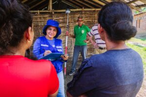
What are the Intercultural Cadaster Schools that USAID is supporting in Chiribiquete about, and how are they connected to the communities?

When we talk about the cadaster with the communities, we have to work with people, empower them, engage them with all these messages so they can make significant contributions to the information collection process and its sustainability. This is what the Intercultural Schools are doing, under the Geography for Life motto. They learn mapping exercises in an effective way, they understand why it is useful and how the community fits into their territory. Through mapping, communities can get to know their surroundings better and strengthen their spatial relationships. Sustainability is only achieved when people are empowered.

How does the cadaster contribute to conservation and environmental protection?

The information collected through the multipurpose cadaster contributes to the defense of strategic ecosystems in our country and continent, because we are connected to the Amazon and to the rivers that flow through it. This is why we have to know about them, their location, and have detailed information that allows us to make better decisions to defend and protect the environment. We have to monitor the levels of deforestation and illegal mining to defend our regions effectively.

How does the IGAC work with other government entities for land formalization?

a group of people sat on classroom benches while taking notesIn Colombia, the land administration trio of agencies includes IGAC, the National Land Agency (ANT) and the Superintendence of Notaries and Registers (SNR). IGAC is responsible for collecting and managing detailed information, and in areas that have been prioritized by the government, we receive support from the ANT as a cadastral operator. The ANT then administers the land that has been formalized or that will be redistributed and continues with the formalization and title delivery processes. The cycle then finishes with the SNR, which registers and issues the land titles.

USAID coordinates inter-institutional cooperation among Colombia’s land administration entities.

Why is the support of international donors important?

Donors, such as USAID, play a vital role, not just because they provide financing, but they also transfer knowledge, best practices, and technical capacities, which make us more efficient. We can also learn from international experiences, of how it has been done in other places or how we can improve information processing. The Intercultural Schools come from international experiences and from what donors have done elsewhere. The Land for Prosperity Activity has carried out property surveys and through trial and error helped to create a lot of the new methodologies we have today. Donors also have an added value because they coordinate institutions, because sometimes we are so busy with our day-to-day tasks that we have no time left to sit down and coordinate actions together.

Cross-posted from USAID Exposure

Women’s Land Rights Champion: Emile Ako

This interview with Emile Ako, USAID/Côte d’Ivoire, is part of the REFS/CNE/LRG Women’s Land Rights Champions series, which profiles staff across USAID Missions and operating units who are working to advance women’s land rights.

Tell us about yourself.

I am a Project Management Specialist in USAID’s Democracy, Rights, Governance and Conflict Prevention office in Abidjan, Côte d’Ivoire. I joined USAID in September 2021; however, my commitment to the Agency goes back nearly 10 years. Previously, I was involved as a consultant and later as an awardee under the USAID Office of Transition Initiatives, where I helped rebuild broken intercommunal relations after the 2011 post-electoral crisis. During this time, USAID produced a short film about my work. Subsequently, I was one of the 12 Young Ivorians selected to participate in former President Obama’s Flagship program, the Mandela Washington Fellowship for Young African Leaders Initiative (MWF-YALI) in 2015. My career in the international development sector started in 2016 when I joined the American NGO Search for Common Ground as a Project Manager in western Côte d’Ivoire. In addition to working in Côte d’Ivoire, I have worked in Ghana, Liberia, and in the Democratic Republic of Congo (DRC).  

In Côte d’Ivoire and in the DRC, local land-related conflicts have exacerbated tensions between communities. My efforts helped to broker peace between communities and resolve land conflicts in both countries. In western Côte d’Ivoire, I led the mediation process that resulted in the reconciliation and land agreement between the previously opposed Baoulé and the Guéré ethnic groups in the town of Kaade. In the DRC, as a Project Manager with Search for Common Ground, I contributed to securing grouped land titles for several thousands of small farmers, including the Twa/Batwa community in the Luberizi Groupement of the South Kivu Province.

Why are women’s land rights and resource governance important to your work? And to other USAID development work?

Equitable and unobstructed access to land for women has a direct impact on poverty reduction, reduces the propensity of violent conflicts, and decreases gender-based violence in the long-run.  According to the FAO, while women produce between 60 and 80 percent of subsistence crops in developing countries, they face incredible challenges in gaining access to land and resources, like funds to fertilize their soil or increase their production.¹ The situation is no different in Côte d’Ivoire. The recent 2021 Demographic and Health Survey in Côte d’Ivoire revealed that the percentage of women aged 15 to 49 who reported that they do not possess land has increased from 75 percent in 2011 to 88 percent in 2021.² Moreover, land and resource-related conflicts are frequently identified as a leading cause of conflicts and violence.³ Securing land ownership and access for women is a key contribution that USAID can support to reduce poverty, remove women from abusive and toxic subordination, and make it possible for them to fully participate in the market-based economy. Elevating the status of women also holds a great potential for women’s political participation; as their economic power increases, they become better equipped to challenge regressive social norms and increase their leadership in their communities. 

What are some of the biggest challenges in helping women secure land rights and what are some things being done to overcome them?

A political economy analysis conducted as part of the USAID-funded Improving Land Access for Women (ILAW) activity revealed that social norms, traditional practices, and patriarchal beliefs constitute major challenges to women’s access and ownership of land. Other assessments have revealed that, as women are empowered and become economically independent, male patriarchal norms and practices are perceived as threatened, so women are therefore prevented in some traditional societies from having full access and control of land and resources. 

In addition to traditional norms, the length and cost of procedures to establish legal land documentation and/or pursue litigation in case of conflict prevent many women from attempting to seek legal or administrative protection for their land. The process of establishing land ownership for rural and urban lands in Côte d’Ivoire has several stages, each with their own costs, long time delays, and specialized procedures. The whole process requires multiple visits to multiple administrations and excessive time and money, so gaining legal land rights can last several months or even years. These challenges can disincentivize rural women, who typically have less income, often lack formal education and have more pressing daily domestic demands. Furthermore, the absence of qualified lawyers in remote areas that can provide legal assistance to these women adds an additional layer of difficulty. 

To address some of these challenges, ILAW piloted a multilayered approach that combined awareness, social dialogue, behavior change communication, land mediation and direct legal and organizational support to women and communities. The project initiated educational campaigns to raise awareness about recent positive changes in Ivorian property rights and inheritance laws and behavior change communication campaigns by a local theater group. In addition, the project provided direct livelihood assistance through the introduction of the Gender Action Learning System (GALS),⁴ which allowed about 500 community members to define their collective vision for a more viable and inclusive future for women and girls. The project also provided legal assistance for women to facilitate legal access to land. 

What are some of USAID’s successes in the area of women’s land rights?

ILAW is a three-year pilot activity, but even after two years of work, community partners have reported tangible changes at both the individual and collective levels. Below are a few anecdotal successes:

  • The village chief from the village of Kapounon on the border with Burkina Faso decided to double the amount of land reserved for women’s agricultural activities following his participation in social dialogue and GALS sessions, despite his initial reluctance.
  • Another farmer in northern Côte d’Ivoire reported the following: “Before going to the (GALS) training, I used to work alone, I did not inform my wife and my children of what I earned. But now I bring them together, we talk, and we budget our expenses. It is not a common practice for men and women (husband and wife) to have open communication in our culture. But now I have understood that it’s when we talk to each other, and we get along, that we can give each other new ideas to move forward, and everyone is happy. So, I talk, I discuss, and now they are no longer afraid to come and talk to me.”
  • A village chief in western Côte d’Ivoire was quoted saying: “After being village chief for 32 years, I can say that this project has completely transformed my village.” He then described how the training and awareness-raising events led him to divide his land equally between his children, legally marry his wife, and integrate three women into his council of elders. 
  • The National Rural Land Agency (AFOR), impressed by the GALs tool, initiated dialogue with other international donors to integrate the tool in potential future projects.
  • Moreover, AFOR recently partnered with ILAW to pilot a new village land registry. There are also fruitful conversations occurring between the World Bank (WB) and ILAW to share lessons learned for future WB programming in Côte d’Ivoire. 

These success stories reveal the transformative power of increasing access to land for women and communities. ILAW has increased communities’ understanding of land regulations, improved the collective bargaining power of rural women, and provided opportunities for women to secure land across target project communities. To date, USAID has reached 6,214 community members in rural western and northern Côte d’Ivoire. 

 Is there anything else you’d like to share?

Land access for women is an area where USAID can make a sustainable, positive impact in Côte d’Ivoire. However, the success of ILAW remains localized to pilot communities, while land issues are widespread. Consolidating the gains and creating connections with the private sector, linking the women supported under ILAW with microfinance institutions, and facilitating their access to markets in urban areas are a few examples of high impact actions for USAID to pursue in the future. 


¹ FAO. 1984. Women in Food Production and Food Security in Africa. Report of the Government Consultation held in Harare, Zimbabwe, 10-13 July 1984, Food and Agriculture Organization of the United Nations, Rome, Italy.

² Jean Chrésus, Côte d’Ivoire: Niellé, un litige foncier au centre de violents affrontements entre les populations fait des morts et des blessés in Koaci.com (retrieved on 10/19/2023).

³ https://www.koaci.com/article/2022/03/04/cote-divoire/societe/cote-divoire-nielle-un-litige-foncier-au-centre-de-violents-affrontements-entre-les-populations-fait-des-morts-et-des-blesses_158149.html.

https://gender.cgiar.org/tools-methods-manuals/gender-action-learning-system-gals

“The Municipal Land Office is our Guide.”

Q&A with the Mayor of Santander de Quilichao, Cauca

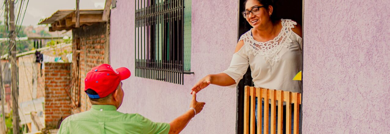
In the last four years, the Municipal Land Office (MLO) of Santander de Quilichao has facilitated the titling of more than 700 parcels. Several of these are public parcels like parks or health centers, or have to do with improving the municipality’s roads. The land office has become a key tool for land use planning and property formalization, and with it, the administration has mobilized more than COP $50,000 million (USD $13.5 million) in public investments.

In this interview, the current mayor of Santander de Quilichao, Eduardo Grijalba, who was recently re-elected, talks about the role of the MLO and the goals of his government.

Twelve years ago, you held the first discussions with USAID about creating a Municipal Land Office. What impressions has the work of the MLO given you since then?

Yes, 12 years ago we created the MLO in our municipality. Today, the land office is a point of reference for the entire country, and influences land use and urban planning. Without land and property administration we could not mobilize public resources to invest in the municipality. In the beginning, that was the main objective, but now I see that the work of the MLO is much broader, and it works with every secretary within the municipal administration. Additionally, it provides information to the community about land formalization.

How has the MLO changed operations?

The MLO has resulted in big changes in the way we operate in the municipality. Before, projects were submitted to public entities to request financing, but when we came upon the question of ownership, the parcel either had no title or it did not belong to the municipality. Many projects could not come to fruition because of that. Now, we start all investment projects at the MLO, and before we submit them, we make sure the parcel is surveyed and titled in the name of the municipality. We also look at the land use issues for each parcel, whether a large tract of land needs to be divided, and if they are connected to public services. Having the MLO under the Secretary of Planning is a big advantage when it comes to mobilizing resources.

What are some examples of how the MLO has unlocked public investments?

According to the latest reports, we can say that thanks to the MLO the municipality has mobilized more than COP $50,000 million (USD $13.5 million). We are talking about impactful projects such as building roads, like the Niza road, and communal spaces such as the Plaza de Toros and the Corona Real park. We also bought the parcels for the Santander de Quilichao Hospital, which has mobilized more than COP $35 million (USD $8,750), and the regional campus for the SENA, which resulted in COP $49 million (USD $12,250). The Villa Maria housing project has mobilized COP $10,000 million (USD $2.5 million) and will provide housing for 400 vulnerable families. For Villa Maria, the MLO helped us with the purchase and division of the parcel. In December we already delivered the first 100 property titles.

Apart from education and infrastructure, the MLO is creating safer space for public entities that provide legal services in the region.

Yes, through the MLO we divided a parcel and titled it to benefit two key government entities: the District Attorney’s Office and the Medical Examiner and Coroner’s Office. The new parcels are on the outskirts of the city, close to the hospital, and having the entities together makes their jobs easier. The current Coroner’s Office receives bodies from eight municipalities, and it is just too small and has to send bodies to Cali. We want to ensure the coroner is well equipped and capable of handling autopsies to provide grieving families better services. The current District Attorney’s Office is paying rent for a privately owned bunker located in a residential area, which increases the risk of violence for the community around it.

What are the objectives and goals of the land office for your administration in the next four years?

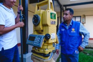
We are going to try to obtain as many titles as possible and meet our goal of 500 property titles. In addition, we have goals with two main roads: La Cañera and Calle Séptima. There are properties in the middle that now belong to private owners, and we are in the process of obtaining them and creating two-laned roads to join two large sectors of the municipality. We also have projects like the hospital and the marketplace. The land office also plays a role in the implementation of our municipal Land Management Plan.

Today, a Rural Property and Land Administration Plan (POSPR) is being implemented in Santander de Quilichao to formalize thousands of rural properties. What challenges have you identified?

Yes, the parcel sweep in our municipality is being supported by USAID in coordination with the National Land Agency. We hope to be able to deliver more than 3,000 property titles for rural families that are currently living informally. With all its years of experience, the MLO is playing an important role in understanding the territory and reaching rural communities. The challenges are huge and some of them have to do with the security conditions and others with convincing the communities to be part of the process. Because of what the parcel sweep represents to our community: Afro-Colombians, indigenous communities and farmers; it should be considered the most important land project in the country.

How have these actions to improve land administration changed the people’s behavior in your municipality?

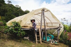
Now, with the parcel sweep, land issues are being promoted. The land office has been a source of information for everybody, in terms of providing advice. The MLO is like our guide, and little by little, people understand better the culture of formal land ownership that we are promoting. People are not frustrated anymore with having to contact Bogotá or a lawyer to ask for information on land or property formalization. We have a population with more opportunities and knowledge, and the MLO has given our residents many solutions.

“For our Afro-Colombians and indigenous communities the parcel sweep represents the most important land project in the country.”
– Eduardo Grijalba, Mayor of Santander de Quilichao (Cauca) 2024-2027

Cross-posted from USAID Exposure

Help from the Governor

Cauca’s Regional Land Office is supporting eight municipalities with land formalization and ensuring continuity with the incoming administration.

Caldono's Municipal Council Meeting Hall building and front door
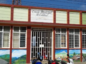
Nobody in Caldono’s Planning Department was surprised to learn that half of City Hall was sitting on a property with no land title. In the municipality of Caldono, six out of 10 parcels are informally owned, and this also applies to schools, health clinics, and municipal assets.

“We don´t have a land title for the Municipal Council Meeting Hall. We have a whole list of municipal properties that are informal: schools, community centers, recreation complexes, basically all the properties that are most important to the community’s wellbeing,” explains Ivan Melo, public administrator in Caldono.

Caldono is a small municipality in the mountains of Northern Cauca and does not have the resources to finance a full-fledged land office that can attend to its everyday property needs. The creation of Cauca’s Regional Land Office (RLO) has given Caldono a valuable opportunity to review its assets, create a plan to legalize its properties, and reach the public with information about land formalization and property rights.

Cauca’s RLO is based in Popayán, the departmental capital, and supports eight municipalities in Northern Cauca. The office regularly sends a small group of topographers and land experts to isolated municipalities to work with local leaders and focus on land formalization, public outreach, and institutional coordination.

So far, the Regional Land Office has helped Caldono title 100 private parcels in urban areas and 13 public properties, including the municipal government building, schools, and recreation facilities.

Caldono's Reconciliation Park
Caldono’s Reconciliation Park today

Through its support, the municipality has already leveraged 410 million pesos (USD $100,000) in investments for schools and parks. One project includes the improvement of Caldono’s Reconciliation Park, a public space that allows residents to reflect on building peace following generations of conflict and violence.

For years, the Reconciliation Park wasn’t suitable for children to run and play. Thanks to the formalization of the land, not only will we have the deed in the name of the municipality, but it will become a place for all of the community to come and enjoy,” says Melo.

Ensuring a Future

a group of people holding land titles
Caldono Administrators have delivered a total of 13 land titles for public properties since creating a Municipal Land Office to coordinate with Cauca’s Regional Land Office

In 2024, Cauca’s new governor, Octavio Guzmán, took over. He inherited a functioning land office that titled over 1,150 parcels in eight municipalities in its first year.

Today, the governor will lean on the recently created Departmental Land Working Group, a cross-cutting body that includes representatives from national land entities as well as Cauca’s Secretaries of Women Affairs and Agriculture.

“All across Cauca we have many poor indigenous and Afro-Colombian families living on small parcels that do not have land deeds and who cannot access a line of credit. The Regional Land Office is the place where we can start strengthening land formalization and facilitate coordination with the national government on land issues and make it possible to provide them with legal security and stability,” explains incoming Governor, Octavio Guzmán.

The innovative concept of a Regional Land Office was first supported by USAID in the department of Meta, and has found success in other departments like Sucre and Bolívar. The RLO strategy has planted seeds for regional-level leadership in land administration and created a conduit of support for secure land rights.

“The Regional Land Office allows us to organize property in rural territories and to provide security and legal stability to our farmers, our indigenous communities and our Afro-Colombian people.” – Octavio Guzmán, current Cauca Governor

Cross-posted from USAID Exposure


Coffee Guild Gets Behind Rural Land Rights

With the support of USAID and the government, the National Federation of Coffee Growers is supporting the titling of 300 coffee farms in Cauca.

The end of the year brought good news for coffee growers in Northern Cauca. Seven families from Caldono received property titles to their coffee farms. Some of the families had initiated proceedings 10 years ago and had given up hope of ever obtaining a registered land title.

USAID’s Land for Prosperity Activity launched the initiative with support from the National Land Agency and in partnership with the National Federation of Coffee Growers (FNC). The partnership marks a milestone in Northern Cauca as the first time that a private sector stakeholder invests in the formalization of rural property. The strategy is expected to reach 300 families in Caldono who lack a land title to their coffee farms.

The FNC has committed more than $30,000 USD in investment and is providing workspace, logistical support, and valuable knowledge of the municipality.

Coffee growers who own farms with legal certainty are more likely to invest their own resources in improving coffee production and processing. Above all, secure land tenure reduces tension around land in Cauca, a region where for years, land conflicts have delayed rural development and the delivery of state services.

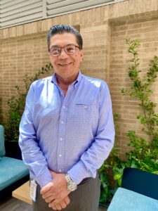
“The most important thing that we can do for our coffee growers is protect their property. My recommendation is to move forward with companies and the government, seeking policies that facilitate land formalization through taxes. Coffee growers pay taxes, with this strategy, we can find several actors that can help.”

-Gerardo Montenegro, Technical Manager of the National Federation of Coffee Growers.

In addition to strengthening the farmer’s connection to their land, a registered land title reduces the chances of forced displacement and influences the decision to continue to grow coffee as the main economic activity and contribute to Cauca’s economic development.

The facilitation of private sector investments in clarifying and documenting rural property is an innovative strategy to strengthen land rights and rural value chains like coffee. The strategy is aimed at companies and organizations with corporate social responsibility objectives or specific interests in key value chains. The strategy requires stakeholders to co-invest a minimum of 15 percent of the project cost and raises awareness about the role of land tenure in rural development.

Coffee in Cauca

In Cauca, over 380,000 people representing 94,000 families depend on the coffee sector for their livelihood. In Caldono, an estimated 5,000 families cultivate coffee on 4,700 hectares and produce 8,000 tons of coffee per year. For these coffee growers, which include Misak and Nasa indigenous communities, coffee is more than an economic activity, it is a livelihood.

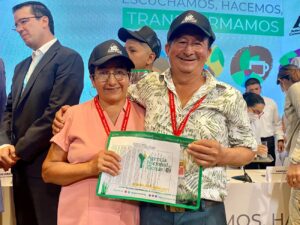
In Caldono, 66 percent of parcels are informally owned, indicating that some 1,900 coffee-growing families do not have a property title. Alba Ituyán and Ameiro Mosquera are coffee growers who started the land titling process almost ten years ago. Thanks to USAID and the National Coffee Federation, in 2023, they received a joint land title to their coffee farm.

“In 2014, we started a titling process. Thanks to USAID’s Land for Prosperity Activity, we obtained the land title in two months and this farm is officially ours.” said Ameiro Mosquera, a coffee grower from Caldono.

At the title delivery event, Colombia’s Minister of Agriculture and Rural Development, Jhenifer Mojica, reminded the audience of the government’s responsibility to boost sustainable agricultural development.

“With the Agrarian Reform we will apply instruments of land administration and put productive land to work,” she said.

Cross-posted from USAID Exposure


The Wait is Over

USAID is developing capacity in land administration to strengthen land rights in underfunded municipalities across Colombia.

Piece by Piece

Raúl Moreno waited 15 years for a land title to the property he owns in the town of La Macarena. During the wait, the elementary school teacher and community leader built his home, piece by piece.

Although he thought about it often, Moreno never processed a land title for his property. In Colombia land titling services are expensive and time-consuming. In a complicated system involving several government entities, the process can take over two years, and there is no guarantee that a property title will be waiting for you on the other side.

“I would have to hire and bring a land survey to our municipality. I would have to pay a lawyer. The whole process is difficult and costly,” he says. “And doing this in La Macarena would not be easy.”

A new strategy, which puts the task of titling parcels in urban areas in the hands of local and regional administrators, is delivering property titles to people like Moreno and improving urban planning and rural development for municipal leaders.

In this video, we visit La Macarena and meet Raúl Moreno.

La Macarena is nestled in an isolated corner of rural Colombia where the eastern plains of Meta drop into the Amazon basin. Over the years, it has become famous for tourism as an entrypoint for the La Macarena National Park, but remains cut off from any paved road by 10 hours of bonejarring dirt road.

In 2022, with support from USAID, the Department of Meta created a Regional Land Office to carry out tasks like land formalization in isolated municipalities with limited budgets. USAID Land for Prosperity provided technical and in-kind assistance to set up Meta’s Departmental Land Strategy, which has already delivered more than 1,000 urban land titles in eight municipalities including La Macarena.

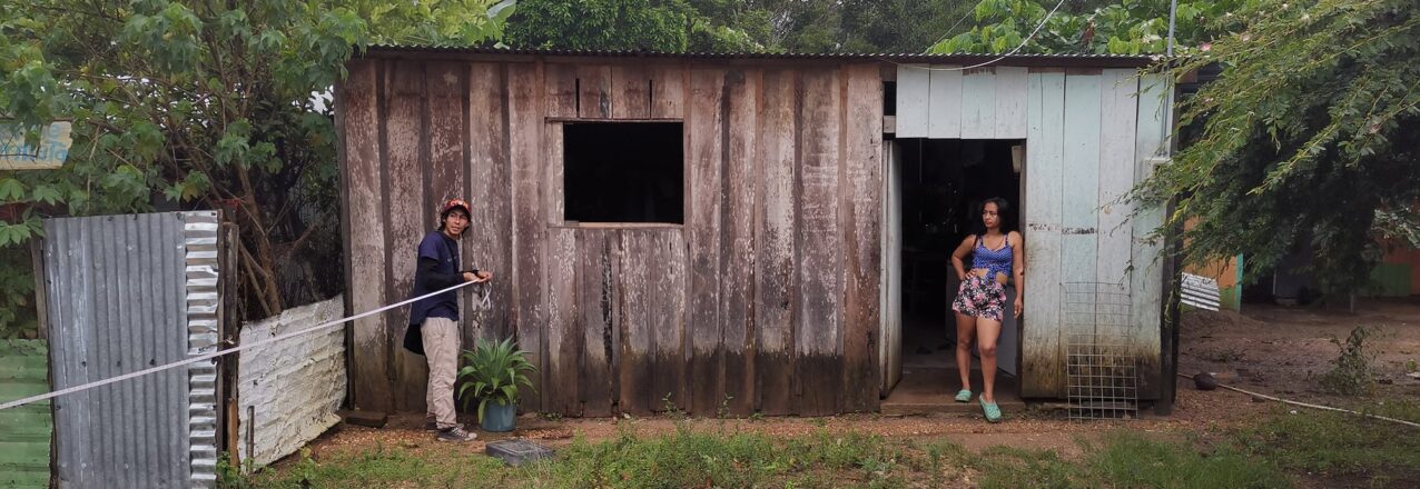
In each of the nine participating municipalities, USAID has trained public officials to give residents information about land titling and property issues. Jhojan Smith is an engineer working in La Macarena’s municipal administration, and when Meta’s regional team comes to work, he helps them reach the community.

The main objective is to regain the public’s confidence. In the past, land formalization was quite slow. With the support of the Regional Land Office, land titling processes that took up to two years are being done in 2-3 months,” he says.

Decentralizing Land Administration

The innovative concept was first developed by USAID in the department of Meta, and has found success in departments like Cauca, Sucre, and Bolívar. The strategy has planted seeds for regional-level leadership in land administration and created a conduit of support for secure land rights.

“The Regional Land Office strategy has helped our municipality to understand the importance of land titling. The strategy is raising awareness about the benefits of formal land ownership for families and for our administrators in terms of property tax collection and meeting the goals of the municipal development plan,” says Luis Hernando Hernández, La Macarena’s Planning Secretary.

In its first year, Meta’s Regional Land Office has delivered over 1,000 urban land titles, including more than 25 public properties where schools, health clinics, and municipal assets like parks and recreation are located.The Regional Land Office has titled properties in Mesetas, La Macarena, Uribe, Vista Hermosa, San Juan de Arama, and Puerto Concordia.

A Family’s Future

Now that Raúl Moreno is the official owner of his property and has a registered land title backed by the government, he can support his family in other ways.

“There are so many benefits like having access to credit and loan and the possibility to invest in my property, and improve my family’s living conditions. That is a blessing. There is the feeling of certainty that this property is no longer just mine but belongs to my children and will be theirs in the future.” he says.

“We have changed how to collect information, simplified forms, and consolidated tools.”

Q&A with the Subdirector of the National Land Agency in Colombia, Andrea Silva

a woman sits in her officeSince signing the 2016 Peace Accords, the government of Colombia has transformed rural land administration by adopting a model that puts the onus of formalizing rural property on government land agencies like the National Land Agency (ANT). With the support of USAID’s Land for Prosperity Activity, the ANT is streamlining processes and simplifying the steps needed to deliver land titles. In this interview, the Technical Subdirector of the ANT, Andrea Silva, talks about how the Agency has taken advantage of USAID’s experience and is embracing an evolving approach to securing land rights.

What are the biggest challenges that the ANT faces during the formalization processes?

The main situation that affects our progress is that we need people to move land processes forward, and there are not a lot of skilled people with experience in land. It is not easy to find cadastral engineers or topographers with experience in rural land surveying. Therefore, we have to find new methodologies that allow us to collect physical and legal information, which is why we are making a big effort to move from direct to indirect methods. This paradigm change sometimes generates resistance, but it is necessary to make progress, because with parcel-to-parcel visits, we are not going to achieve comprehensive rural reform.

Has this changed how the government faces land informality?

Everything we do is useful for the cadastral authority, but that does not necessarily mean that we have to survey the entire municipality. So a big change in order to optimize time and resources is completing municipal parcel sweeps by intervention units. In this regard, an intervention unit is surveyed and the information is delivered to the ANT for validation. While the first unit is going through the ANT’s internal process, in the field, the second unit is already being surveyed. Through analysis, we know which units are the most informal, and so when we arrive, we already have a more accurate and clearer objective.

Is this new adaptation going to be used in the Santander de Quilichao parcel sweep?

We have already used it, for example in the units that LFP delivered in Fuentedeoro and Puerto Lleras, we have already delivered land titles. In Santander de Quilichao we are going to identify the people and parcels that need to be formalized, that need land administration or legal tenure. We are going to make the processes quicker, more consistent, and especially produce results faster. What we aspire to is to avoid what happened to us in previous parcel sweeps, which were very long processes, too long for a single municipality, so we can gradually make progress.

What role do new technologies play in simplifying processes?

Strengthening information systems and data collection systems is very important to the ANT. We are increasingly moving towards the improved use of technology, even though in rural environments this is difficult. In the countryside, people do not feel comfortable signing digital documents, on a tablet, for example. They like using pen and paper, having a hard copy of the document to take home with them. It is necessary to move towards technology in a gradual way, so that the communities continue to trust us.

Have the recommendations made by LFP increased the efficiency of the ANT and other public entities like IGAC?

Yes, we have implemented many changes, not only in the processes but also in simplifying forms, consolidating information collection tools, and issuing guidelines that are clear, not just for ANT employees but also for the parcel sweep operators. For example, before the ANT had 32 attention routes for land formalization, and we simplified the processes to 24 routes. Everything LFP has done to support the ANT with Rural Property and Land Use Planning translates to the possibility for a dignified life for rural Colombians.

Are these changes strengthening how the ANT achieves comprehensive rural reform?

The comprehensive rural reform goes beyond delivering land titles. Of course, the title is the first step for people to access institutional services, for them to have a guarantee when requesting a low-interest loan from a bank, or to access a subsidy. The ANT looks for the people and parcels that are subject to formalization in a way that permits them to access all institutional services. Delivering a property title is delivering hope, delivering possibilities, it means that the life projects of these rural communities can be given certainty.

Cross-posted from USAID Exposure

“We have to believe in ourselves, have goals and achieve them.”

USAID promotes the participation of women in agricultural production in Montes de María.

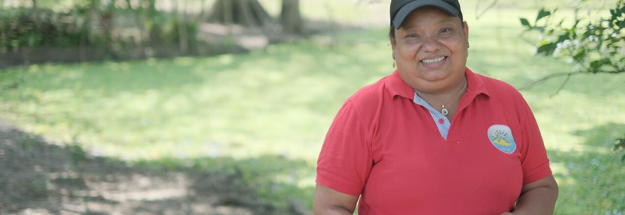
Luz Mery Valdez is an iconic woman, who is defying gender stereotypes through her work as a cassava and yam farmer in the Montes de María region of Colombia. She works with the Association of United Women of San Isidro (AMUSI) in the municipality of El Carmen de Bolívar.

USAID, through its Land for Prosperity Activity, is supporting the departments of Bolívar and Sucre in the Montes de María with land tenure programming and rural development initiatives. The Activity established a series of Public-Private Partnerships (PPP) in the sesame, honey, yam and cassava value chains to shore up investments in agribusiness, improve yields, and bring more women into the value chain. So far, almost 400 rural women have benefited from the PPPs.

How has your experience growing cassava and yam been, since you joined the Public-Private Partnership?

LM: My experience has been great, as we have been able to regain the recognition that women can also participate in agriculture activities, which is something that had been lost.

What was the reaction of the men around you, when you joined this agribusiness?

LM: At the beginning when we started growing yam, the men found it unusual. To see women growing yam and cassava in the countryside is just not very common in our region. Then we started to get more involved in all of the process, to learn more about the business. We are reclaiming a space for women that we deserve.

What have been the most visible changes since women have participated in farming activities?

LM: The vision that women have today is very different to the one we had a few years ago. Now we think about agriculture production, about generating income for our families, and about strengthening our cultural bonds as women.

How do the men of your community see you now?

LM: Men see us in a different way, I think, at least when it comes to our farmers association, the Association of United Women of San Isidro, which sees itself as a women’s association that strives to increase income for its members. Thanks to USAID programs, we can achieve this, specializing in the production of cassava and yam.

What would you say to other women?

LM: I would tell them that they have to believe, believe in themselves, have goals, and achieve them. It was not easy when we started, because women see things from a different point of view than men. It may be difficult to participate in farming, but it is not impossible. What we have to do is believe and have goals with objectives so we can achieve them.

“To rural women I would say that it might be difficult but not impossible. Every day you have to get up thinking that you can do it, to move forward.”

Luz Mery Valdez, cassava and yam producer.

Cross-posted from USAID Exposure

“The collective land title means we are taking back what once was ours.”

USAID is echoing the voices of women asserting their rights to land.

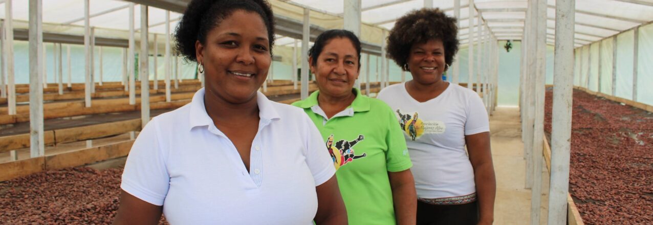
As part of the 16 days of activism to end violence against women and girls, LFP talked to Judith Rodríguez, a member of AFROMUVARAS, an association of afro-Colombian women who farm cacao in the Rescate Las Varas Community Council in Tumaco, Nariño.

Despite violence against women in her municipality and community, people are changing their mentality. Women, in particular, are becoming aware of their rights to land and the importance of their contributions to the productive development of their collective territories and the care of their families.

In 2021, USAID’s Land for Prosperity Activity created a public-private partnership in the cacao value chain in Tumaco, which seeks to strengthen farmer associations like AFROMUVARAS so they can improve the quality of their cacao and access new markets. The cacao association was founded in 2017 and has 367 members.

What has the experience of having a collective land title for AFROMUVARAS been like?

JR: For us women, the collective land title means we are taking back what once was ours. As women, we are always forced to depend on men. Lately, there has been a lot of progress, and we are very thankful for it. In AFROMUVARAS it has been a wonderful experience to be part of this big group of women who want to develop their territory and improve the quality of life for women in rural areas. We want to make progress collectively, to be the voice of women in these regions, to take a chance on peace, on the wellbeing of our children, on the growth of our territory, as well as to generate employment opportunities and grow as a business.

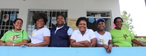
In the Community Council, you share the land between members. Do you think the women who own land individually or jointly with their partners are as protected as you?

JR: Yes, I think working with men or living with their partners and their children, if they have a title they are protected. I mean, we are betting every day on personal and territorial growth, this is the foundation. Working hand in hand, every day, with our families.

AFROMUVARAS knows of cases of economic violence against women in Tumaco?

JR: You can’t see it, but you can feel the economic violence, because women always depend on men or their partners. They expect the man to be the one that provides, and when he gets home he decides what everyone can do. It is harder for women to generate our own income and provide because usually, they do not have the same education or economic opportunities. And the men take advantage of this to exert economic violence, because there are fewer employment opportunities for women in Tumaco. Men always get the opportunity to work first.

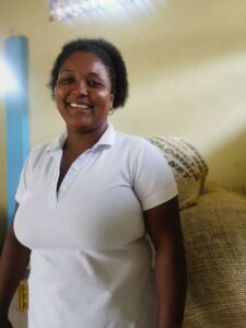
There are laws to stop men from selling common properties without the consent of their partners. Do you think there is a need to talk about these laws more widely? 

JR: Yes, we need more outreach, so that women know these laws. So they can feel empowered enough around these issues to be sure that they are important. Land and property are their rights.

In AFROMUVARAS, do you think the way rural men and women think is changing? Is violence against women diminishing? How?

JR: Yes, things are changing. And I am very proud to answer this and it makes me smile, to see how women are taking part in many collective processes, participating in spaces where we are invited. We are raising our voices and protesting. These processes are empowering women, but there is still a lot of work to do. It is a long and difficult process. For example, today the President of our Community Council is a woman.

Why should the women of Tumaco have hope?

JR: We can be hopeful, very hopeful. If we work together, if we continue to be united as women, hand in hand, and continue to empower ourselves in social and educational issues, we can continue to grow in our territory.

How do you encourage other women to understand and recognize their rights?

JR: Today, from the rural areas of Tumaco, from our Community Council and our organization, as a member of AFROMUVARAS and also as a person, I tell women in neighboring areas that we are all women, we should all be empowered, we should work together, be strong and keep fighting. We can’t give up, we need to persist, be sisters and look for spaces where we can grow and be equal to men. We need to be present in those spaces to get what we want, because we can do it. We can participate in public spaces, social spaces, everywhere we want as women, we can grow and take a chance on peace.

Cross-posted from USAID Medium

A Home Called The Blessing

USAID is helping the government to increase efficiencies around rural land administration and reduce the cost and time to title rural property in Colombia.

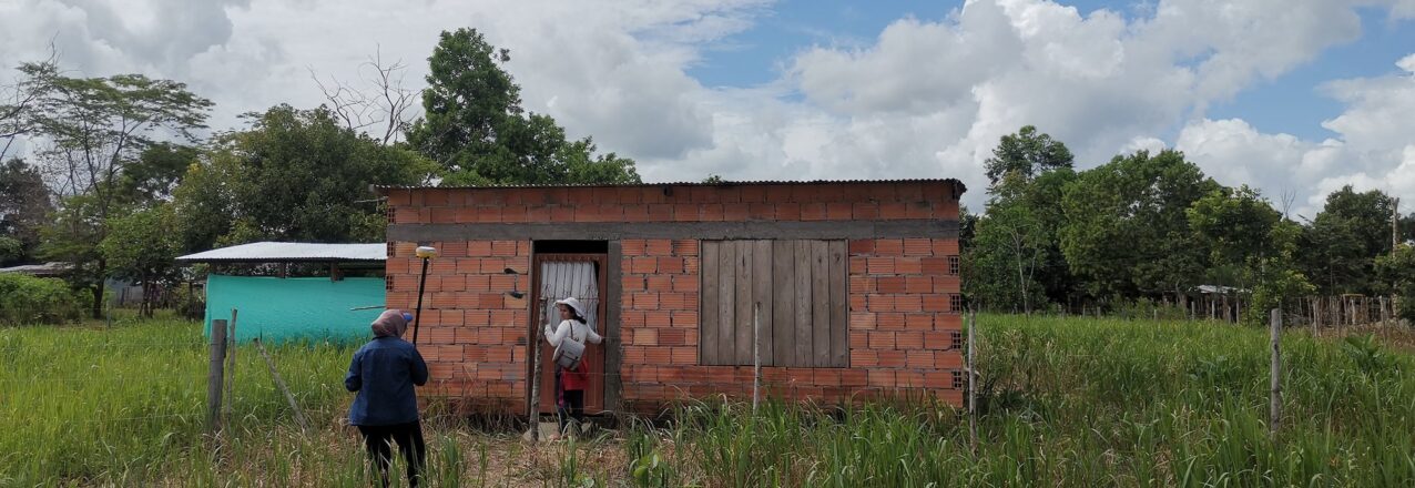
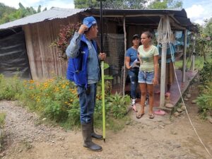
One early morning in 1994, Gloria Ester Buelvas was woken and told she had to leave her grandfather’s farm in San Pedro de Urabá, where she had lived 16 years of her life. Nearly three decades later, Buelvas still does not know why she and dozens of members of her family were threatened and forced to leave their hometown.

“The paramilitaries told us we had from dusk to dawn to leave town. We organized ourselves and went to Carepa, 100 kilometers away,” Buelvas said, recounting a traumatic experience. “But when we got there, they told us that we had to leave from there too.”

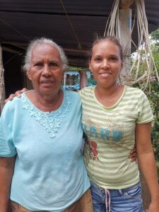
Colombia’s Urabá region stretches from the border of Panama along the Caribbean coast and is famous for bananas and large cattle ranching estates. Over generations, the region became a textbook example of the type of class divisions between landless farmers and an elite land-owning class that fomented strife and erupted in brazen warfare between the leftist guerrillas and paramilitary groups in the nineties. Families like the Buelvas were caught in the middle, accused of helping or supporting one side or the other.

Although the traumatic memory of displacement persists, Gloria Buelvas and her family eventually found peace 500 kilometers away in Meta, a corner of Colombia’s eastern plains. La Unión del Ariari is located in the municipality of Puerto Lleras and home to a hodgepodge of families displaced by decades of conflict and several Venezuelan families who recently arrived.

Lack of Access

Over the years, the municipality provided relief, including improved roads and electricity, and the families rebuilt their lives. Gloria and her neighbors supported each other through subsistence agriculture, but none have ever obtained a land title for their property. In Colombia, low-income families can rarely afford to access land formalization services, which are complicated and expensive. In fact, the majority of Colombia’s rural parcels lack a registered land title.

Families without registered land titles mean the country’s cadaster, which is a comprehensive map of land ownership, is severely out of date, especially in areas that have been affected by violence. Unclear land rights with no backing from the state have made it easy for illegal groups to run off people like Gloria Buelvas from their land. 

This is changing, thanks to the implementation of Rural Property and Land Administration Plans, or POSPRs by their Spanish acronym, all over the country. USAID is helping the Government of Colombia untangle land administration issues and meet its commitments to the 2016 Peace Accords. The Land for Prosperity Activity is USAID’s largest investment in land tenure programming in the world and its main objectives are updating the rural cadaster and strengthening land administration.

Updating Records

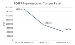
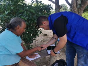
When the cadaster of Puerto Lleras was last updated in 2011, it included 2,300 properties. Following the implementation of the 2023 POSPR, the initiative surveyed over 4,600 properties, many of which are home to displaced families. More than half of these parcels are not recognized by the state but are ready to be formalized and issued a registered land title.

In addition to formalizing properties, the Rural Property and Land Administration Plan provides the government with information about landholdings that could be subject to agrarian reform processes and provides a path for more than 700 landless farmers from Puerto Lleras to apply for land with the government.

“The government is going to give me the deed to my little piece of land, so I named my farm ‘La Bendición’ (The Blessing) because it has been a blessing for me and my family.” says Gloria Ester Buelvas.

Reaching Complex Municipalities

Puerto Lleras is one of 11 municipal-wide Rural Property and Land Administration Plans being supported by USAID. After considerable preparation and training, the implementation of POSPR requires an average of 18 months to complete field work and information gathering. Once completed, it is up to Colombia’s National Land Agency to deliver property titles to landowners.

With government support, USAID is implementing POSPR in some of Colombia’s most complex regions, where armed groups operate and illicit crops play a role in the local economy.

The POSPR methodology, which has evolved since being first tested in 2018, uses a variety of approaches to reach rural landowners. After a thorough analysis of available property records, squads of technical, legal, and social experts sweep the countryside, engaging communities, documenting parcels, and updating landowner information in the cadaster. A social outreach component relies on the support of volunteer community leaders and is critical in reaching rural residents with information about the land titling process, formal land markets, and women’s land rights.

“People around here ask why the state wants to give them land titles. There is a fear that if the government gives you a land title, it will then take away your land,” explains Luz Estela Velandia, who worked as a community volunteer for the POSPR in Fuentedeoro. “We assure them that nobody will come and take away their land. In fact, it is the opposite. A land title ensures they are recognized as owners under the law.”

Calculating Costs

To improve implementation, USAID has created a mathematical model to calculate the direct cost per property of POSPR implementation in municipalities where USAID has completed interventions, including Puerto Lleras. By tallying all costs related to the implementation of the parcel sweeps, including labor, logistics, systems, infrastructure, and more, USAID extrapolated a cost per property as well as cost per property by process, type of parcel, and route of parcel formalization.

Using a baseline from Colombia’s former land administration authority, INCODER, in Puerto Lleras USAID identified a 72% decrease in the cost-per-parcel from COP $3,802,639 to COP $1,080,376. When compared to the results of the first USAID-supported massive parcel sweep in Ovejas, which had already reduced the costs of the baseline, USAID found a 43% decrease (See graph below in Colombian pesos).

This would still be a steep price for first time landowners, however the cost of adjusting property records thereafter is much lower.

Since the Peace Accord was signed in 2016, USAID has been the foremost partner in facilitating the government strategy to move away from a demand-driven land administration policy to one in which the government assumes the cost of first-time formalization. The large-scale POSPR interventions alleviate the burdens that once prevented most low-income rural landholders from seeking a valid title. Once a property is registered, future title transfers become less time and cost intensive.

“I tell people that, yes, they will have to pay property taxes, but a land title can also bring them government subsidies, programs, and better services. I tell them a land title represents their rights. And I tell them that women have the same rights to appear on a property title as a man,” says Velandia.

Cross-posted from USAID Exposure