Protecting a Public Monument

With USAID support, Puerto Rico, Colombia is strengthening land governance and improving opportunities to invest in public spaces

A Tragic Day

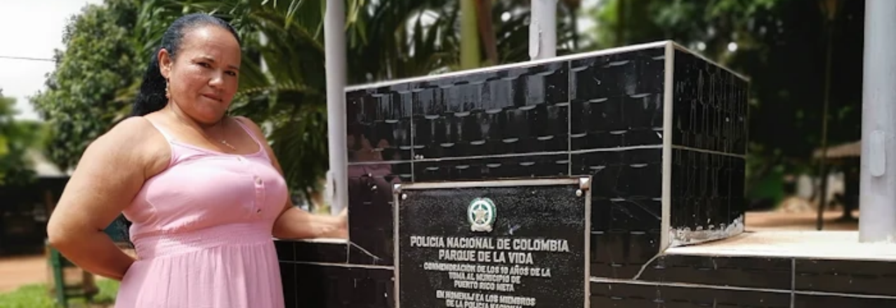
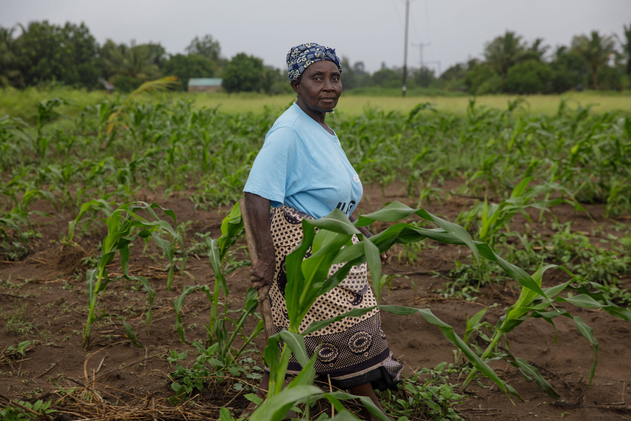
As she walks, Elizabeth Ríos seems to carry images of the guerrilla and paramilitary violence that shook the municipality of Puerto Rico for much of the 1990s and 2000s.

“We had security problems,” says Ríos looking off into the distance, recalling times she doesn’t know how she survived. “One day there were two dead, another day, three. The town was divided until 1999, when the guerrillas took control.”

It was on July 10, 1999, when some 2,000 guerrillas of the FARC’s now defunct 42nd Front stormed and besieged the entrance to Puerto Rico and surrounded the police station, which at the time was staffed by about 30 policemen.

“Those policemen were like cannon fodder,” Ríos still recalls with fear, evoking the images of horror in her mind. “The guerrilla shot them with rifles and threw gas canisters at them.”

The bloodshed ended after a 40-hour siege of the police station leaving five policemen dead. The remaining tired 28 policemen gave up when they had no more ammunition or food and were kidnapped by the insurgents.

For Ríos, who has been a member of the Puerto Rico municipal council for 15 years and knows the history of the conflict in the municipality, the FARC takeover also destroyed the local branch of the Caja Agraria, a gas station, and left the town’s population without electricity. To never forget this difficult chapter, with the support of Ríos and the council, the battle site was converted into a memorial park in 2013.

Untitled Parcels

The Parque de la Vida y de la Paz, as the memorial park is officially known, has a monument commemorating the fallen policemen and those who were kidnapped during the three-day siege. But the parcel of land where the battalion was once located has never been titled in the name of the municipality. In fact, hardly any public properties in Puerto Rico are titled. Following the 2016 Peace Accords signed with the FARC, formalizing public properties became a priority. Clear land rights are necessary for rural development investments. With support from USAID, through the Land for Prosperity program, Puerto Rico titled the parcel where the park stands. The procedure is relatively simple, but no less important.

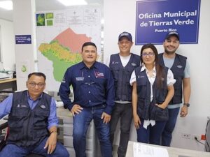
In 2022, USAID partnered with Puerto Rico leaders to create a Municipal Land Office. In its first six months, the local land office, which is embedded under the municipality’s Secretary of Planning has identified dozens of public parcels in the municipality that cannot receive national or regional funding without a registered land title.

“Legalizing property is fundamental. If not, we find ourselves in this bottleneck that, if they are not legalized, no investment can be made in them. Historically, no one cared about legalizing property, and the land administration process was poorly executed. This is an example of a mistake from the past that brings us consequences today.”-Diana Navarro, Mayor of Puerto Rico

In the Municipality’s Name

With USAID’s support, the Municipal Land Office has titled 10 public properties including the parcels of the Municipality Offices, the Fire Department, Villa García Park, El Morichal school, Villa Suárez Park and the memorial to the police battalion, Parque de la Vida.

“To have a local land office in the municipality, with the support of development partners, is very important,” said Mayor Navarro. “We still need to title 43 schools, four health centers, and another 51 community spaces.”

In addition to legalizing and titling the municipality’s public properties, the Municipal Land Office can title private properties in urban areas. The office’s staff includes land surveyors, lawyers, and social workers who raise awareness and promote a culture of formal land ownership. For the 12,000 inhabitants of Puerto Rico, the office represents a place to go with questions and learn about the land formalization processes. This year, Puerto Rico has already delivered the 32 land titles for urban parcels, all free of charge. The initial goal is to title 400 properties.

Juan Eduardo Ruiz, Puerto Rico’s Secretary of Planning

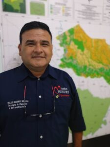
Juan Eduardo Ruiz, Puerto Rico’s Secretary of Planning, says it was vital to create a municipal land office in Puerto Rico because the office decentralizes land administration and improves coordination with Colombia’s national land agencies and property registry.

“Before this, the measurements of properties were never accepted by the IGAC’s cadastral offices because of differences, and a cadastral correction process had to be done,” says Secretary Ruiz. “Now we have the capacity to get it right.”

In the Meta Department, USAID is supporting a handful of land offices that have already titled hundreds of properties, including in neighboring Puerto Lleras and Fuentedeoro.

“I already knew about the Fuentedeoro Land Office,” Ruiz said. “I knew Puerto Rico would give strong results with an office here. It has been very well received in the municipality.”

Besides providing land tenure security for families who have lived in Puerto Rico for decades, among other benefits, landowners can access credit and government subsidies to improve their homes or for agricultural projects in rural areas since financial entities are more likely to lend money to people who have a registered property title.

“Now it is essential to legalize property in rural areas”, adds Mayor Navarro. With the resources that come from the payment of the property tax of the legalized properties, the Mayor’s Office will be able to raise money through property taxes to improve basic services in the municipality.

Puerto Rico has already delivered the 32 land titles for urban parcels and aims to title 400 properties.

This blog is cross-posted from the Land for Prosperity exposure site

Putting community land rights first: responsible private-sector divestment in Mozambique

This post originally appeared on Land Portal.

In Mozambique, community land rights are recognised under the country’s progressive land laws. Yet many private-sector companies also hold long-term leases on wide swathes of land that once belonged to communities. Here, Sarah Lowery of USAID’s Land and Resource Governance Division discusses how USAID partnered with agroforestry firm Green Resources to help it responsibly divest its land-use rights back to local communities.

How private-sector leaseholds affect community land rights

Mozambique has a complex history of land tenure that dates back to colonial times. Some private companies were given large tracts of land for development under Portuguese rule and, after independence, those companies retained use rights to that land. Other companies have been granted land concessions in more recent years. Conflicts surrounding these company lands, including the country’s vast plantation forests and the land upon which they stand, have increased over the past 10 years. Although all land in Mozambique is officially owned by the state (as is common in most of sub-Saharan Africa), the country recognises the land-use rights of communities and individuals acquired through customary systems and good faith occupancy, and it allows communities to register those rights. However, over 75 per cent of rural land in the country is unregistered, and millions of rural people are left without secure land tenure. Communities, especially women, are vulnerable to the outcomes of decisions made by government and community leaders who negotiate and make deals with companies, including forestry firms, to use or lease the community’s lands (often without much input from community members).

A recipe for local mistrust

Over the course of several years, the multinational forestry company Green Resources acquired four forestry companies with land-use rights in Mozambique. This gave them land-use rights to 360,000 hectares in Mozambique’s Niassa, Nampula, and Zambezia provinces. With these acquisitions, Green Resources became one of Africa’s largest forestry operators, active in Mozambique, Tanzania, and Uganda.

Yet Green Resources has struggled to manage these vast landholdings in Mozambique. Many of the companies Green Resources purchased had made commitments to local communities that they failed to deliver on, such as building or improving schools, health clinics and infrastructure, and generating employment opportunities. Many of the parcels held by these companies were effectively abandoned after Green Resources acquired the companies. Yet the land was not returned to the communities, increasing feelings of uncertainty and mistrust.

Rebuilding relations: the USAID-Green Resources partnership

By 2019, the amount of scattered landholdings Green Resources had acquired in Mozambique had become a liability and too onerous to manage. The company decided then to disinvest, or relinquish, its land rights to more than 230,000 hectares. Much of the land was never developed into forestry plantations, but some are high-value parcels with existing tree plantations and infrastructure.

Not surprisingly, this process of ceding land-use rights can be fraught with attempts by various parties to grab land or resources. The company’s board was eager to ensure that the return of land was done in an inclusive manner that benefitted local communities. Green Resources wanted to prioritise an approach where local communities could document their rights to the land in parallel with the company’s disinvestment efforts and also ensure that communities were prepared to manage the land.

Over 350,000 people stand to benefit from the land being disinvested by the company across Nampula, Niassa, and Zambezia provinces. To successfully bring to fruition this land disinvestment process that protects communities’ rights, USAID partnered with Green Resources and a number of local civil society organisations (including iTC-F, ANAM Niassa, and Terra Nossa) with expertise in land-tenure documentation.

Under USAID’s Integrated Land and Resource Governance (ILRG) programme, communities are supported to clarify community boundaries using a participatory land-documentation methodology known as mobile approaches to secure tenure (MAST). The MAST approach for communities includes: raising communities’ awareness of their rights and the ensuing documentation process; establishing inclusive community land associations that reflect the diversity of communities, including women; physically walking and delimiting communities’ boundaries; leading communities through a participatory land-use planning process that reflects current uses, needs, and a changing climate; and, finally, developing and adopting community-level land-use regulations. The participatory land-use planning process assists communities to look at agricultural practices, water resources and use, as well as environmental risks, which helps them devise mitigation efforts to curb deforestation, reverse erosion, reduce environmental pollution and guarantee sustainable use of the land and forestry resources.

The MAST approach goes beyond delimitation to make sure that the communities can manage their land with transparency and equity, emphasising socially-inclusive and gender-equitable outreach efforts to ensure that women, youth, and other marginalised groups are represented and actively participate and benefit. High-value resources, including standing timber, are transferred to the community associations who are charged with responsible management.

In addition to USAID-supported training on land governance and natural resource management, Green Resources is providing communities with technical support to manage eucalyptus trees on high-value parcels so these resources can be a renewable source of community wealth. Communities that have valuable timber plantations and infrastructure on their land will also receive follow-on support to sustainably manage these resources and run viable businesses.

Impacts and next steps

To date, Green Resources has disinvested from 230,000 hectares of land, and USAID and local civil society organisations have helped 86 communities obtain or apply for certificates of community land rights that provide them with secure land tenure. The certificates cover over 466,000 hectares, including both lands renounced by the company and other land that communities historically occupied, benefiting over 200,000 people (52 per cent women).

Some communities adjacent to Green Resources’ land had previously been delimited, and work in these areas has focused on establishing and training community land associations. In total, the USAID-Green Resources partnership has helped 125 communities establish land associations to manage and make decisions regarding communal land and natural resources. Women make up 43 per cent of the associations’ founding members, ensuring their needs are considered now and in the future.

For communities, land delimitation has led to a decrease in conflict. According to Régulo Canhaua, a traditional leader in Mecuburi, Nampula Province:

There used to be community conflicts about land limits and use of the land. Now people know where each village begins and ends.

Having community associations increases accountability and transparency in the use of resources, preventing a small group of people from selling resources for their own benefit. As communities learn to manage newly held natural resources and pursue sustainable resource-based livelihood strategies, they will be able to generate income for long-awaited community development projects such as bridges, clinics, and schools.

This disinvestment initiative is poised to be a win for both Green Resources and communities. The company hopes this effort will help repair broken relationships with and within communities and make its current landholdings more manageable. The communities stand to benefit from the newly relinquished land and existing resources by asserting and formalising their rights to these holdings, reducing land conflicts, and investing in sustainable land and natural resource management practices.

As companies around the world audit their land-based investments and responsibilities to surrounding communities, the concept of responsible land divestment may become increasingly compelling. Whether divesting entire properties due to business closure or downsizing landholdings for other reasons, the process of allowing local communities and stakeholders to participate will reduce opportunities for corruption and empower communities to assert their rights and proactively benefit from their land. These efforts do require enabling policy conditions that allow communities to register their rights to divested landholdings, which necessitates continued engagement with national governments to promote inclusive land governance systems.

For a more in-depth look at the USAID’s private sector partnerships in the land and natural resource space, see the Responsible Land-Based Investments Case Study Series.

From conflict to public-private partnerships: Securing land-use rights and livelihoods in Mozambique

This post originally appeared on LandPortal.

Mozambique’s 1997 land law recognises land rights acquired through customary practice and good faith occupancy, even without a formal title. However, the lack of transparent public confirmation or documentation can lead to conflict. Sr. Land and Resource Governance Advisor Karol Boudreaux discusses how a partnership between USAID and agribusiness Grupo Madal has helped the company and local communities address long-standing land-access issues and improve livelihoods.

What is causing conflict over land rights?

Mozambique’s land laws allow citizens to have their land rights confirmed by the verbal testimony of other community members – and this testimony creates a legal claim that is just as valid as title documentation, even without documented proof. Despite this, the lack of documentation of community and individual land rights can lead to tensions between neighbours over boundaries or rights to specific areas. It also places many Mozambicans in a weak position when investors seek rights to their land for forestry, farming, and other uses.

In central Mozambique’s Zambézia province, due to a lack of available farmland, roughly 50,000 smallholder farmers have started growing their crops on unused land legally held by the agribusiness Grupo Madal. Most of these farmers are women, using small tracts of land to grow mostly food for their families. At the same time, in the communities adjacent to Grupo Madal’s farms, thousands of others have acquired land rights, but very few have documented proof. This lack of documentation has led to tensions and conflicts between people within these communities competing over scarce land.

USAID’s Integrated Land and Resource Governance (ILRG) programme is partnering with Grupo Madal and a local civil society organisation (CSO), the Associação de Apoio ao Desenvolvimento (Development Support Association or NANA) to raise awareness of land and resource rights and improving tenure security, while addressing harmful gender norms and promoting women’s empowerment and economic security.

The USAID-Grupo Madal partnership

In 2016, Grupo Madal changed ownership, prompting a shift away from an estate-based production model, which had been in place since Mozambique’s colonial period, to a more inclusive business model designed to intentionally integrate and benefit neighbouring communities. The company’s new approach has included an initiative to help resource-poor farmers who were using Madal land to transition into a more secure situation. The goal was to help the farmers feed their families and earn income, while providing a source of revenue for the company.

How the public-private partnership works

The partnership initially worked with 3,300 smallholder farmers (over 67% were women) from 14 communities adjacent to four Madal plantations. Through an innovative model for ‘ingrowers’ (mostly landless women farming on Madal land) and ‘outgrowers’ (women and men farmers with land in neighbouring communities), the partnership seeks to include these smallholder farmers in Madal’s supply chains.

After an initial assessment to gauge community needs, the partnership has focused on introducing land-use agreements and farming contracts for ingrower families to strengthen their land-use rights and provide an opportunity to enter commercial value chains to help increase incomes. Families farming on Madal lands now have access to larger plots, allowing them to grow and sell commodities to Madal and grow food crops for household consumption. Madal specifies the crops it requires, provides appropriate inputs and technical advice, and guarantees to buy the resulting harvest.

Madal has also recruited seven community members, four of them women, with farming experience and communication skills to support the company’s extension officers and increase engagement within the communities. Most Madal extension agents are men, so engaging women as community facilitators has improved the company’s ability to reach women farmers. This community-based extension model inspires other women by increasing their technical skills, self-esteem, and confidence.

Now, with greater tenure security, these farmers have also organised themselves into producers’ clubs. “Before, each one of us women farmers worked separately. Now we are organised in producers’ clubs,” said Florinda Francisco, an ingrower farmer. “We have confidence in working with Madal and we want to sell our production to the company because they are the ones who made the land available for us.”

Documenting and managing community lands

Neighbouring outgrower communities have also received help to document their collective land rights and their individual farms. Similar to the ingrower agreement, some may decide to sign contracts to produce crops for Madal, receiving inputs and technical support.

With support from NANA, communities clarify their boundaries using mobile applications to secure tenure (MAST), a participatory land-documentation approach that improves transparency and equity and emphasises social inclusion and gender equality. The approach begins by raising communities’ awareness of their legal land rights. Communities then establish land associations to manage their land and natural resources, engage in participatory land-use planning, and develop community land-use regulations.

Impacts and next steps

Since 2020, the USAID-Madal partnership has mapped 8,000 hectares in 14 communities adjacent to Madal lands through participatory processes, enabling 6,500 families to receive certificates of community land rights from the provincial government. A total of 1,300 ingrower farmers (85% women) have entered into land-use agreements on Madal lands, and 2,000 outgrower farmers (55% women) have delimited their family lands, opening up opportunities for them to benefit from contract farming.

The partnership’s approach to strengthen land claims and build trusting and beneficial relationships between companies and neighbouring farmers is uncommon in Mozambique. It has the potential to create a viable model for responsible land-based investment that benefits private-sector actors and communities, and improves women’s economic security. The Mozambique Ministry of Agriculture and Rural Development has already expressed interest in supporting expansion of this innovative model to other companies and provinces.

Grupo Madal sees this activity as a major opportunity to clarify land rights and build trust with communities. The partnership has helped Madal to focus on rehabilitating its historically unused landholdings and integrating communities into their supply chain with benefits for both. The company has also welcomed USAID’s support in engaging with farmers – most of whom are women – in a gender-responsive way.

Sensitising private companies to land-related issues and supporting them to set up inclusive models can benefit communities and help secure their long-term rights to access and use land. Despite inherent power imbalances, with support, farmers can work with companies to clarify their land holdings, giving them the security they need to invest in their plots. Smallholders can also increase their access to inputs, technical skills, and markets, thereby improving their livelihoods, food security, and well-being. Public-private partnerships can be particularly beneficial for women, allowing them to feed their families while helping to earn additional income. Working with companies and CSOs can help ensure community rights and needs are considered, and help aggregate community voices for greater impact. Further support from the Government of Mozambique is essential to scale-up and institutionalise these approaches. Taking this holistic approach, USAID is helping improve livelihoods for thousands of Mozambique’s women and men.

Natural Climate Solutions: How Spatial Data Can Help Prioritize Land-Based Climate Mitigation Investments

USAID’s Sustainable Landscape Opportunity Analyses (SLOAs) provide an overview of options available to reduce greenhouse gas emissions from land conservation, management, and restoration. SLOAs are created through a collaborative process with USAID Missions to help develop programming that aims to reduce carbon emissions and/or increase carbon sequestration. They provide an assessment of land-based climate mitigation opportunities at the national and sub-national level, reflecting the biophysical potential of the land, as well as potential priorities and constraints on different mitigation pathways.

To accompany the SLOA for Papua New Guinea (PNG), USAID has developed a new Geospatial Companion that can assist USAID/PNG in leveraging its SLOA findings for spatial planning, as described below. The Geospatial Companion is a visual tool that brings the maps and data included in the SLOA, as well as additional datasets as applicable, to life as dynamic resources that can be updated to reflect changes in information or priorities. Its user-friendly maps and data can be manipulated and combined to help decision makers visualize and identify where investments in land-based climate mitigation can be most effective, as well as help decision makers integrate climate outcomes with other development priorities. This Geospatial Companion can also serve as a model for the development of other SLOA Geospatial Companions in assisting USAID Missions and partners in leveraging SLOA findings.

SLOA Geospatial Companion: Papua New Guinea

The island of New Guinea hosts the third largest expanse of tropical rainforests on the planet, among other geographically diverse terrestrial and aquatic environments. PNG comprises the eastern half of the island and is the largest Pacific Island country both by landmass and population. The country has pledged to completely end deforestation by the year 2030 to combat climate change. At the same time, it is undertaking large road and electricity infrastructure projects to spur economic growth and address widespread poverty.

Understanding where to prioritize investments in PNG to most effectively make advancements in land-based climate mitigation efforts is complicated. There are a wide variety of land governance systems that exist for different types of land resources—from protected areas to agriculture concessions. Furthermore, among the country’s population of over 10 million people, more than 850 languages are spoken and there are more than 600 distinct tribes, each with their own traditional land governance rules.

To effectively support both PNG’s economic development and the country’s international commitment to protect its forests, USAID’s Geospatial Companion integrates and analyzes land-based climate mitigation datasets together with USAID geographic and programming priorities. It features maps of datasets that are referenced in the PNG SLOA and also includes additional information, such as the forest cover loss “hotspots” shown in Figure 1.

Looking at the SLOA data alongside complementary datasets allows users to visualize trade-offs or opportunities to develop programming that combines emissions reductions with other priority outcomes, such as biodiversity conservation (Figure 2) or infrastructure development. Dedicated climate change mitigation programs, as well as contributions from other development sector programs, are necessary for achieving USAID’s target of reducing, avoiding, or sequestering six billion metric tons of carbon dioxide equivalent emissions by 2030.

The Geospatial Companion data and maps are part of a larger package of support that can be provided to USAID Missions. The scenario map shown in Figure 2 is one example–iIt is based on a spatial model that considers multiple criteria to identify locations where the potential for both climate mitigation and conservation benefits are highest.

Figure 2: By combining and strategically weighting different datasets in a spatial model, locations are identified where the potential for both climate mitigation and conservation benefits is highest.
Credit: USAID

The Power of Geospatial Information
Understanding the geographic scope of where the most effective mitigation opportunities might exist under a variety of scenarios can be extremely complex and difficult to conceptualize. In addition, a number of important local factors that are critical to sustainable and resilient development programming could be overlooked without proper analysis. Maps and spatial data are powerful tools to visualize this kind of complex information in space and time.

The SLOA Geospatial Companion helps guide USAID decision-making and is designed to improve the efficacy of USAID programming related to land-based climate mitigation and biodiversity conservation on the ground. Its scenarios can help USAID Missions and operating units identify pathways for reducing emissions while also responding to other development challenges. In PNG, the Geospatial Companion shows at a glance where climate mitigation potential, biodiversity, and land rights intersect. In other regions, governance, health, livelihoods, population, agriculture, water stress, energy, infrastructure, or other types of data might be used to determine further opportunities for increased climate action.

International Rural Women’s Day 2022 – “My Land, Our Futures”

Around the world, USAID is helping thousands of rural women secure their rights to land – providing them, their children and their communities with the security they need to build a brighter future.

Mozambique

Woman in fieldFloriana Mariano Jose, 69, never had her own land. Last year, she received the long-term right to use a half-hectare plot in Inhangulue, Mozambique, from local agroforestry company Grupo Madal. This was revolutionary for Floriana: her plot allowed her to move beyond subsistence farming and enter commercial value chains, growing coconuts and beans to sell. She signed a commercial farming agreement with Madal, which is providing her with seeds, guidance on how to care for these crops, and a guaranteed market for her produce. She feels confident having her land use rights documented on paper, knowing that her daughters and granddaughters will be able to continue to work this land in the years to come. As she said: “In addition to a guaranteed buyer and support to increase our production, there is a lot of work within the community to support women, to decrease violence against women, and to ensure that our husbands know they can’t take the money we make selling coconut and beans.”

Over the years, smallholder farmers encroached on Grupo Madal’s land in Zambezia, Mozambique. Rather than evicting these farmers, a partnership between USAID and Madal is resolving encroachment issues in an innovative way by providing long-term land use rights to over 1,300 people, 85 percent of whom are women like Floriana. These farmers gained access to land and formal farming contracts that will allow them to increase their income. The company is also revising internal policies and extension programs to improve outreach to women and supporting women in producers’ clubs to build agricultural and entrepreneurship skills.

Malawi

Woman standing in field
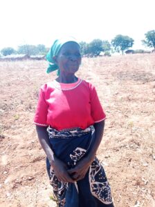
Joyce Daimoni is a 70 year old woman with physical disability who raised seven children and over 30 grandchildren in Chinthankhwa, Malawi. Following custom, she moved to her husband’s village when they married. Custom also dictates that once she left her maternal home, she was not allocated land there and would rely on his land for life. She has farmed the land her whole life, growing groundnuts and maize for the family to eat and sell. When a customary land documentation program started in her village this year, others in the community tried to stop her family from registering their land, saying the land belonged to the clan. Joyce sought help from the local Customary Land Committee and was referred to the Customary Land Tribunal, who decided in favor of Joyce and her husband. They were able to finally register their land, in both their names, and Joyce is relieved. “This means we are still going to be using the land. I am happy we can still cultivate the land and our children will be able to use this land too.”

USAID is working with the government of Malawi to document 10,000 customary land parcels in the Traditional Area of Mwansambo in Nkhoatakota District, making sure that women like Joyce are not left behind in the process. The land registration program will document land rights using gender-responsive approaches that include comprehensive gender equality and social inclusion community sensitization, capacity development for all stakeholders involved in registration process, household level dialogues on harmful gender norms, and skill-development training for women elected to leadership positions in land governance.

Zambia

Woman standing in field holding a paper. 
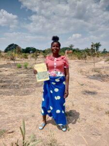
When her husband passed away 15 years ago, Mary Nkhowani, 55, and her 5 children returned to her home village of Muzumbwa in Chifunda Chiefdom, Zambia, to grow maize for subsistence. She went from cultivating her husband’s land to cultivating her father’s land, never imagining women could hold land in their own right. When her father died, she inherited his land. But in rural Zambia, it is often not easy for women – especially widows – to hold land. Twice Mary experienced land grabbing by members of her extended family. Once a USAID-supported land documentation program began working in her village, Mary attended sensitization meetings and learned that women can own land; she then registered her land. Motivated by this life-changing experience, Mary volunteered to serve on the village land committee to help other women have land documented in their own names. “The certificate puts a seal on the land that it is mine and no one can grab it. It means peace for me in life and in death because there were a lot of conflicts over land. Everyone wants land and if you are not a man, no one thinks you are entitled. I feel very happy that the future of my children and grandchildren is now secure.”

In Zambia’s Eastern Province, USAID is promoting gender-responsive land registration and helping to resolve long-standing tensions over customary land rights. Over the past six years, USAID and local partners have documented the land rights of more than 30,000 parcels, benefiting 155,000 rights holders, nearly half of whom are women like Mary.

Ghana

Woman standing next to a tree
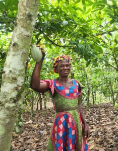
When Grace Annison, 60, got married, she moved to her husband’s cocoa farm in Asorefie, Ghana. Over the past 40 years, Grace has worked on this land every day: during the cocoa season she prunes the trees, harvests the cocoa pods, and dries the beans. Throughout the year she plants pepper, cassava, plantains, and tomatoes for her family to eat and to sell, a crucial source of income in the cocoa off-season. The land and the fruits of her labor enabled Grace to raise her six children. However, as it is customary in the area, the land is registered in her husband’s name only. Grace hopes that if something happens to her husband, nobody will take the land away from her. “I hope to continue to farm the land to achieve my next dream to build a comfortable house for my family.”

USAID is working with Ecom Agroindustrial Corp., a global commodity trader, to empower women and shift gender norms that hinder their access to resources like land and extension services in cocoa communities in Ghana. Ecom is revising policies and procedures to increase gender-responsiveness in their engagement with cocoa producers. Over 2,200 farmers like Grace and her husband are also being trained on harmful gender norms that prevent women from accessing and controlling land, gender-based violence, and women’s empowerment.

India

Woman standing next to a tree
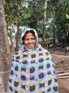
Land is the most important asset for farmer Sumsurnehar Begam. Early in her marriage, Sumsurnehar and her husband farmed two plots of land in West Bengal, India: a small piece of land that he had inherited and another small plot they purchased. However, they never updated their land records, and continued to farm without any formal proof of ownership for years, unaware of the risks. After saving for many years, in 2020 they decided to buy a third plot. By this time, Sumsurnehar had attended land literacy training supported by USAID and PepsiCo and knew the importance of formalizing the land transaction. As the only member of the family who is literate, she took charge and was able to complete the registration process by herself, ensuring that her name was included on the title. This gave her economic independence and made her future more secure. For the past two years she has been cultivating rice and potatoes on this land, independently managing the small farming business. With her increased confidence as a farmer, she joined other women to lease land to grow potatoes and formally enter into the potato supply chain for PepsiCo. “I feel confident that I have my own land and the proper documents to prove it. This is an asset for my good and bad days.”

USAID and PepsiCo are partnering to economically empower women farmers in the PepsiCo’s potato supply chain in West Bengal, India. So far, over 1,100 women have benefited from improved access to land and agronomy training, growing their confidence and economic independence while supporting PepsiCo to meet business and sustainable farming goals.

Liberia

Woman standing in green field
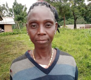
Like most rural women in Zor-Ganaglay community in Liberia, Mamie Kpahn depends on the land and natural resources around the Blei Community Forest for her livelihood. Responding to increasing pressure over natural resources, the Liberian government has enacted legislation and processes to allow communities to self-identify, create communal governance structures, and obtain formal documentation of their community lands. Mamie notes that even though women often use the land more than men, they have been traditionally excluded from decision making around land in the community. After hearing about the importance of inclusive participation, she decided to run for her local land governance committee and was elected as chairperson. Today she participates in every step of the decision-making process related to the community land. Recently she attended a boundary harmonization meeting and helped resolve boundary conflicts between hers and a neighboring community. “As a woman, I was proud to be in this meeting and be part of the decision making to bring us together as neighbors. I am happy that the two communities can be in peace and work together. This will help our children manage our land in the future.”

USAID is supporting Liberia’s customary land formalization process in 44 communities in six counties. This includes strengthening the governance capacity of communities so that they are empowered to make inclusive decisions and enjoy the full potential of their formalized lands and resources. The project uses gender-balanced facilitation teams to sensitize communities about women’s roles in land governance and provides women like Mamie with technical knowledge on land governance. Formerly excluded from these decision-making spaces, women now account for 43 percent of committee members in these USAID-supported communities, and many have been nominated to serve in leadership positions.